
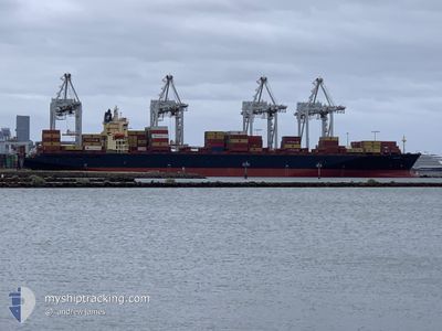
MARIANNA I
Container Ship
Current Trip
| Time Travelled | 1 h, 15 mins |
|---|---|
| Remaining Time | --- |
| Distance Travelled | 10.60 nm |
| Remaining Distance | 339.16 nm |
| AVG Speed | 9.5 Noeuds |
| MAX Speed | 10 Noeuds |
| AVG Wind | 9 knots |
| MAX Wind | 9.1 knots |
| MIN Temp | 20.2°C / 68.36°F |
| MAX Temp | 20.2°C / 68.36°F |
| Tirant d eau | 10.3 m |
| Position reçue | 2 d depuis |
Current Position
| Longitude | 121.62417° |
|---|---|
| Latitude | 35.00611° |
| Etat | Under way using engine |
| Vitesse | 12 Noeuds |
| Parcours | 135.1° |
| Zone | Yellow Sea |
| Station | T-AIS |
| Position reçue | 2 d depuis |
Info
Information
The current position of MARIANNA I is in Yellow Sea with coordinates 35.00611° / 121.62417° as reported on 2024-05-18 06:12 by AIS to our vessel tracker app. The vessel's current speed is 12 Noeuds and is heading at the port of QINGDAO. The estimated time of arrival as calculated by MyShipTracking vessel tracking app is 2024-05-17 08:00 LT
The vessel MARIANNA I (IMO: 9162227, MMSI: 636020349) is a Container Ship that was built in 1998 ( 26 Age ). It's sailing under the flag of [LR] Liberia.
In this page you can find informations about the vessels current position, last detected port calls, and current voyage information. If the vessels is not in coverage by AIS you will find the latest position.
The current position of MARIANNA I is detected by our AIS receivers and we are not responsible for the reliability of the data. The last position was recorded while the vessel was in Coverage by the Ais receivers of our vessel tracking app.
The current draught of MARIANNA I as reported by AIS is 10.3 meters
Weather
| Temperature | 20.2°C / 68.36°F |
|---|---|
| Wind Speed | 9 knots |
| Direction | 123° ESE |
| Pressure | 1015.4 hPa |
| Humidity | 94.3 % |
| Cloud Coverage | 100 % |
Featured Company
Last Port Calls
| Port | Arrival | Departure | Time In Port |
|---|---|---|---|
| 2024-05-19 23:14 | 2024-05-20 22:00 | 22 h | |
| 2024-05-17 08:56 | 2024-05-18 06:36 | 21 h | |
| 2024-05-14 18:20 | 2024-05-16 01:52 | 1 d | |
| 2024-05-01 11:44 | 2024-05-02 14:33 | 1 d | |
| 2024-04-28 02:40 | 2024-04-29 20:09 | 1 d | |
| 2024-04-24 14:01 | 2024-04-26 16:13 | 2 d | |
| 2024-04-20 13:37 | 2024-04-22 06:28 | 1 d | |
| 2024-04-10 06:26 | 2024-04-10 20:49 | 14 h | |
| 2024-04-09 10:38 | 2024-04-09 22:39 | 12 h | |
| 2024-04-08 06:22 | 2024-04-08 18:46 | 12 h |
Last Trips
| Origin | Departure | Destination | Arrival | Distance | |
|---|---|---|---|---|---|
| 2024-05-18 06:36 | 2024-05-19 23:14 | 422.66 nm | |||
| 2024-05-16 01:52 | 2024-05-17 08:56 | 501.47 nm | |||
| 2024-05-02 14:33 | 2024-05-14 18:20 | 4208.22 nm | |||
| 2024-04-29 20:09 | 2024-05-01 11:44 | 551.60 nm | |||
| 2024-04-26 16:13 | 2024-04-28 02:40 | 595.39 nm | |||
| 2024-04-22 06:28 | 2024-04-24 14:01 | 1110.32 nm | |||
| 2024-04-10 20:49 | 2024-04-20 13:37 | 4070.96 nm | |||
| 2024-04-09 22:39 | 2024-04-10 06:26 | 66.88 nm | |||
| 2024-04-08 18:46 | 2024-04-09 10:38 | 81.76 nm | |||
| 2024-03-31 15:20 | 2024-04-08 06:22 | 1053.89 nm |
Events
| Heure | Evenement | Détails | Position/ Destination | Info |
|---|---|---|---|---|
| 2024-05-20 14:00 | Démarrage | 3.42 nm, South East of SHANGHAI |
31.33886 / 121.66367
KRPUS>CNTAO
|
Vitesse: 7.2 kn Parcours: 117° |
| 2024-05-20 14:00 | PORT DE DEPART |
|
31.33886 / 121.66367
KRPUS>CNTAO
|
Vitesse: 2.9 kn Parcours: 108° |
| 2024-05-19 15:14 | Port d'arrivée |
|
31.34132 / 121.65355
[CN] SHANGHAI
|
Vitesse: 0.7 kn Parcours: 122° |
| 2024-05-19 14:47 | Arret | 3.02 nm, South East of SHANGHAI |
31.34167 / 121.65667
KRPUS>CNTAO
|
Vitesse: Parcours: -1° |
| 2024-05-19 07:45 | Démarrage |
31.29671 / 122.73325
KRPUS>CNTAO
|
Vitesse: 9 kn Parcours: 145° |
|
| 2024-05-19 06:50 | Arret |
31.30363 / 122.71589
KRPUS>CNTAO
|
Vitesse: Parcours: 212° |
|
| 2024-05-19 06:20 | Démarrage |
31.32333 / 122.75166
KRPUS>CNTAO
|
Vitesse: 5 kn Parcours: 225° |
|
| 2024-05-19 03:35 | Arret |
31.30340 / 122.72188
KRPUS>CNTAO
|
Vitesse: Parcours: 244° |
|
| 2024-05-18 06:15 | Etat Changé | Default Under way using engine |
35.00048 / 121.63090
KRPUS>CNTAO
|
Vitesse: 12 kn Parcours: 135.1° |
| 2024-05-18 06:12 | Hors de la zone couverte |
35.00611 / 121.62417
Yellow Sea
|
Vitesse: 12 kn Parcours: 135.1° |