
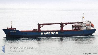
MACONDO
General Cargo
Current Trip
| Time Travelled | 3 days |
|---|---|
| Remaining Time | 3 days |
| Distance Travelled | 727.37 nm |
| Remaining Distance | 819.87 nm |
| AVG Speed | 9.3 Noeuds |
| MAX Speed | 11.5 Noeuds |
| AVG Wind | 19.4 knots |
| MAX Wind | 22.6 knots |
| MIN Temp | 18.4°C / 65.12°F |
| MAX Temp | 26.2°C / 79.16°F |
| Tirant d eau | 8 m |
| Position reçue | 2 d depuis |
Current Position
| Longitude | -79.21983° |
|---|---|
| Latitude | 31.12882° |
| Etat | Under way using engine |
| Vitesse | 9.1 Noeuds |
| Parcours | 173.7° |
| Zone | North Atlantic Ocean |
| Station | T-AIS |
| Position reçue | 2 d depuis |
Info
Information
The current position of MACONDO is in North Atlantic Ocean with coordinates 31.12882° / -79.21983° as reported on 2024-04-27 09:40 by AIS to our vessel tracker app. The vessel's current speed is 9.1 Noeuds and is heading at the port of TAMPICO. The estimated time of arrival as calculated by MyShipTracking vessel tracking app is 2024-05-03 19:38 LT
The vessel MACONDO (IMO: 9299109, MMSI: 371293000) is a General Cargo that was built in 2005 ( 19 Age ). It's sailing under the flag of [PA] Panama.
In this page you can find informations about the vessels current position, last detected port calls, and current voyage information. If the vessels is not in coverage by AIS you will find the latest position.
The current position of MACONDO is detected by our AIS receivers and we are not responsible for the reliability of the data. The last position was recorded while the vessel was in Coverage by the Ais receivers of our vessel tracking app.
The current draught of MACONDO as reported by AIS is 8 meters
Weather
| Temperature | 26.2°C / 79.16°F |
|---|---|
| Wind Speed | 17 knots |
| Direction | 77° ENE |
| Pressure | 1013.6 hPa |
| Humidity | 76.3 % |
| Cloud Coverage | --- |
Featured Company
Last Port Calls
| Port | Arrival | Departure | Time In Port |
|---|---|---|---|
| 2024-04-26 15:10 | 2024-04-26 21:59 | 6 h | |
| 2024-04-24 08:39 | 2024-04-24 09:58 | 1 h | |
| 2024-04-13 21:27 | 2024-04-15 14:34 | 1 d | |
| 2024-04-12 17:00 | 2024-04-13 11:47 | 18 h | |
| 2024-04-05 12:58 | 2024-04-06 21:55 | 1 d | |
| 2024-04-01 00:29 | 2024-04-02 01:50 | 1 d | |
| 2024-03-21 10:43 | 2024-03-21 11:35 | 51 m | |
| 2024-03-15 20:13 | 2024-03-16 23:57 | 1 d | |
| 2024-03-09 16:32 | 2024-03-10 20:22 | 1 d | |
| 2024-03-02 12:36 | 2024-03-03 16:54 | 1 d |
Most Visited Ports (Last year)
| Port | Arrivals | |
|---|---|---|
| 8 | ||
| 5 | ||
| 4 | ||
| 4 | ||
| 4 | ||
| 3 |
Last Trips
| Origin | Departure | Destination | Arrival | Distance | |
|---|---|---|---|---|---|
| 2024-04-24 05:58 | 2024-04-26 11:10 | 26.41 nm | |||
| 2024-04-15 10:34 | 2024-04-24 04:39 | 1638.12 nm | |||
| 2024-04-13 07:47 | 2024-04-13 17:27 | 108.90 nm | |||
| 2024-04-06 17:55 | 2024-04-12 13:00 | 1639.40 nm | |||
| 2024-04-01 19:50 | 2024-04-05 08:58 | 916.50 nm | |||
| 2024-03-21 07:35 | 2024-03-31 18:29 | 1615.24 nm | |||
| 2024-03-16 19:57 | 2024-03-21 06:43 | 1219.18 nm | |||
| 2024-03-10 14:22 | 2024-03-15 16:13 | 1058.21 nm | |||
| 2024-03-03 10:54 | 2024-03-09 10:32 | 1480.16 nm | |||
| 2024-02-22 15:17 | 2024-03-02 06:36 | 1559.72 nm |
Events
| Heure | Evenement | Détails | Position/ Destination | Info |
|---|---|---|---|---|
| 2024-04-27 09:44 | Etat Changé | Default Under way using engine |
31.11833 / -79.21667
MXTAM
|
Vitesse: 9.1 kn Parcours: 173.7° |
| 2024-04-27 09:40 | Hors de la zone couverte |
31.12882 / -79.21983
North Atlantic Ocean
MXTAM
|
Vitesse: 9.1 kn Parcours: 173.7° |
|
| 2024-04-27 09:07 | Etat Changé | Under way using engine Default |
31.20781 / -79.24124
MXTAM
|
Vitesse: 8 kn Parcours: 164° |
| 2024-04-27 09:05 | Etat Changé | Default Under way using engine |
31.21333 / -79.24167
MXTAM
|
Vitesse: 8.4 kn Parcours: 167.1° |
| 2024-04-27 08:48 | Etat Changé | Under way using engine Default |
31.25302 / -79.25505
MXTAM
|
Vitesse: 8 kn Parcours: 164° |
| 2024-04-27 08:41 | Dans la zone couverte |
31.25302 / -79.25505
North Atlantic Ocean
MXTAM
|
Vitesse: 8.6 kn Parcours: 165.6° |
|
| 2024-04-27 04:17 | Etat Changé | Default Under way using engine |
31.79500 / -79.51166
MXTAM
|
Vitesse: 9.4 kn Parcours: 169.3° |
| 2024-04-27 04:12 | Etat Changé | Under way using engine Default |
31.80824 / -79.51515
MXTAM
|
Vitesse: 9 kn Parcours: 166° |
| 2024-04-27 04:12 | Hors de la zone couverte |
31.80824 / -79.51515
North Atlantic Ocean
MXTAM
|
Vitesse: 9.4 kn Parcours: 169.3° |
|
| 2024-04-27 04:05 | Etat Changé | Default Under way using engine |
31.82500 / -79.51833
MXTAM
|
Vitesse: 10.1 kn Parcours: 171.7° |