
LEONIDAS P.C.
Cargo
Current Trip
| Time Travelled | 35 days |
|---|---|
| Remaining Time | 1 h, 8 mins |
| Distance Travelled | 9051.30 nm |
| Remaining Distance | 9.79 nm |
| AVG Speed | 11.6 Noeuds |
| MAX Speed | 16.6 Noeuds |
| AVG Wind | 13 knots |
| MAX Wind | 26.9 knots |
| MIN Temp | 16.3°C / 61.34°F |
| MAX Temp | 36.4°C / 97.52°F |
| Tirant d eau | 8.7 m |
| Position reçue | 1 h, 8 m depuis |
Current Position
| Longitude | -46.25357° |
|---|---|
| Latitude | -24.13494° |
| Etat | At anchor |
| Vitesse | 1.3 Noeuds |
| Parcours | 102° |
| Zone | South Atlantic Ocean |
| Station | T-AIS |
| Position reçue | 1 h, 8 m depuis |
Info
Information
The current position of LEONIDAS P.C. is in South Atlantic Ocean with coordinates -24.13494° / -46.25357° as reported on 2024-05-22 01:40 by AIS to our vessel tracker app. The vessel's current speed is 1.3 Noeuds and is heading at the port of SANTOS. The estimated time of arrival as calculated by MyShipTracking vessel tracking app is 2024-05-22 03:56 LT
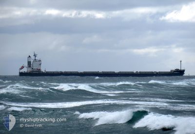
The vessel LEONIDAS P.C. (IMO: 9461233, MMSI: 538009568) is a Cargo It's sailing under the flag of [MH] Marshall Is.
In this page you can find informations about the vessels current position, last detected port calls, and current voyage information. If the vessels is not in coverage by AIS you will find the latest position.
The current position of LEONIDAS P.C. is detected by our AIS receivers and we are not responsible for the reliability of the data. The last position was recorded while the vessel was in Coverage by the Ais receivers of our vessel tracking app.
The current draught of LEONIDAS P.C. as reported by AIS is 8.7 meters
Weather
| Temperature | 20.8°C / 69.44°F |
|---|---|
| Wind Speed | 3 knots |
| Direction | 32° NNE |
| Pressure | 1020.5 hPa |
| Humidity | 82.3 % |
| Cloud Coverage | 89 % |
Featured Company
Events
| Heure | Evenement | Détails | Position/ Destination | Info |
|---|---|---|---|---|
| 2024-05-22 02:33 | Démarrage | 10.49 nm, South of SANTOS |
-24.13052 / -46.25338
BR SSZ
|
Vitesse: 5.5 kn Parcours: 293° |
| 2024-05-22 01:43 | Etat Changé | Default At anchor |
-24.13333 / -46.25167
BR SSZ
|
Vitesse: 1.3 kn Parcours: 102° |
| 2024-05-22 01:40 | Hors de la zone couverte |
-24.13494 / -46.25357
South Atlantic Ocean
|
Vitesse: 1.3 kn Parcours: 74° |
|
| 2024-05-22 01:13 | Detecté en mer | Brazilian part of the South Atlantic Ocean |
-24.13451 / -46.25346
South Atlantic Ocean
|
Vitesse: 0.4 kn Parcours: 323.6° |
| 2024-05-22 01:13 | Dans la zone couverte |
-24.13451 / -46.25346
South Atlantic Ocean
|
Vitesse: 0.4 kn Parcours: 323.6° |
|
| 2024-05-21 17:07 | Arret | 10.74 nm, South of SANTOS |
-24.13398 / -46.25059
BR SSZ
|
Vitesse: 0.1 kn Parcours: 187° |
| 2024-05-21 15:49 | Démarrage | 6.28 nm, South of SANTOS |
-24.07117 / -46.34090
BR SSZ
|
Vitesse: 6.7 kn Parcours: 156° |
| 2024-05-21 11:04 | Arret | 5.79 nm, South of SANTOS |
-24.06333 / -46.33833
BR SSZ
|
Vitesse: Parcours: -1° |
| 2024-05-21 09:38 | Démarrage | 11.48 nm, South East of SANTOS |
-24.14181 / -46.23666
BR SSZ
|
Vitesse: 5 kn Parcours: 242° |
| 2024-05-21 04:07 | Arret | 11.23 nm, South East of SANTOS |
-24.13500 / -46.23167
BR SSZ
|
Vitesse: Parcours: -1° |