
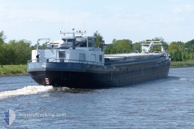
LABORA
Cargo
Current Trip
LABORA is out of coverage. Learn how you can join the community and extend the coverage to your area by clicking here!
ZOETERWOUDE
Unknown Port
ETA*
---
| Time Travelled | 2 days |
|---|---|
| Remaining Time | --- |
| Distance Travelled | 74.98 nm |
| Remaining Distance | --- |
| AVG Speed | 5.9 Noeuds |
| MAX Speed | 9.2 Noeuds |
| AVG Wind | 9.2 knots |
| MAX Wind | 13.8 knots |
| MIN Temp | 6.5°C / 43.7°F |
| MAX Temp | 15°C / 59°F |
| Tirant d eau | 0 m |
| Position reçue | 1 d depuis |
Current Position
| Longitude | 5.71597° |
|---|---|
| Latitude | 51.01229° |
| Etat | Under way using engine |
| Vitesse | 4.8 Noeuds |
| Parcours | 12.5° |
| Zone | North Sea |
| Station | T-AIS |
| Position reçue | 1 d depuis |
Info
info
Information
The current position of LABORA is in North Sea with coordinates 51.01229° / 5.71597° as reported on 2024-04-26 09:19 by AIS to our vessel tracker app. The vessel's current speed is 4.8 Noeuds
The vessel LABORA (MMSI: 244710400) is a Cargo It's sailing under the flag of [NL] Netherlands.
In this page you can find informations about the vessels current position, last detected port calls, and current voyage information. If the vessels is not in coverage by AIS you will find the latest position.
The current position of LABORA is detected by our AIS receivers and we are not responsible for the reliability of the data. The last position was recorded while the vessel was in Coverage by the Ais receivers of our vessel tracking app.
Weather
| Temperature | 14.8°C / 58.64°F |
|---|---|
| Wind Speed | 12 knots |
| Direction | 183° S |
| Pressure | 1005.3 hPa |
| Humidity | 64.2 % |
| Cloud Coverage | 77 % |
Featured Company
Limited time offer - Install a base station receiver to your area and list your company on MyShipTracking Free forever!
Last Port Calls
| Port | Arrival | Departure | Time In Port |
|---|---|---|---|
| 2024-04-25 08:32 | 2024-04-25 09:03 | 30 m | |
| 2024-04-08 10:51 | 2024-04-08 12:16 | 1 h | |
| 2024-03-29 07:37 | 2024-03-29 07:50 | 13 m | |
| 2024-03-29 05:54 | 2024-03-29 06:09 | 15 m |
Most Visited Ports (Last year)
| Port | Arrivals | |
|---|---|---|
| 7 | ||
| 6 | ||
| 5 | ||
| 3 | ||
| 3 | ||
| 2 |
Last Trips
| Origin | Departure | Destination | Arrival | Distance | |
|---|---|---|---|---|---|
| 2024-04-08 14:16 | 2024-04-25 10:32 | 506.79 nm | |||
| 2024-03-29 08:50 | 2024-04-08 12:51 | 240.56 nm | |||
| 2024-03-29 07:09 | 2024-03-29 08:37 | 8.26 nm | |||
| 2024-03-29 07:09 | 2024-03-29 06:54 | 8.26 nm |
Events
| Heure | Evenement | Détails | Position/ Destination | Info |
|---|---|---|---|---|
| 2024-04-26 16:26 | Arret | 2.46 nm, East of DESSEL |
51.23667 / 5.18167
ZOETERWOUDE
|
Vitesse: Parcours: -1° |
| 2024-04-26 09:19 | Hors de la zone couverte |
51.01229 / 5.71597
North Sea
|
Vitesse: 4.8 kn Parcours: 12.5° |
|
| 2024-04-26 09:19 | Etat Changé | Under way using engine Default |
51.01199 / 5.71587
ZOETERWOUDE
|
Vitesse: 4 kn Parcours: -1° |
| 2024-04-26 09:02 | Dans la zone couverte |
51.01229 / 5.71597
North Sea
|
Vitesse: 4.8 kn Parcours: 12.5° |
|
| 2024-04-26 07:17 | Etat Changé | Default Under way using engine |
50.86833 / 5.68500
ZOETERWOUDE
|
Vitesse: 3.8 kn Parcours: 304.7° |
| 2024-04-26 06:50 | Hors de la zone couverte |
50.86244 / 5.69656
North Sea
|
Vitesse: 3.8 kn Parcours: 304.7° |
|
| 2024-04-26 05:18 | Démarrage | 4.7 nm, South West of BARGE TERMINAL BORN |
50.98800 / 5.76605
ZOETERWOUDE
|
Vitesse: 4.8 kn Parcours: 213.4° |
| 2024-04-25 17:36 | Arret | 4.59 nm, South West of BARGE TERMINAL BORN |
50.98953 / 5.76798
ZOETERWOUDE
|
Vitesse: 0.1 kn Parcours: 511° |
| 2024-04-25 16:58 | Démarrage | 1.67 nm, South of BARGE TERMINAL BORN |
51.03429 / 5.79814
ZOETERWOUDE
|
Vitesse: 4.1 kn Parcours: 197° |
| 2024-04-25 16:37 | Arret | 1.56 nm, South of BARGE TERMINAL BORN |
51.03607 / 5.79902
ZOETERWOUDE
|
Vitesse: 0.2 kn Parcours: 511° |