
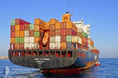
KOBE EXPRESS
Container Ship
Current Trip
| Time Travelled | 22 h, 9 mins |
|---|---|
| Remaining Time | 10 h, 49 mins |
| Distance Travelled | 258.45 nm |
| Remaining Distance | 138.64 nm |
| AVG Speed | 11.1 Noeuds |
| MAX Speed | 16.5 Noeuds |
| AVG Wind | 4.7 knots |
| MAX Wind | 14 knots |
| MIN Temp | 6.4°C / 43.52°F |
| MAX Temp | 23.6°C / 74.48°F |
| Tirant d eau | 11 m |
| Position reçue | 45 m depuis |
Current Position
| Longitude | --- |
|---|---|
| Latitude | --- |
| Etat | Under way using engine |
| Vitesse | 12 Noeuds |
| Parcours | 181.4° |
| Zone | North Atlantic Ocean |
| Station | T-AIS |
| Position reçue | 45 m depuis |
Info
Information
The current position of KOBE EXPRESS is in North Atlantic Ocean with coordinates 28.31797° / -79.83804° as reported on 2025-12-05 10:15 by AIS to our vessel tracker app. The vessel's current speed is 12 Noeuds and is heading at the port of PORT EVERGLADES. The estimated time of arrival as calculated by MyShipTracking vessel tracking app is 2025-12-05 16:50 LT
The vessel KOBE EXPRESS (IMO: 9143544, MMSI: 310764000) is a Container Ship that was built in 1997 ( 28 Age ). It's sailing under the flag of [BM] Bermuda.
In this page you can find informations about the vessels current position, last detected port calls, and current voyage information. If the vessels is not in coverage by AIS you will find the latest position.
The current position of KOBE EXPRESS is detected by our AIS receivers and we are not responsible for the reliability of the data. The last position was recorded while the vessel was in Coverage by the Ais receivers of our vessel tracking app.
The current draught of KOBE EXPRESS as reported by AIS is 11 meters
Weather
| Temperature | 23.6°C / 74.48°F |
|---|---|
| Wind Speed | 10 knots |
| Direction | 168° SSE |
| Pressure | 1018 hPa |
| Humidity | 67.1 % |
| Cloud Coverage | 53 % |
Featured Company
Last Port Calls
| Port | Arrival | Departure | Time In Port |
|---|---|---|---|
| 2025-12-03 11:35 | 2025-12-04 07:52 | 20 h | |
| 2025-11-30 20:25 | 2025-12-01 16:43 | 20 h | |
| 2025-11-25 15:15 | 2025-11-26 16:05 | 1 d | |
| 2025-11-11 18:15 | 2025-11-13 04:27 | 1 d | |
| 2025-11-07 16:08 | 2025-11-09 06:48 | 1 d | |
| 2025-11-02 12:04 | 2025-11-03 11:00 | 22 h | |
| 2025-10-31 01:58 | 2025-11-01 13:49 | 1 d | |
| 2025-10-29 21:35 | 2025-10-30 21:37 | 1 d | |
| 2025-10-14 18:57 | 2025-10-14 19:06 | 8 m | |
| 2025-10-13 20:37 | 2025-10-14 18:47 | 22 h |
Last Trips
| Origin | Departure | Destination | Arrival | Distance | |
|---|---|---|---|---|---|
| 2025-12-01 16:43 | 2025-12-03 11:35 | 535.80 nm | |||
| 2025-11-26 16:05 | 2025-11-30 20:25 | 336.44 nm | |||
| 2025-11-13 04:27 | 2025-11-25 15:15 | 4243.07 nm | |||
| 2025-11-09 06:48 | 2025-11-11 18:15 | 370.04 nm | |||
| 2025-11-03 11:00 | 2025-11-07 16:08 | 843.69 nm | |||
| 2025-11-01 13:49 | 2025-11-02 12:04 | 317.77 nm | |||
| 2025-10-30 21:37 | 2025-10-31 01:58 | 56.01 nm | |||
| 2025-10-14 19:06 | 2025-10-29 21:35 | 5793.42 nm | |||
| 2025-10-14 18:47 | 2025-10-14 18:57 | 0.49 nm | |||
| 2025-10-13 20:20 | 2025-10-13 20:37 | 0.79 nm |
Events
| Heure | Evenement | Détails | Position/ Destination | Info |
|---|---|---|---|---|
| 2025-12-05 10:18 | Etat Changé | Default Under way using engine |
28.30734 / -79.83830
USPEF
|
Vitesse: 12 kn Parcours: 181.4° |
| 2025-12-05 10:15 | Etat Changé | Under way using engine Default |
28.31797 / -79.83804
USPEF
|
Vitesse: 12 kn Parcours: 181° |
| 2025-12-05 10:02 | Dans la zone couverte |
28.31797 / -79.83804
North Atlantic Ocean
|
Vitesse: 12 kn Parcours: 181.4° |
|
| 2025-12-04 15:54 | Etat Changé | Default Under way using engine |
31.88677 / -80.55461
USPEF
|
Vitesse: 9.2 kn Parcours: 127° |
| 2025-12-04 15:45 | Hors de la zone couverte |
31.90016 / -80.57493
North Atlantic Ocean
USPEF
|
Vitesse: 9.2 kn Parcours: 127° |
|
| 2025-12-04 13:11 | Changement d'ETA | 2025/12/05 03:00 2025/12/06 02:00 |
32.09947 / -81.01404
USPEF
|
Vitesse: 9.9 kn Parcours: 59.3° |
| 2025-12-04 12:52 | PORT DE DEPART |
|
32.08004 / -81.05183
USPEF
|
Vitesse: 6.6 kn Parcours: 90° |
| 2025-12-04 11:29 | Démarrage |
32.12723 / -81.13627
[US] SAVANNAH
|
Vitesse: 3.9 kn Parcours: 339° |
|
| 2025-12-04 11:00 | Etat Changé | Under way using engine Default |
32.12518 / -81.13607
[US] SAVANNAH
|
Vitesse: Parcours: 336° |
| 2025-12-04 11:00 | Tirant d'eau modifié | 11 10.5 |
32.12518 / -81.13607
[US] SAVANNAH
|
Vitesse: Parcours: 336° |