
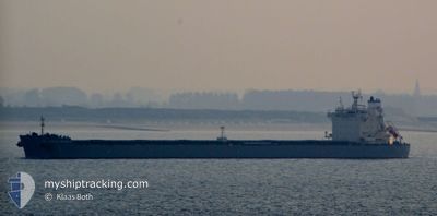
KMARIN GOTEBORG
Bulk Carrier
Current Trip
| Time Travelled | 10 days |
|---|---|
| Remaining Time | --- |
| Distance Travelled | 2782.71 nm |
| Remaining Distance | --- |
| AVG Speed | 11.2 Noeuds |
| MAX Speed | 13.1 Noeuds |
| AVG Wind | 12.1 knots |
| MAX Wind | 18 knots |
| MIN Temp | 14.1°C / 57.38°F |
| MAX Temp | 27.1°C / 80.78°F |
| Tirant d eau | 14.8 m |
| Position reçue | 9 d depuis |
Current Position
| Longitude | -75.06186° |
|---|---|
| Latitude | 36.52214° |
| Etat | Under way using engine |
| Vitesse | 11 Noeuds |
| Parcours | 118° |
| Zone | North Atlantic Ocean |
| Station | T-AIS |
| Position reçue | 9 d depuis |
Info
Information
The current position of KMARIN GOTEBORG is in North Atlantic Ocean with coordinates 36.52214° / -75.06186° as reported on 2024-05-02 23:08 by AIS to our vessel tracker app. The vessel's current speed is 11 Noeuds and is heading at the port of SINGAPORE. The estimated time of arrival as calculated by MyShipTracking vessel tracking app is 2024-06-17 08:00 LT
The vessel KMARIN GOTEBORG (IMO: 9643300, MMSI: 538007419) is a Bulk Carrier that was built in 2013 ( 11 Age ). It's sailing under the flag of [MH] Marshall Is.
In this page you can find informations about the vessels current position, last detected port calls, and current voyage information. If the vessels is not in coverage by AIS you will find the latest position.
The current position of KMARIN GOTEBORG is detected by our AIS receivers and we are not responsible for the reliability of the data. The last position was recorded while the vessel was in Coverage by the Ais receivers of our vessel tracking app.
The current draught of KMARIN GOTEBORG as reported by AIS is 14.8 meters
Weather
| Temperature | 26.6°C / 79.88°F |
|---|---|
| Wind Speed | 11 knots |
| Direction | 51° NE |
| Pressure | 1012.9 hPa |
| Humidity | 78.2 % |
| Cloud Coverage | 41 % |
Featured Company
Most Visited Ports (Last year)
| Port | Arrivals | |
|---|---|---|
| 4 | ||
| 2 | ||
| 1 | ||
| 1 | ||
| 1 | ||
| 1 |
Events
| Heure | Evenement | Détails | Position/ Destination | Info |
|---|---|---|---|---|
| 2024-05-02 23:14 | Etat Changé | Default Under way using engine |
36.51325 / -75.04085
SGSIN
|
Vitesse: 11 kn Parcours: 118° |
| 2024-05-02 23:08 | Hors de la zone couverte |
36.52214 / -75.06186
North Atlantic Ocean
|
Vitesse: 11 kn Parcours: 118° |
|
| 2024-05-02 23:06 | Etat Changé | Under way using engine Default |
36.52590 / -75.07062
SGSIN
|
Vitesse: 11.6 kn Parcours: 118° |
| 2024-05-02 22:54 | Etat Changé | Default Under way using engine |
36.54355 / -75.11121
SGSIN
|
Vitesse: 11 kn Parcours: 118° |
| 2024-05-02 22:39 | Etat Changé | Under way using engine Default |
36.56638 / -75.16399
SGSIN
|
Vitesse: 11.5 kn Parcours: 118° |
| 2024-05-02 22:27 | Etat Changé | Default Under way using engine |
36.58476 / -75.20665
SGSIN
|
Vitesse: 11 kn Parcours: 118° |
| 2024-05-02 22:25 | Etat Changé | Under way using engine Default |
36.58811 / -75.21408
SGSIN
|
Vitesse: 11.4 kn Parcours: 118° |