
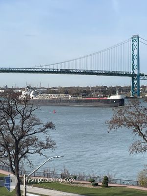
JOHN J. BOLAND
Self Discharging Bulk Carrier
Current Trip
| Time Travelled | 4 days |
|---|---|
| Remaining Time | 14 h, 30 mins |
| Distance Travelled | 589.22 nm |
| Remaining Distance | 185.07 nm |
| AVG Speed | 10.1 Noeuds |
| MAX Speed | 12.7 Noeuds |
| AVG Wind | 17.2 knots |
| MAX Wind | 26 knots |
| MIN Temp | -21.5°C / -6.7°F |
| MAX Temp | 4.2°C / 39.56°F |
| Tirant d eau | 8.2 m |
| Position reçue | 1 m depuis |
Current Position
| Longitude | --- |
|---|---|
| Latitude | --- |
| Etat | Under way using engine |
| Vitesse | 12.7 Noeuds |
| Parcours | 31.3° |
| Zone | --- |
| Station | T-AIS |
| Position reçue | 1 m depuis |
Info
Information
The current position of JOHN J. BOLAND is in --- with coordinates 44.89338° / -87.12695° as reported on 2025-12-17 15:29 by AIS to our vessel tracker app. The vessel's current speed is 12.7 Noeuds and is heading at the port of CALCITE. The estimated time of arrival as calculated by MyShipTracking vessel tracking app is 2025-12-18 01:01 LT
The vessel JOHN J. BOLAND (IMO: 7318901, MMSI: 366938780) is a Self Discharging Bulk Carrier that was built in 1973 ( 52 Age ). It's sailing under the flag of [US] USA.
In this page you can find informations about the vessels current position, last detected port calls, and current voyage information. If the vessels is not in coverage by AIS you will find the latest position.
The current position of JOHN J. BOLAND is detected by our AIS receivers and we are not responsible for the reliability of the data. The last position was recorded while the vessel was in Coverage by the Ais receivers of our vessel tracking app.
The current draught of JOHN J. BOLAND as reported by AIS is 8.2 meters
Weather
| Temperature | -2.1°C / 28.22°F |
|---|---|
| Wind Speed | 9 knots |
| Direction | 327° NNW |
| Pressure | 1013.8 hPa |
| Humidity | 77.6 % |
| Cloud Coverage | 62 % |
Featured Company
Last Port Calls
| Port | Arrival | Departure | Time In Port |
|---|---|---|---|
| 2025-12-12 12:31 | 2025-12-13 03:41 | 15 h | |
| 2025-12-09 16:10 | 2025-12-11 09:40 | 1 d | |
| 2025-12-07 22:15 | 2025-12-08 17:30 | 19 h | |
| 2025-12-05 10:52 | 2025-12-05 11:50 | 57 m | |
| 2025-12-02 09:10 | 2025-12-03 00:51 | 15 h | |
| 2025-12-01 06:15 | 2025-12-01 13:23 | 7 h | |
| 2025-11-30 16:37 | 2025-11-30 17:26 | 48 m | |
| 2025-11-28 18:50 | 2025-11-28 19:46 | 55 m | |
| 2025-11-24 20:19 | 2025-11-27 05:41 | 2 d | |
| 2025-11-23 07:27 | 2025-11-23 08:16 | 49 m |
Most Visited Ports (Last year)
| Port | Arrivals | |
|---|---|---|
| 60 | ||
| 24 | ||
| 20 | ||
| 19 | ||
| 15 | ||
| 6 |
Last Trips
| Origin | Departure | Destination | Arrival | Distance | |
|---|---|---|---|---|---|
| 2025-12-11 09:40 | 2025-12-12 12:31 | 234.38 nm | |||
| 2025-12-08 17:30 | 2025-12-09 16:10 | 46.53 nm | |||
| 2025-12-05 11:50 | 2025-12-07 22:15 | 350.86 nm | |||
| 2025-12-03 00:51 | 2025-12-05 10:52 | 410.22 nm | |||
| 2025-12-01 13:23 | 2025-12-02 09:10 | 205.61 nm | |||
| 2025-11-30 17:26 | 2025-12-01 06:15 | 143.20 nm | |||
| 2025-11-28 19:46 | 2025-11-30 16:37 | 265.61 nm | |||
| 2025-11-27 05:41 | 2025-11-28 18:50 | 434.46 nm | |||
| 2025-11-23 08:16 | 2025-11-24 20:19 | 350.74 nm | |||
| 2025-11-22 23:07 | 2025-11-23 07:27 | 75.32 nm |
Events
| Heure | Evenement | Détails | Position/ Destination | Info |
|---|---|---|---|---|
| 2025-12-17 13:08 | Changement d'ETA | 2025/12/18 06:00 2025/12/18 09:00 |
44.44916 / -87.41861
CALCITE
|
Vitesse: 12.4 kn Parcours: 18.9° |
| 2025-12-17 13:04 | Etat Changé | Under way using engine Default |
44.43721 / -87.42134
CALCITE
|
Vitesse: 12 kn Parcours: 5° |
| 2025-12-17 12:59 | Etat Changé | Default Under way using engine |
44.41667 / -87.42333
CALCITE
|
Vitesse: 12.4 kn Parcours: 5° |
| 2025-12-17 12:58 | Etat Changé | Under way using engine Default |
44.41645 / -87.42408
CALCITE
|
Vitesse: 12.4 kn Parcours: 6° |
| 2025-12-17 12:58 | Dans la zone couverte |
44.41645 / -87.42408
CALCITE
|
Vitesse: 12.4 kn Parcours: 5° |
|
| 2025-12-17 09:55 | Etat Changé | Default Under way using engine |
43.80131 / -87.62327
CALCITE
|
Vitesse: 12.5 kn Parcours: 8.7° |
| 2025-12-17 09:51 | Hors de la zone couverte |
43.78673 / -87.62624
CALCITE
|
Vitesse: 12.5 kn Parcours: 8.7° |
|
| 2025-12-17 09:48 | Etat Changé | Under way using engine Default |
43.77861 / -87.62786
CALCITE
|
Vitesse: 12.6 kn Parcours: 8° |
| 2025-12-17 09:39 | Etat Changé | Default Under way using engine |
43.74607 / -87.63468
CALCITE
|
Vitesse: 12.7 kn Parcours: 9.6° |
| 2025-12-17 09:33 | Etat Changé | Under way using engine Default |
43.72467 / -87.63941
CALCITE
|
Vitesse: 12.7 kn Parcours: 10° |