
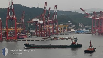
JIAN YANG HUI
Cargo
Current Trip
| Trip Time | 3 days |
|---|---|
| Trip Distance | 389.58 nm |
| AVG Speed | 7.3 Noeuds |
| MAX Speed | 10.9 Noeuds |
| Tirant d eau | 3.8 m |
| AVG Wind | 9.3 knots |
| MAX Wind | 24.7 knots |
| MIN Temp | 8.4°C / 47.12°F |
| MAX Temp | 18.9°C / 66.02°F |
| Position reçue | 2 d depuis |
Current Position
| Longitude | 141.80202° |
|---|---|
| Latitude | 40.79795° |
| Etat | Under way using engine |
| Vitesse | 7.9 Noeuds |
| Parcours | 188.3° |
| Zone | North Pacific Ocean |
| Station | T-AIS |
| Position reçue | 2 d depuis |
Info
Information
The current position of JIAN YANG HUI is in North Pacific Ocean with coordinates 40.79795° / 141.80202° as reported on 2024-05-20 23:55 by AIS to our vessel tracker app. The vessel's current speed is 7.9 Noeuds and is currently inside the port of ISHINOMAKI.
The vessel JIAN YANG HUI (IMO: 9532070, MMSI: 457422000) is a Cargo It's sailing under the flag of [MN] Mongolia.
In this page you can find informations about the vessels current position, last detected port calls, and current voyage information. If the vessels is not in coverage by AIS you will find the latest position.
The current position of JIAN YANG HUI is detected by our AIS receivers and we are not responsible for the reliability of the data. The last position was recorded while the vessel was in Coverage by the Ais receivers of our vessel tracking app.
The current draught of JIAN YANG HUI as reported by AIS is 3.8 meters
Weather
| Temperature | 21.1°C / 69.98°F |
|---|---|
| Wind Speed | 6 knots |
| Direction | 183° S |
| Pressure | 1012.6 hPa |
| Humidity | 62.4 % |
| Cloud Coverage | 96 % |
Featured Company
Last Port Calls
| Port | Arrival | Departure | Time In Port |
|---|---|---|---|
| 2024-05-22 12:35 | |||
| 2024-05-18 06:40 | 2024-05-18 17:12 | 10 h | |
| 2024-05-02 12:48 | 2024-05-07 16:47 | 5 d | |
| 2024-04-25 12:12 | 2024-04-27 20:08 | 2 d | |
| 2024-04-23 01:02 | 2024-04-23 16:01 | 14 h | |
| 2024-03-11 14:19 | 2024-03-15 17:45 | 4 d | |
| 2024-03-02 11:03 |
Last Trips
| Origin | Departure | Destination | Arrival | Distance | |
|---|---|---|---|---|---|
| 2024-05-18 17:12 | 2024-05-22 12:35 | 389.58 nm | |||
| 2024-05-07 16:47 | 2024-05-18 06:40 | 1231.03 nm | |||
| 2024-04-27 20:08 | 2024-05-02 12:48 | 846.70 nm | |||
| 2024-04-23 16:01 | 2024-04-25 12:12 | 412.64 nm | |||
| 2024-03-15 17:45 | 2024-04-23 01:02 | 5066.62 nm | |||
| 2024-03-02 11:03 | 2024-03-11 14:19 | 1404.27 nm |
Events
| Heure | Evenement | Détails | Position/ Destination | Info |
|---|---|---|---|---|
| 2024-05-22 04:04 | Arret |
38.41667 / 141.26666
[JP] ISHINOMAKI
|
Vitesse: Parcours: -1° |
|
| 2024-05-22 03:35 | Port d'arrivée |
|
38.39885 / 141.26270
[JP] ISHINOMAKI
|
Vitesse: 6 kn Parcours: 8° |
| 2024-05-22 03:07 | Démarrage | 1.59 nm, South of ISHINOMAKI |
38.37500 / 141.27499
JP ISM
|
Vitesse: 6 kn Parcours: 244° |
| 2024-05-21 20:10 | Arret | 1.2 nm, South of ISHINOMAKI |
38.38167 / 141.28667
JP ISM
|
Vitesse: Parcours: -1° |
| 2024-05-21 00:00 | Etat Changé | Default Under way using engine |
40.78447 / 141.79927
JP ISM
|
Vitesse: 7.9 kn Parcours: 188.3° |
| 2024-05-20 23:55 | Hors de la zone couverte |
40.79795 / 141.80202
North Pacific Ocean
|
Vitesse: 7.9 kn Parcours: 188.3° |
|
| 2024-05-20 23:53 | Etat Changé | Under way using engine Default |
40.80133 / 141.80263
JP ISM
|
Vitesse: 7.4 kn Parcours: 188° |
| 2024-05-20 23:45 | Démarrage | 18.18 nm, North East of MISAWA |
40.81448 / 141.79862
JP ISM
|
Vitesse: 4.1 kn Parcours: 130° |
| 2024-05-20 23:27 | Etat Changé | Default Not under command |
40.82272 / 141.79094
JP ISM
|
Vitesse: 1.8 kn Parcours: 204° |
| 2024-05-20 23:21 | Etat Changé | Not under command Default |
40.82532 / 141.78897
JP ISM
|
Vitesse: 1.9 kn Parcours: 200° |