
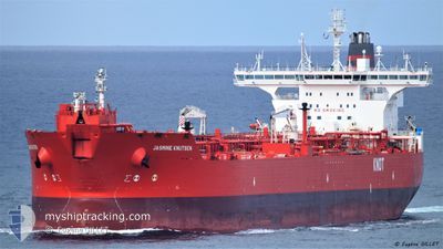
JASMINE KNUTSEN
Shuttle Tanker
Current Trip
FPSO WESTERN ISLES
| Time Travelled | 11 days |
|---|---|
| Remaining Time | --- |
| Distance Travelled | 873.09 nm |
| Remaining Distance | --- |
| AVG Speed | 9.5 Noeuds |
| MAX Speed | 14.2 Noeuds |
| AVG Wind | 11.1 knots |
| MAX Wind | 29.9 knots |
| MIN Temp | 7.1°C / 44.78°F |
| MAX Temp | 12.9°C / 55.22°F |
| Tirant d eau | 9 m |
| Position reçue | 5 h, 37 m depuis |
Current Position
| Longitude | -1.07650° |
|---|---|
| Latitude | 57.75700° |
| Etat | Under way using engine |
| Vitesse | 11.3 Noeuds |
| Parcours | 10° |
| Zone | North Sea |
| Station | T-AIS |
| Position reçue | 5 h, 37 m depuis |
Info
Information
The current position of JASMINE KNUTSEN is in North Sea with coordinates 57.75700° / -1.07650° as reported on 2024-05-10 13:03 by AIS to our vessel tracker app. The vessel's current speed is 11.3 Noeuds
The vessel JASMINE KNUTSEN (IMO: 9273557, MMSI: 257324000) is a Shuttle Tanker that was built in 2005 ( 19 Age ). It's sailing under the flag of [NO] Norway.
In this page you can find informations about the vessels current position, last detected port calls, and current voyage information. If the vessels is not in coverage by AIS you will find the latest position.
The current position of JASMINE KNUTSEN is detected by our AIS receivers and we are not responsible for the reliability of the data. The last position was recorded while the vessel was in Coverage by the Ais receivers of our vessel tracking app.
The current draught of JASMINE KNUTSEN as reported by AIS is 9 meters
Weather
| Temperature | 9.7°C / 49.46°F |
|---|---|
| Wind Speed | 6 knots |
| Direction | 202° SSW |
| Pressure | 1020.5 hPa |
| Humidity | 94 % |
| Cloud Coverage | 81 % |
Featured Company
Last Port Calls
| Port | Arrival | Departure | Time In Port |
|---|---|---|---|
| 2024-04-28 00:14 | 2024-04-28 22:45 | 22 h | |
| 2024-04-03 16:17 | 2024-04-04 15:44 | 23 h | |
| 2024-03-22 17:36 | 2024-03-23 13:16 | 19 h | |
| 2024-03-07 04:42 | 2024-03-08 02:10 | 21 h |
Most Visited Ports (Last year)
| Port | Arrivals | |
|---|---|---|
| 10 | ||
| 4 | ||
| 3 | ||
| 2 | ||
| 2 | ||
| 2 |
Last Trips
| Origin | Departure | Destination | Arrival | Distance | |
|---|---|---|---|---|---|
| 2024-04-04 15:44 | 2024-04-28 00:14 | 803.41 nm | |||
| 2024-03-23 13:16 | 2024-04-03 16:17 | 1230.47 nm | |||
| 2024-03-08 02:10 | 2024-03-22 17:36 | 915.04 nm | |||
| 2024-02-18 11:45 | 2024-03-07 04:42 | 1225.37 nm |
Events
| Heure | Evenement | Détails | Position/ Destination | Info |
|---|---|---|---|---|
| 2024-05-10 13:10 | Etat Changé | Default Under way using engine |
57.77879 / -1.06973
FPSO WESTERN ISLES
|
Vitesse: 11.3 kn Parcours: 10° |
| 2024-05-10 13:03 | Etat Changé | Under way using engine Default |
57.75700 / -1.07650
FPSO WESTERN ISLES
|
Vitesse: 11.2 kn Parcours: 9° |
| 2024-05-10 13:03 | Hors de la zone couverte |
57.75700 / -1.07650
North Sea
FPSO WESTERN ISLES
|
Vitesse: 11.3 kn Parcours: 10° |
|
| 2024-05-10 12:38 | Etat Changé | Default Under way using engine |
57.68148 / -1.09085
FPSO WESTERN ISLES
|
Vitesse: 11.4 kn Parcours: 2° |
| 2024-05-10 12:19 | Etat Changé | Under way using engine Default |
57.62067 / -1.09933
FPSO WESTERN ISLES
|
Vitesse: 11.7 kn Parcours: 9° |
| 2024-05-10 12:18 | Etat Changé | Default Under way using engine |
57.61800 / -1.10015
FPSO WESTERN ISLES
|
Vitesse: 11.7 kn Parcours: 8° |
| 2024-05-10 12:11 | Etat Changé | Under way using engine Default |
57.59292 / -1.10748
FPSO WESTERN ISLES
|
Vitesse: 11.5 kn Parcours: 9° |
| 2024-05-10 11:30 | Etat Changé | Default Under way using engine |
57.47376 / -1.15103
FPSO WESTERN ISLES
|
Vitesse: 11 kn Parcours: 41° |
| 2024-05-10 09:54 | Etat Changé | Under way using engine Default |
57.26933 / -1.58117
FPSO WESTERN ISLES
|
Vitesse: 11.5 kn Parcours: 52° |
| 2024-05-10 09:50 | Etat Changé | Default Under way using engine |
57.26302 / -1.59573
FPSO WESTERN ISLES
|
Vitesse: 11.6 kn Parcours: 51° |