
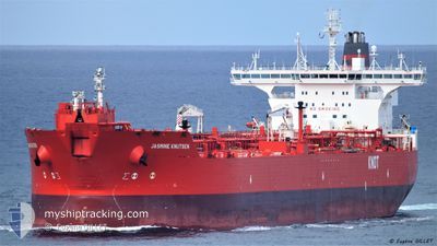
JASMINE KNUTSEN
Shuttle Tanker
Current Trip
| Time Travelled | 21 days |
|---|---|
| Remaining Time | 9 h, 0 mins |
| Distance Travelled | 639.66 nm |
| Remaining Distance | 105.94 nm |
| AVG Speed | 8.6 Knots |
| MAX Speed | 13.3 Knots |
| AVG Wind | 18.9 knots |
| MAX Wind | 33.9 knots |
| MIN Temp | 3°C / 37.4°F |
| MAX Temp | 16.8°C / 62.24°F |
| Draught | 9 m |
| Position Received | 1 m ago |
Current Position
| Longitude | 3.72333° |
|---|---|
| Latitude | 59.35900° |
| Status | Under way using engine |
| Speed | 0.3 Knots |
| Course | 303° |
| Area | North Sea |
| Station | T-AIS |
| Position Received | 1 m ago |
Info
Information
The current position of JASMINE KNUTSEN is in North Sea with coordinates 59.35900° / 3.72333° as reported on 2024-04-25 20:54 by AIS to our vessel tracker app. The vessel's current speed is 0.3 Knots and is heading at the port of MONGSTAD . The estimated time of arrival as calculated by MyShipTracking vessel tracking app is 2024-04-26 05:55 LT
The vessel JASMINE KNUTSEN (IMO: 9273557, MMSI: 257324000) is a Shuttle Tanker that was built in 2005 ( 19 years old ). It's sailing under the flag of [NO] Norway.
In this page you can find informations about the vessels current position, last detected port calls, and current voyage information. If the vessels is not in coverage by AIS you will find the latest position.
The current position of JASMINE KNUTSEN is detected by our AIS receivers and we are not responsible for the reliability of the data. The last position was recorded while the vessel was in Coverage by the Ais receivers of our vessel tracking app.
The current draught of JASMINE KNUTSEN as reported by AIS is 9 meters
Weather
| Temperature | 5.7°C / 42.26°F |
|---|---|
| Wind Speed | 8 knots |
| Direction | 83° E |
| Pressure | 1005.5 hPa |
| Humidity | 73 % |
| Cloud Coverage | 100 % |
Featured Company
Last Port Calls
| Port | Arrival | Departure | Time In Port |
|---|---|---|---|
| 2024-04-03 14:17 | 2024-04-04 13:44 | 23 h | |
| 2024-03-22 16:36 | 2024-03-23 12:16 | 19 h | |
| 2024-03-07 03:42 | 2024-03-08 01:10 | 21 h | |
| 2024-02-17 12:33 | 2024-02-18 10:45 | 22 h |
Most Visited Ports (Last year)
| Port | Arrivals | |
|---|---|---|
| 11 | ||
| 3 | ||
| 3 | ||
| 2 | ||
| 2 | ||
| 2 |
Last Trips
| Origin | Departure | Destination | Arrival | Distance | |
|---|---|---|---|---|---|
| 2024-03-23 13:16 | 2024-04-03 16:17 | 1230.47 nm | |||
| 2024-03-08 02:10 | 2024-03-22 17:36 | 915.04 nm | |||
| 2024-02-18 11:45 | 2024-03-07 04:42 | 1225.37 nm | |||
| 2024-01-29 18:51 | 2024-02-17 13:33 | 1461.45 nm |
Events
| Time | Event | Details | Position / Dest | Info |
|---|---|---|---|---|
| 2024-04-25 17:44 | STOP Moving |
59.36188 / 3.74351
MONGSTAD
|
Speed: 0.3 kn Course: 279° |
|
| 2024-04-25 15:22 | Status Changed | Under way using engine Default |
59.33300 / 3.95517
MONGSTAD
|
Speed: 8.1 kn Course: 284° |
| 2024-04-25 15:20 | Status Changed | Default Under way using engine |
59.33161 / 3.96430
MONGSTAD
|
Speed: 8 kn Course: 289° |
| 2024-04-25 10:27 | ETA Changed | 2024/04/26 19:00 2024/04/25 19:00 |
59.07183 / 4.17083
MONGSTAD
|
Speed: 3.7 kn Course: 358° |
| 2024-04-25 02:36 | Status Changed | Under way using engine Default |
57.75233 / 4.34717
MONGSTAD
|
Speed: 11.6 kn Course: 353° |
| 2024-04-25 02:24 | IN Coverage |
57.75233 / 4.34717
North Sea
MONGSTAD
|
Speed: 11.6 kn Course: 355° |
|
| 2024-04-24 21:44 | Status Changed | Default Under way using engine |
56.76759 / 4.51101
MONGSTAD
|
Speed: 12.1 kn Course: 355° |
| 2024-04-24 21:32 | OUT of Coverage |
56.72903 / 4.51802
North Sea
MONGSTAD
|
Speed: 12.1 kn Course: 355° |
|
| 2024-04-24 20:11 | Change Sea Area | Norwegian part of the North Sea Danish part of the North Sea |
56.46075 / 4.55837
North Sea
MONGSTAD
|
Speed: 12 kn Course: 357° |
| 2024-04-24 17:46 | Status Changed | Under way using engine Default |
55.99017 / 4.45300
MONGSTAD
|
Speed: 11.6 kn Course: 7° |