
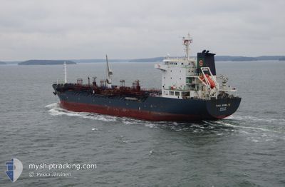
GT VICTORY
Oil/Chemical Tanker
Current Trip
NGHISON_VN
| Time Travelled | 1 day |
|---|---|
| Remaining Time | --- |
| Distance Travelled | 195.45 nm |
| Remaining Distance | --- |
| AVG Speed | 10.7 Noeuds |
| MAX Speed | 11.6 Noeuds |
| AVG Wind | 15.6 knots |
| MAX Wind | 26.3 knots |
| MIN Temp | 25.4°C / 77.72°F |
| MAX Temp | 30.3°C / 86.54°F |
| Tirant d eau | 5.5 m |
| Position reçue | 1 d depuis |
Current Position
| Longitude | 107.64438° |
|---|---|
| Latitude | 19.69210° |
| Etat | Under way using engine |
| Vitesse | 11 Noeuds |
| Parcours | 257° |
| Zone | South China Sea |
| Station | T-AIS |
| Position reçue | 1 d depuis |
Info
Information
The current position of GT VICTORY is in South China Sea with coordinates 19.69210° / 107.64438° as reported on 2024-05-04 12:01 by AIS to our vessel tracker app. The vessel's current speed is 11 Noeuds
The vessel GT VICTORY (IMO: 9321641, MMSI: 574003530) is a Oil/Chemical Tanker that was built in 2006 ( 18 Age ). It's sailing under the flag of [VN] Vietnam.
In this page you can find informations about the vessels current position, last detected port calls, and current voyage information. If the vessels is not in coverage by AIS you will find the latest position.
The current position of GT VICTORY is detected by our AIS receivers and we are not responsible for the reliability of the data. The last position was recorded while the vessel was in Coverage by the Ais receivers of our vessel tracking app.
The current draught of GT VICTORY as reported by AIS is 5.5 meters
Weather
| Temperature | 26°C / 78.8°F |
|---|---|
| Wind Speed | 3 knots |
| Direction | 341° NNW |
| Pressure | 1010.8 hPa |
| Humidity | 89 % |
| Cloud Coverage | 88 % |
Featured Company
Most Visited Ports (Last year)
| Port | Arrivals | |
|---|---|---|
| 8 | ||
| 7 | ||
| 6 | ||
| 3 | ||
| 3 | ||
| 3 |
Last Trips
| Origin | Departure | Destination | Arrival | Distance | |
|---|---|---|---|---|---|
| 2024-04-29 13:09 | 2024-05-03 07:36 | 327.40 nm | |||
| 2024-04-20 07:44 | 2024-04-28 14:49 | 1041.76 nm | |||
| 2024-04-13 15:26 | 2024-04-18 18:49 | 1223.53 nm | |||
| 2024-03-05 14:01 | 2024-04-11 17:34 | 3993.24 nm | |||
| 2024-02-13 17:35 | 2024-03-04 06:30 | 2470.19 nm |
Events
| Heure | Evenement | Détails | Position/ Destination | Info |
|---|---|---|---|---|
| 2024-05-05 04:20 | Arret |
19.36428 / 105.79287
NGHISON_VN
|
Vitesse: 0.1 kn Parcours: 145° |
|
| 2024-05-05 03:36 | Démarrage |
19.37333 / 105.87170
NGHISON_VN
|
Vitesse: 6.8 kn Parcours: 273° |
|
| 2024-05-04 21:43 | Arret |
19.37010 / 105.87558
NGHISON_VN
|
Vitesse: 0.2 kn Parcours: 28° |
|
| 2024-05-04 12:02 | Etat Changé | Default Under way using engine |
19.69173 / 107.64267
NGHISON_VN
|
Vitesse: 11 kn Parcours: 257° |
| 2024-05-04 12:01 | Etat Changé | Under way using engine Default |
19.69210 / 107.64438
NGHISON_VN
|
Vitesse: 11 kn Parcours: 258° |
| 2024-05-04 12:01 | Hors de la zone couverte |
19.69210 / 107.64438
South China Sea
|
Vitesse: 11 kn Parcours: 257° |
|
| 2024-05-04 11:06 | Etat Changé | Default Under way using engine |
19.72727 / 107.82156
NGHISON_VN
|
Vitesse: 11.2 kn Parcours: 258° |
| 2024-05-04 11:04 | Etat Changé | Under way using engine Default |
19.72845 / 107.82743
NGHISON_VN
|
Vitesse: 11 kn Parcours: 257° |
| 2024-05-04 10:50 | Etat Changé | Default Under way using engine |
19.73763 / 107.87493
NGHISON_VN
|
Vitesse: 11.2 kn Parcours: 259° |
| 2024-05-04 10:46 | Etat Changé | Under way using engine Default |
19.73998 / 107.88662
NGHISON_VN
|
Vitesse: 11.2 kn Parcours: 258° |