
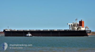
GLOBAL PROSPERITY
Cargo
Current Trip
| Time Travelled | 20 days |
|---|---|
| Remaining Time | --- |
| Distance Travelled | 5908.00 nm |
| Remaining Distance | --- |
| AVG Speed | 12.1 Noeuds |
| MAX Speed | 13.9 Noeuds |
| AVG Wind | 15 knots |
| MAX Wind | 32.4 knots |
| MIN Temp | 16°C / 60.8°F |
| MAX Temp | 29.4°C / 84.92°F |
| Tirant d eau | 18.6 m |
| Position reçue | 6 d depuis |
Current Position
| Longitude | 19.08262° |
|---|---|
| Latitude | -34.91491° |
| Etat | Under way using engine |
| Vitesse | 12 Noeuds |
| Parcours | 112.2° |
| Zone | South Atlantic Ocean |
| Station | T-AIS |
| Position reçue | 6 d depuis |
Info
Information
The current position of GLOBAL PROSPERITY is in South Atlantic Ocean with coordinates -34.91491° / 19.08262° as reported on 2024-05-01 08:23 by AIS to our vessel tracker app. The vessel's current speed is 12 Noeuds and is heading at the port of POHANG. The estimated time of arrival as calculated by MyShipTracking vessel tracking app is 2024-05-28 12:00 LT
The vessel GLOBAL PROSPERITY (IMO: 9489508, MMSI: 636015714) is a Cargo It's sailing under the flag of [LR] Liberia.
In this page you can find informations about the vessels current position, last detected port calls, and current voyage information. If the vessels is not in coverage by AIS you will find the latest position.
The current position of GLOBAL PROSPERITY is detected by our AIS receivers and we are not responsible for the reliability of the data. The last position was recorded while the vessel was in Coverage by the Ais receivers of our vessel tracking app.
The current draught of GLOBAL PROSPERITY as reported by AIS is 18.6 meters
Weather
| Temperature | 22.6°C / 72.68°F |
|---|---|
| Wind Speed | 13 knots |
| Direction | 94° E |
| Pressure | 1026.6 hPa |
| Humidity | 67.6 % |
| Cloud Coverage | 85 % |
Featured Company
Most Visited Ports (Last year)
| Port | Arrivals | |
|---|---|---|
| 5 | ||
| 3 | ||
| 2 | ||
| 2 | ||
| 1 |
Events
| Heure | Evenement | Détails | Position/ Destination | Info |
|---|---|---|---|---|
| 2024-05-01 08:26 | Etat Changé | Default Under way using engine |
-34.91938 / 19.09624
KR KPO
|
Vitesse: 12 kn Parcours: 112.2° |
| 2024-05-01 08:23 | Hors de la zone couverte |
-34.91491 / 19.08262
South Atlantic Ocean
KR KPO
|
Vitesse: 12 kn Parcours: 112.2° |
|
| 2024-05-01 08:01 | Etat Changé | Under way using engine Default |
-34.88811 / 19.00053
KR KPO
|
Vitesse: 12 kn Parcours: 112° |
| 2024-05-01 07:57 | Etat Changé | Default Under way using engine |
-34.88344 / 18.98681
KR KPO
|
Vitesse: 12.1 kn Parcours: 110.8° |
| 2024-05-01 07:53 | Etat Changé | Under way using engine Default |
-34.87855 / 18.97081
KR KPO
|
Vitesse: 12.2 kn Parcours: 110° |
| 2024-05-01 07:41 | Etat Changé | Default Under way using engine |
-34.86540 / 18.92497
KR KPO
|
Vitesse: 12.1 kn Parcours: 110.1° |
| 2024-05-01 07:13 | Etat Changé | Under way using engine Default |
-34.83254 / 18.81431
KR KPO
|
Vitesse: 12 kn Parcours: 109° |
| 2024-05-01 06:42 | Etat Changé | Default Under way using engine |
-34.79771 / 18.69654
KR KPO
|
Vitesse: 11.9 kn Parcours: 112.1° |
| 2024-05-01 06:36 | Etat Changé | Under way using engine Default |
-34.79050 / 18.67397
KR KPO
|
Vitesse: 12.1 kn Parcours: 112° |
| 2024-05-01 06:13 | Etat Changé | Default Under way using engine |
-34.76281 / 18.58644
KR KPO
|
Vitesse: 12.2 kn Parcours: 109.6° |