
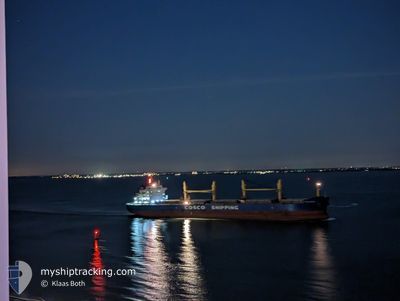
FENG XIU HAI
Cargo
Current Trip
| Time Travelled | 10 days |
|---|---|
| Remaining Time | --- |
| Distance Travelled | 2680.68 nm |
| Remaining Distance | 4.34 nm |
| AVG Speed | 12.5 Noeuds |
| MAX Speed | 17 Noeuds |
| AVG Wind | 8.9 knots |
| MAX Wind | 21 knots |
| MIN Temp | 23.1°C / 73.58°F |
| MAX Temp | 30.7°C / 87.26°F |
| Tirant d eau | 11.5 m |
| Position reçue | Maintenant |
Current Position
| Longitude | -79.59677° |
|---|---|
| Latitude | 9.00166° |
| Etat | Under way using engine |
| Vitesse | |
| Parcours | 136° |
| Zone | North Atlantic Ocean |
| Station | T-AIS |
| Position reçue | Maintenant |
Info
Information
The current position of FENG XIU HAI is in North Atlantic Ocean with coordinates 9.00166° / -79.59677° as reported on 2024-04-28 22:21 by AIS to our vessel tracker app. The vessel's current speed is 0 Noeuds and is heading at the port of CRISTOBAL. The estimated time of arrival as calculated by MyShipTracking vessel tracking app is 2024-04-27 02:00 LT
The vessel FENG XIU HAI (IMO: 9747508, MMSI: 477027300) is a Cargo It's sailing under the flag of [HK] Hong Kong.
In this page you can find informations about the vessels current position, last detected port calls, and current voyage information. If the vessels is not in coverage by AIS you will find the latest position.
The current position of FENG XIU HAI is detected by our AIS receivers and we are not responsible for the reliability of the data. The last position was recorded while the vessel was in Coverage by the Ais receivers of our vessel tracking app.
The current draught of FENG XIU HAI as reported by AIS is 11.5 meters
Weather
| Temperature | 27.7°C / 81.86°F |
|---|---|
| Wind Speed | 1 knots |
| Direction | 258° WSW |
| Pressure | 1007.4 hPa |
| Humidity | 80.1 % |
| Cloud Coverage | 83 % |
Featured Company
Most Visited Ports (Last year)
| Port | Arrivals | |
|---|---|---|
| 2 | ||
| 2 | ||
| 1 | ||
| 1 | ||
| 1 | ||
| 1 |
Last Trips
| Origin | Departure | Destination | Arrival | Distance | |
|---|---|---|---|---|---|
| 2024-03-30 22:54 | 2024-04-16 05:13 | 1659.83 nm | |||
| 2024-03-04 15:27 | 2024-03-23 03:16 | 4838.00 nm | |||
| 2024-02-21 20:06 | 2024-03-01 00:57 | 1040.44 nm | |||
| 2024-02-17 22:57 | 2024-02-18 17:29 | 72.73 nm | |||
| 2024-01-21 08:46 | 2024-02-15 14:49 | 6672.51 nm |
Events
| Heure | Evenement | Détails | Position/ Destination | Info |
|---|---|---|---|---|
| 2024-04-28 22:20 | Arret | 3.08 nm, North West of RODMAN |
9.00166 / -79.59677
CRISTOBAL
|
Vitesse: Parcours: 136° |
| 2024-04-28 22:07 | Etat Changé | Under way using engine Default |
9.00383 / -79.59908
CRISTOBAL
|
Vitesse: 1.5 kn Parcours: 134° |
| 2024-04-28 22:06 | Etat Changé | Default Under way using engine |
9.00410 / -79.59937
CRISTOBAL
|
Vitesse: 3.2 kn Parcours: 137° |
| 2024-04-28 21:56 | Etat Changé | Under way using engine Default |
9.00998 / -79.60491
CRISTOBAL
|
Vitesse: 3.3 kn Parcours: 138° |
| 2024-04-28 21:54 | Démarrage | 3.84 nm, North West of RODMAN |
9.01119 / -79.60602
CRISTOBAL
|
Vitesse: 3.3 kn Parcours: 138° |
| 2024-04-28 21:29 | Etat Changé | Default Under way using engine |
9.01738 / -79.61265
CRISTOBAL
|
Vitesse: 0.1 kn Parcours: 132° |
| 2024-04-28 21:15 | Etat Changé | Under way using engine Default |
9.01749 / -79.61279
CRISTOBAL
|
Vitesse: 1.1 kn Parcours: 132° |
| 2024-04-28 20:59 | Etat Changé | Default Under way using engine |
9.01952 / -79.61507
CRISTOBAL
|
Vitesse: Parcours: 132° |
| 2024-04-28 20:40 | Etat Changé | Under way using engine Default |
9.02064 / -79.61633
CRISTOBAL
|
Vitesse: Parcours: 132° |
| 2024-04-28 20:40 | Dans la zone couverte |
9.02064 / -79.61633
North Atlantic Ocean
|
Vitesse: Parcours: 354° |