
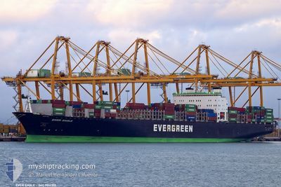
EVER EAGLE
Container Ship
Current Trip
| Time Travelled | 9 days |
|---|---|
| Remaining Time | 3 days |
| Distance Travelled | 3123.57 nm |
| Remaining Distance | 1168.36 nm |
| AVG Speed | 14.5 Noeuds |
| MAX Speed | 22.2 Noeuds |
| AVG Wind | 12.8 knots |
| MAX Wind | 27 knots |
| MIN Temp | 2.9°C / 37.22°F |
| MAX Temp | 22.3°C / 72.14°F |
| Tirant d eau | 11.6 m |
| Position reçue | 8 d depuis |
Current Position
| Longitude | -127.82915° |
|---|---|
| Latitude | 49.33010° |
| Etat | Under way using engine |
| Vitesse | 13.2 Noeuds |
| Parcours | 295.1° |
| Zone | North Pacific Ocean |
| Station | T-AIS |
| Position reçue | 8 d depuis |
Info
Information
The current position of EVER EAGLE is in North Pacific Ocean with coordinates 49.33010° / -127.82915° as reported on 2024-05-11 08:27 by AIS to our vessel tracker app. The vessel's current speed is 13.2 Noeuds and is heading at the port of TOKYO. The estimated time of arrival as calculated by MyShipTracking vessel tracking app is 2024-05-23 09:40 LT
The vessel EVER EAGLE (IMO: 9241310, MMSI: 235335000) is a Container Ship that was built in 2001 ( 23 Age ). It's sailing under the flag of [GB] United Kingdom.
In this page you can find informations about the vessels current position, last detected port calls, and current voyage information. If the vessels is not in coverage by AIS you will find the latest position.
The current position of EVER EAGLE is detected by our AIS receivers and we are not responsible for the reliability of the data. The last position was recorded while the vessel was in Coverage by the Ais receivers of our vessel tracking app.
The current draught of EVER EAGLE as reported by AIS is 11.6 meters
Weather
| Temperature | 5.1°C / 41.18°F |
|---|---|
| Wind Speed | 17 knots |
| Direction | 245° WSW |
| Pressure | 1014.9 hPa |
| Humidity | 78.2 % |
| Cloud Coverage | 56 % |
Featured Company
Last Port Calls
| Port | Arrival | Departure | Time In Port |
|---|---|---|---|
| 2024-05-08 03:08 | 2024-05-10 06:47 | 2 d | |
| 2024-04-30 14:34 | 2024-05-03 03:57 | 2 d | |
| 2024-04-14 09:07 | 2024-04-15 01:05 | 15 h | |
| 2024-04-12 19:06 | 2024-04-13 10:22 | 15 h | |
| 2024-04-10 12:45 | 2024-04-11 00:37 | 11 h | |
| 2024-04-05 19:33 | 2024-04-06 11:09 | 15 h | |
| 2024-04-02 19:09 | 2024-04-03 08:33 | 13 h | |
| 2024-03-27 18:22 | 2024-03-28 14:55 | 20 h | |
| 2024-03-21 19:03 | 2024-03-22 13:04 | 18 h | |
| 2024-03-19 22:56 | 2024-03-20 16:40 | 17 h |
Last Trips
| Origin | Departure | Destination | Arrival | Distance | |
|---|---|---|---|---|---|
| 2024-05-03 03:57 | 2024-05-08 03:08 | 187.48 nm | |||
| 2024-04-15 01:05 | 2024-04-30 14:34 | 5973.55 nm | |||
| 2024-04-13 10:22 | 2024-04-14 09:07 | 345.16 nm | |||
| 2024-04-11 00:37 | 2024-04-12 19:06 | 689.39 nm | |||
| 2024-04-06 11:09 | 2024-04-10 12:45 | 1001.11 nm | |||
| 2024-04-03 08:33 | 2024-04-05 19:33 | 434.93 nm | |||
| 2024-03-28 14:55 | 2024-04-02 19:09 | 1568.63 nm | |||
| 2024-03-22 13:04 | 2024-03-27 18:22 | 1537.57 nm | |||
| 2024-03-20 16:40 | 2024-03-21 19:03 | 427.77 nm | |||
| 2024-02-14 00:40 | 2024-03-19 22:56 | 1631.15 nm |
Events
| Heure | Evenement | Détails | Position/ Destination | Info |
|---|---|---|---|---|
| 2024-05-11 08:32 | Etat Changé | Default Under way using engine |
49.33731 / -127.85280
CA VAN>>JP TYO
|
Vitesse: 13.2 kn Parcours: 295.1° |
| 2024-05-11 08:27 | Hors de la zone couverte |
49.33010 / -127.82915
North Pacific Ocean
CA VAN>>JP TYO
|
Vitesse: 13.2 kn Parcours: 295.1° |
|
| 2024-05-11 07:55 | Etat Changé | Under way using engine Default |
49.28446 / -127.66479
CA VAN>>JP TYO
|
Vitesse: 13.1 kn Parcours: 293° |
| 2024-05-11 07:50 | Etat Changé | Default Under way using engine |
49.27747 / -127.64010
CA VAN>>JP TYO
|
Vitesse: 12.9 kn Parcours: 294.6° |
| 2024-05-10 22:26 | Changement de zone | Canadian part of the North Pacific Ocean Canadian part of the The Coastal Waters of Southeast Alaska and British Columbia |
48.51007 / -124.73175
North Pacific Ocean
CA VAN>>JP TYO
|
Vitesse: 13.8 kn Parcours: 279.1° |
| 2024-05-10 22:19 | Etat Changé | Under way using engine Default |
48.50275 / -124.69553
CA VAN>>JP TYO
|
Vitesse: 13.5 kn Parcours: 291° |
| 2024-05-10 22:14 | Etat Changé | Default Under way using engine |
48.49498 / -124.66719
CA VAN>>JP TYO
|
Vitesse: 13.8 kn Parcours: 292.6° |
| 2024-05-10 22:00 | Etat Changé | Under way using engine Default |
48.47471 / -124.59267
CA VAN>>JP TYO
|
Vitesse: 14 kn Parcours: 292° |
| 2024-05-10 21:58 | Etat Changé | Default Under way using engine |
48.47167 / -124.58167
CA VAN>>JP TYO
|
Vitesse: 14.1 kn Parcours: 291.9° |
| 2024-05-10 21:20 | Etat Changé | Under way using engine Default |
48.41484 / -124.37686
CA VAN>>JP TYO
|
Vitesse: 14.3 kn Parcours: 294° |