
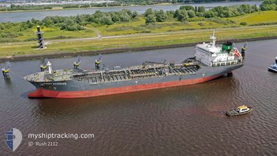
EMMY SCHULTE
Oil/Chemical Tanker
Current Trip
| Time Travelled | 1 day |
|---|---|
| Remaining Time | --- |
| Distance Travelled | 288.11 nm |
| Remaining Distance | --- |
| AVG Speed | 10.5 Noeuds |
| MAX Speed | 15 Noeuds |
| AVG Wind | 22.6 knots |
| MAX Wind | 33.7 knots |
| MIN Temp | 10°C / 50°F |
| MAX Temp | 11.2°C / 52.16°F |
| Tirant d eau | 7.8 m |
| Position reçue | 12 h, 42 m depuis |
Current Position
| Longitude | --- |
|---|---|
| Latitude | --- |
| Etat | Under way using engine |
| Vitesse | 12.2 Noeuds |
| Parcours | 325.5° |
| Zone | Inner Seas off the West Coast of Scotland |
| Station | T-AIS |
| Position reçue | 12 h, 42 m depuis |
Info
Information
The current position of EMMY SCHULTE is in Inner Seas off the West Coast of Scotland with coordinates 54.89015° / -5.39672° as reported on 2025-12-11 03:58 by AIS to our vessel tracker app. The vessel's current speed is 12.2 Noeuds and is heading at the port of KALUNDBORG. The estimated time of arrival as calculated by MyShipTracking vessel tracking app is 2025-12-14 17:00 LT
The vessel EMMY SCHULTE (IMO: 9394519, MMSI: 235068963) is a Oil/Chemical Tanker that was built in 2009 ( 16 Age ). It's sailing under the flag of [GB] United Kingdom.
In this page you can find informations about the vessels current position, last detected port calls, and current voyage information. If the vessels is not in coverage by AIS you will find the latest position.
The current position of EMMY SCHULTE is detected by our AIS receivers and we are not responsible for the reliability of the data. The last position was recorded while the vessel was in Coverage by the Ais receivers of our vessel tracking app.
The current draught of EMMY SCHULTE as reported by AIS is 7.8 meters
Weather
| Temperature | 10.4°C / 50.72°F |
|---|---|
| Wind Speed | 19 knots |
| Direction | 220° SW |
| Pressure | 1001.6 hPa |
| Humidity | 67.8 % |
| Cloud Coverage | 100 % |
Featured Company
Last Port Calls
| Port | Arrival | Departure | Time In Port |
|---|---|---|---|
| 2025-12-10 13:43 | 2025-12-10 14:33 | 50 m | |
| 2025-12-08 15:41 | 2025-12-10 13:03 | 1 d | |
| 2025-12-08 14:23 | 2025-12-08 15:12 | 49 m | |
| 2025-12-04 04:11 | 2025-12-05 12:09 | 1 d | |
| 2025-12-03 08:43 | 2025-12-04 02:37 | 17 h | |
| 2025-11-28 04:37 | 2025-11-30 06:06 | 2 d | |
| 2025-11-25 20:21 | 2025-11-27 19:29 | 1 d | |
| 2025-11-24 11:31 | 2025-11-25 18:10 | 1 d | |
| 2025-11-20 17:37 | 2025-11-21 17:11 | 23 h | |
| 2025-11-19 15:46 | 2025-11-20 15:14 | 23 h |
Last Trips
| Origin | Departure | Destination | Arrival | Distance | |
|---|---|---|---|---|---|
| 2025-12-10 13:03 | 2025-12-10 13:43 | 1.97 nm | |||
| 2025-12-08 15:12 | 2025-12-08 15:41 | 1.43 nm | |||
| 2025-12-05 12:09 | 2025-12-08 14:23 | 724.84 nm | |||
| 2025-12-04 02:37 | 2025-12-04 04:11 | 13.13 nm | |||
| 2025-11-30 06:06 | 2025-12-03 08:43 | 754.65 nm | |||
| 2025-11-25 18:10 | 2025-11-28 04:37 | 117.43 nm | |||
| 2025-11-25 18:10 | 2025-11-25 20:21 | 21.13 nm | |||
| 2025-11-21 17:11 | 2025-11-24 11:31 | 714.96 nm | |||
| 2025-11-20 15:14 | 2025-11-20 17:37 | 17.01 nm | |||
| 2025-11-19 13:10 | 2025-11-19 15:46 | 21.60 nm |
Events
| Heure | Evenement | Détails | Position/ Destination | Info |
|---|---|---|---|---|
| 2025-12-11 04:03 | Etat Changé | Default Under way using engine |
54.90404 / -5.41329
KALUNDBORG
|
Vitesse: 12.2 kn Parcours: 325.5° |
| 2025-12-11 03:58 | Hors de la zone couverte |
54.89015 / -5.39672
Inner Seas off the West Coast of Scotland
KALUNDBORG
|
Vitesse: 12.2 kn Parcours: 325.5° |
|
| 2025-12-11 01:41 | Changement de zone | United Kingdom part of the Inner Seas off the West Coast of Scotland United Kingdom part of the Irish Sea and St. George's Channel |
54.51103 / -5.17879
Inner Seas off the West Coast of Scotland
KALUNDBORG
|
Vitesse: 10.6 kn Parcours: 341.5° |
| 2025-12-10 23:08 | Etat Changé | Under way using engine Default |
54.03950 / -4.99715
KALUNDBORG
|
Vitesse: 11.6 kn Parcours: 349° |
| 2025-12-10 22:59 | Dans la zone couverte |
54.04102 / -4.99768
Irish Sea and St. George's Channel
KALUNDBORG
|
Vitesse: 11.7 kn Parcours: 348.8° |
|
| 2025-12-10 18:43 | Etat Changé | Default Under way using engine |
53.61436 / -3.84728
KALUNDBORG
|
Vitesse: 11.8 kn Parcours: 299.4° |
| 2025-12-10 18:38 | Hors de la zone couverte |
53.60614 / -3.82225
Irish Sea and St. George's Channel
KALUNDBORG
|
Vitesse: 11.8 kn Parcours: 299.4° |
|
| 2025-12-10 15:27 | Changement d'ETA | 2025/12/14 16:00 2025/12/14 12:00 |
53.43619 / -3.02081
KALUNDBORG
|
Vitesse: 8.8 kn Parcours: 339.8° |
| 2025-12-10 14:33 | PORT DE DEPART |
|
53.32845 / -2.95290
KALUNDBORG
|
Vitesse: 4.3 kn Parcours: 335° |
| 2025-12-10 14:30 | Démarrage |
53.32524 / -2.95014
[GB] EASTHAM
|
Vitesse: 3.1 kn Parcours: 332° |