
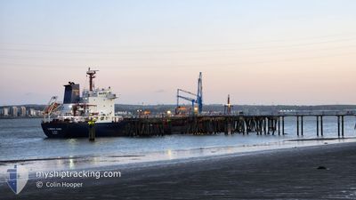
CUMBRIAN FISHER
Oil/Chemical Tanker
Current Trip
| Time Travelled | 1 day |
|---|---|
| Remaining Time | 12 h, 14 mins |
| Distance Travelled | 416.66 nm |
| Remaining Distance | 132.22 nm |
| AVG Speed | 10.8 Noeuds |
| MAX Speed | 13.3 Noeuds |
| AVG Wind | 10.7 knots |
| MAX Wind | 17.2 knots |
| MIN Temp | 9.1°C / 48.38°F |
| MAX Temp | 12.3°C / 54.14°F |
| Tirant d eau | 6.4 m |
| Position reçue | Maintenant |
Current Position
| Longitude | -5.40118° |
|---|---|
| Latitude | 53.32883° |
| Etat | Under way using engine |
| Vitesse | 10.7 Noeuds |
| Parcours | 12° |
| Zone | Irish Sea and St. George's Channel |
| Station | T-AIS |
| Position reçue | Maintenant |
Info
Information
The current position of CUMBRIAN FISHER is in Irish Sea and St. George's Channel with coordinates 53.32883° / -5.40118° as reported on 2024-05-01 22:31 by AIS to our vessel tracker app. The vessel's current speed is 10.7 Noeuds and is heading at the port of CAMPBELTOWN. The estimated time of arrival as calculated by MyShipTracking vessel tracking app is 2024-05-02 10:45 LT
The vessel CUMBRIAN FISHER (IMO: 9298404, MMSI: 311758000) is a Oil/Chemical Tanker that was built in 2004 ( 20 Age ). It's sailing under the flag of [BS] Bahamas.
In this page you can find informations about the vessels current position, last detected port calls, and current voyage information. If the vessels is not in coverage by AIS you will find the latest position.
The current position of CUMBRIAN FISHER is detected by our AIS receivers and we are not responsible for the reliability of the data. The last position was recorded while the vessel was in Coverage by the Ais receivers of our vessel tracking app.
The current draught of CUMBRIAN FISHER as reported by AIS is 6.4 meters
Weather
| Temperature | 9.5°C / 49.1°F |
|---|---|
| Wind Speed | 9 knots |
| Direction | 333° NNW |
| Pressure | 1010.3 hPa |
| Humidity | 89.3 % |
| Cloud Coverage | 100 % |
Featured Company
Last Port Calls
| Port | Arrival | Departure | Time In Port |
|---|---|---|---|
| 2024-04-25 13:26 | 2024-04-30 09:05 | 4 d | |
| 2024-04-18 14:35 | 2024-04-23 15:12 | 5 d | |
| 2024-04-04 13:19 | 2024-04-12 07:40 | 7 d | |
| 2024-03-21 02:41 | 2024-03-22 07:59 | 1 d | |
| 2024-03-06 14:54 | 2024-03-07 12:22 | 21 h |
Last Trips
| Origin | Departure | Destination | Arrival | Distance | |
|---|---|---|---|---|---|
| 2024-04-23 17:12 | 2024-04-25 14:26 | 304.53 nm | |||
| 2024-04-12 08:40 | 2024-04-18 16:35 | 908.99 nm | |||
| 2024-03-22 08:59 | 2024-04-04 14:19 | 1444.99 nm | |||
| 2024-03-07 13:22 | 2024-03-21 03:41 | 2970.29 nm | |||
| 2024-02-23 08:33 | 2024-03-06 15:54 | 1763.67 nm |
Events
| Heure | Evenement | Détails | Position/ Destination | Info |
|---|---|---|---|---|
| 2024-05-01 17:49 | Etat Changé | Under way using engine Default |
52.54193 / -5.60340
GBCBT
|
Vitesse: 10.8 kn Parcours: 5° |
| 2024-05-01 17:46 | Etat Changé | Default Under way using engine |
52.53458 / -5.60480
GBCBT
|
Vitesse: 10.7 kn Parcours: 6° |
| 2024-05-01 17:41 | Etat Changé | Under way using engine Default |
52.51973 / -5.60715
GBCBT
|
Vitesse: 10.8 kn Parcours: 8° |
| 2024-05-01 17:22 | Etat Changé | Default Under way using engine |
52.46212 / -5.61920
GBCBT
|
Vitesse: 11.1 kn Parcours: 6° |
| 2024-05-01 17:14 | Etat Changé | Under way using engine Default |
52.43577 / -5.62405
GBCBT
|
Vitesse: 11.1 kn Parcours: 5° |
| 2024-05-01 17:11 | Etat Changé | Default Under way using engine |
52.42577 / -5.62580
GBCBT
|
Vitesse: 11.3 kn Parcours: 7° |
| 2024-05-01 17:04 | Etat Changé | Under way using engine Default |
52.40587 / -5.63002
GBCBT
|
Vitesse: 11.4 kn Parcours: 7° |
| 2024-05-01 16:34 | Etat Changé | Default Under way using engine |
52.31120 / -5.64953
GBCBT
|
Vitesse: 11.7 kn Parcours: 8° |
| 2024-05-01 16:19 | Changement de zone | Irish part of the Irish Sea and St. George's Channel United Kingdom part of the Irish Sea and St. George's Channel |
52.26333 / -5.66008
Irish Sea and St. George's Channel
GBCBT
|
Vitesse: 11.8 kn Parcours: 7° |
| 2024-05-01 16:05 | Etat Changé | Under way using engine Default |
52.21842 / -5.67012
GBCBT
|
Vitesse: 12 kn Parcours: 7° |