
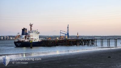
CUMBRIAN FISHER
Oil/Chemical Tanker
Current Trip
| Trip Time | 6 days |
|---|---|
| Trip Distance | 908.99 nm |
| AVG Speed | 10.6 Knots |
| MAX Speed | 12.6 Knots |
| Draught | 6.9 m |
| AVG Wind | 21.5 knots |
| MAX Wind | 34.9 knots |
| MIN Temp | 3.9°C / 39.02°F |
| MAX Temp | 12.1°C / 53.78°F |
| Position Received | 14 h, 25 m ago |
Current Position
| Longitude | 4.78673° |
|---|---|
| Latitude | 52.95593° |
| Status | Under way using engine |
| Speed | |
| Course | 349° |
| Area | North Sea |
| Station | T-AIS |
| Position Received | 14 h, 25 m ago |
Info
Information
The current position of CUMBRIAN FISHER is in North Sea with coordinates 52.95593° / 4.78673° as reported on 2024-04-18 15:19 by AIS to our vessel tracker app. The vessel's current speed is 0 Knots and is currently inside the port of DEN HELDER.
The vessel CUMBRIAN FISHER (IMO: 9298404, MMSI: 311758000) is a Oil/Chemical Tanker that was built in 2004 ( 20 years old ). It's sailing under the flag of [BS] Bahamas.
In this page you can find informations about the vessels current position, last detected port calls, and current voyage information. If the vessels is not in coverage by AIS you will find the latest position.
The current position of CUMBRIAN FISHER is detected by our AIS receivers and we are not responsible for the reliability of the data. The last position was recorded while the vessel was in Coverage by the Ais receivers of our vessel tracking app.
The current draught of CUMBRIAN FISHER as reported by AIS is 6.9 meters
Weather
| Temperature | 8.3°C / 46.94°F |
|---|---|
| Wind Speed | 15 knots |
| Direction | 280° W |
| Pressure | 1019.2 hPa |
| Humidity | 71.1 % |
| Cloud Coverage | 100 % |
Featured Company
Last Port Calls
| Port | Arrival | Departure | Time In Port |
|---|---|---|---|
| 2024-04-18 14:35 | |||
| 2024-04-04 13:19 | 2024-04-12 07:40 | 7 d | |
| 2024-03-21 02:41 | 2024-03-22 07:59 | 1 d | |
| 2024-03-06 14:54 | 2024-03-07 12:22 | 21 h | |
| 2024-02-18 08:21 | 2024-02-23 08:33 | 5 d | |
| 2024-02-13 10:12 | 2024-02-15 01:38 | 1 d | |
| 2024-02-08 08:34 | 2024-02-08 09:18 | 44 m | |
| 2024-02-01 04:24 | 2024-02-08 07:57 | 7 d | |
| 2024-02-01 03:02 | 2024-02-01 03:49 | 46 m | |
| 2024-02-01 00:00 |
Last Trips
| Origin | Departure | Destination | Arrival | Distance | |
|---|---|---|---|---|---|
| 2024-04-12 08:40 | 2024-04-18 16:35 | 908.99 nm | |||
| 2024-03-22 08:59 | 2024-04-04 14:19 | 1444.99 nm | |||
| 2024-03-07 13:22 | 2024-03-21 03:41 | 2970.29 nm | |||
| 2024-02-23 08:33 | 2024-03-06 15:54 | 1763.67 nm | |||
| 2024-02-15 02:38 | 2024-02-18 08:21 | 761.68 nm | |||
| 2024-02-08 09:18 | 2024-02-13 11:12 | 729.27 nm | |||
| 2024-02-08 07:57 | 2024-02-08 08:34 | 1.93 nm | |||
| 2024-02-01 03:49 | 2024-02-01 04:24 | 1.95 nm | |||
| 2024-01-28 10:21 | 2024-02-01 03:02 | 717.77 nm |
Events
| Time | Event | Details | Position / Dest | Info |
|---|---|---|---|---|
| 2024-04-18 15:19 | OUT of Coverage |
52.95593 / 4.78673
North Sea
[NL] DEN HELDER
|
Speed: Course: 18° |
|
| 2024-04-18 14:52 | STOP Moving |
52.95582 / 4.78638
[NL] DEN HELDER
|
Speed: 0.1 kn Course: 348° |
|
| 2024-04-18 14:35 | PORT ARRIVAL |
|
52.96528 / 4.78755
[NL] DEN HELDER
|
Speed: 4.7 kn Course: 185° |
| 2024-04-18 09:03 | IN Coverage |
52.48053 / 3.69863
North Sea
NLDHR
|
Speed: 11.1 kn Course: 41° |
|
| 2024-04-18 07:57 | Status Changed | Default Under way using engine |
52.33390 / 3.48075
NLDHR
|
Speed: 10.5 kn Course: 14° |
| 2024-04-18 07:47 | Status Changed | Under way using engine Default |
52.30645 / 3.46983
NLDHR
|
Speed: 10.9 kn Course: 68° |
| 2024-04-18 07:47 | OUT of Coverage |
52.30645 / 3.46983
North Sea
NLDHR
|
Speed: 10.5 kn Course: 14° |
|
| 2024-04-18 06:54 | Status Changed | Default Under way using engine |
52.20896 / 3.28280
NLDHR
|
Speed: 10.2 kn Course: 54° |
| 2024-04-18 03:32 | Change Sea Area | Dutch part of the North Sea Belgian part of the North Sea |
51.79985 / 2.66617
North Sea
NLDHR
|
Speed: 9.8 kn Course: 37° |
| 2024-04-18 01:23 | Detected in Sea | Belgian part of the North Sea |
51.51683 / 2.27105
North Sea
NLDHR
|
Speed: 10.9 kn Course: 43° |