
COREBEST OL
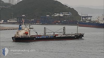
General Cargo
Current Trip
| Time Travelled | 15 days |
|---|---|
| Remaining Time | --- |
| Distance Travelled | 3628.44 nm |
| Remaining Distance | --- |
| AVG Speed | 10.2 Noeuds |
| MAX Speed | 12.1 Noeuds |
| AVG Wind | 10.8 knots |
| MAX Wind | 22 knots |
| MIN Temp | 20.8°C / 69.44°F |
| MAX Temp | 27.3°C / 81.14°F |
| Tirant d eau | 5.4 m |
| Position reçue | 9 h, 41 m depuis |
Current Position
| Longitude | -48.19510° |
|---|---|
| Latitude | -25.64367° |
| Etat | Under way using engine |
| Vitesse | 1.2 Noeuds |
| Parcours | 156° |
| Zone | South Atlantic Ocean |
| Station | T-AIS |
| Position reçue | 9 h, 41 m depuis |
Info
Information
The current position of COREBEST OL is in South Atlantic Ocean with coordinates -25.64367° / -48.19510° as reported on 2024-05-07 19:37 by AIS to our vessel tracker app. The vessel's current speed is 1.2 Noeuds
The vessel COREBEST OL (IMO: 9651943, MMSI: 373841000) is a General Cargo that was built in 2012 ( 12 Age ). It's sailing under the flag of [PA] Panama.
In this page you can find informations about the vessels current position, last detected port calls, and current voyage information. If the vessels is not in coverage by AIS you will find the latest position.
The current position of COREBEST OL is detected by our AIS receivers and we are not responsible for the reliability of the data. The last position was recorded while the vessel was in Coverage by the Ais receivers of our vessel tracking app.
The current draught of COREBEST OL as reported by AIS is 5.4 meters
Weather
| Temperature | 20.7°C / 69.26°F |
|---|---|
| Wind Speed | 2 knots |
| Direction | 302° WNW |
| Pressure | 1010.8 hPa |
| Humidity | 83.2 % |
| Cloud Coverage | 9 % |
Featured Company
Last Port Calls
| Port | Arrival | Departure | Time In Port |
|---|---|---|---|
| 2024-04-17 09:22 | 2024-04-22 22:38 | 5 d | |
| 2024-03-14 10:42 |
Last Trips
| Origin | Departure | Destination | Arrival | Distance | |
|---|---|---|---|---|---|
| 2024-03-14 06:42 | 2024-04-17 10:22 | 4570.16 nm |
Events
| Heure | Evenement | Détails | Position/ Destination | Info |
|---|---|---|---|---|
| 2024-05-08 04:07 | Arret | 4.37 nm, East of PARANAGUA |
-25.50150 / -48.43708
BR PNG
|
Vitesse: 0.3 kn Parcours: 27° |
| 2024-05-08 01:07 | Démarrage | 10.04 nm, South of ILHA DO MEL |
-25.70165 / -48.24497
BR PNG
|
Vitesse: 3.3 kn Parcours: 35° |
| 2024-05-07 23:03 | Arret | 10.4 nm, South East of ILHA DO MEL |
-25.68453 / -48.19441
BR PNG
|
Vitesse: 0.1 kn Parcours: 32° |
| 2024-05-07 19:40 | Etat Changé | Default Under way using engine |
-25.64450 / -48.19569
BR PNG
|
Vitesse: 1.2 kn Parcours: 156° |
| 2024-05-07 19:37 | Hors de la zone couverte |
-25.64367 / -48.19510
South Atlantic Ocean
|
Vitesse: 1.2 kn Parcours: 198.5° |
|
| 2024-05-07 18:42 | Tirant d'eau modifié | 5.4 8.8 |
-25.62754 / -48.18525
BR PNG
|
Vitesse: 1 kn Parcours: 160° |
| 2024-05-07 18:42 | Changement de destination | BR PNG LC VIF |
-25.62754 / -48.18525
BR PNG
|
Vitesse: 1 kn Parcours: 160° |
| 2024-05-07 18:42 | Changement d'ETA | 2024/05/07 08:00 2024/02/10 17:00 |
-25.62754 / -48.18525
BR PNG
|
Vitesse: 1 kn Parcours: 160° |
| 2024-05-07 18:40 | Etat Changé | Under way using engine Default |
-25.62692 / -48.18487
LC VIF
|
Vitesse: 0.9 kn Parcours: 157° |
| 2024-05-07 18:20 | Etat Changé | Default Under way using engine |
-25.61796 / -48.19587
LC VIF
|
Vitesse: 8.2 kn Parcours: 120.9° |