
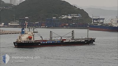
COREBEST OL
General Cargo
Current Trip
| Time Travelled | 16 days |
|---|---|
| Remaining Time | 8 h, 4 mins |
| Distance Travelled | 3718.92 nm |
| Remaining Distance | 92.28 nm |
| AVG Speed | 10.2 Knots |
| MAX Speed | 12.1 Knots |
| AVG Wind | 10.8 knots |
| MAX Wind | 22 knots |
| MIN Temp | 20.2°C / 68.36°F |
| MAX Temp | 35.8°C / 96.44°F |
| Dybgang | 5.4 m |
| Position Modtaget | Nu |
Current Position
| Longitude | -48.14878° |
|---|---|
| Latitude | -26.93908° |
| Status | Under way using engine |
| Fart | 11 Knots |
| Kurs | 178.6° |
| Område | South Atlantic Ocean |
| Station | T-AIS |
| Position Modtaget | Nu |
Info
Information
The current position of COREBEST OL is in South Atlantic Ocean with coordinates -26.93908° / -48.14878° as reported on 2024-05-09 01:47 by AIS to our vessel tracker app. The vessel's current speed is 11 Knots and is heading at the port of PARANAGUA. The estimated time of arrival as calculated by MyShipTracking vessel tracking app is 2024-05-09 09:52 LT
The vessel COREBEST OL (IMO: 9651943, MMSI: 373841000) is a General Cargo that was built in 2012 ( 12 år gamle ). It's sailing under the flag of [PA] Panama.
In this page you can find informations about the vessels current position, last detected port calls, and current voyage information. If the vessels is not in coverage by AIS you will find the latest position.
The current position of COREBEST OL is detected by our AIS receivers and we are not responsible for the reliability of the data. The last position was recorded while the vessel was in Coverage by the Ais receivers of our vessel tracking app.
The current draught of COREBEST OL as reported by AIS is 5.4 meters
Weather
| Temperature | 25°C / 77°F |
|---|---|
| Wind Speed | 13 knots |
| Direction | 349° N |
| Pressure | 1011.6 hPa |
| Humidity | 84.4 % |
| Cloud Coverage | 6 % |
Featured Company
Last Port Calls
| Port | Arrival | Departure | Time In Port |
|---|---|---|---|
| 2024-04-17 09:22 | 2024-04-22 22:38 | 5 d | |
| 2024-03-14 10:42 |
Most Visited Ports (Last year)
| Port | Arrivals | |
|---|---|---|
| 3 | ||
| 1 | ||
| 1 | ||
| 1 | ||
| 1 | ||
| 1 |
Last Trips
| Origin | Departure | Destination | Arrival | Distance | |
|---|---|---|---|---|---|
| 2024-03-14 06:42 | 2024-04-17 10:22 | 4570.16 nm |
Events
| Tid | Hændelsen | Detaljer | Position / Dest | Info |
|---|---|---|---|---|
| 2024-05-09 00:52 | Status er ændret | Under way using engine Default |
-26.76923 / -48.15684
BR PNG
|
Fart: 11 kn Kurs: 182° |
| 2024-05-09 00:37 | Status er ændret | Default Under way using engine |
-26.72395 / -48.15946
BR PNG
|
Fart: 10.9 kn Kurs: 174° |
| 2024-05-08 23:42 | Status er ændret | Under way using engine Default |
-26.55885 / -48.16331
BR PNG
|
Fart: 11.2 kn Kurs: 175° |
| 2024-05-08 23:24 | Indenfor Dækning |
-26.56397 / -48.16296
South Atlantic Ocean
|
Fart: 11 kn Kurs: 176.5° |
|
| 2024-05-08 17:11 | START Sejllads | 4.53 nm, East of PARANAGUA |
-25.50048 / -48.43431
BR PNG
|
Fart: 3.7 kn Kurs: 100° |
| 2024-05-08 12:05 | Status er ændret | Default At anchor |
-25.50220 / -48.43698
BR PNG
|
Fart: 0.3 kn Kurs: 25° |
| 2024-05-08 11:59 | Status er ændret | At anchor Default |
-25.50214 / -48.43664
BR PNG
|
Fart: 0.3 kn Kurs: 18° |
| 2024-05-08 11:59 | Udenfor Dækning |
-25.50214 / -48.43664
South Atlantic Ocean
|
Fart: 0.3 kn Kurs: 281.2° |
|
| 2024-05-08 11:47 | Indenfor Dækning |
-25.50214 / -48.43664
South Atlantic Ocean
|
Fart: 0.3 kn Kurs: 281.2° |
|
| 2024-05-08 04:07 | STOP Sejllads | 4.37 nm, East of PARANAGUA |
-25.50150 / -48.43708
BR PNG
|
Fart: 0.3 kn Kurs: 27° |