
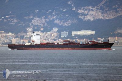
CONSTANTINOS P II
Container Ship
Current Trip
OMSLL
| Time Travelled | 1 day |
|---|---|
| Remaining Time | --- |
| Distance Travelled | 454.83 nm |
| Remaining Distance | --- |
| AVG Speed | 12.1 Noeuds |
| MAX Speed | 15 Noeuds |
| AVG Wind | 5.6 knots |
| MAX Wind | 9 knots |
| MIN Temp | 21.6°C / 70.88°F |
| MAX Temp | 24°C / 75.2°F |
| Tirant d eau | 12.4 m |
| Position reçue | 5 d depuis |
Current Position
| Longitude | --- |
|---|---|
| Latitude | --- |
| Etat | Under way using engine |
| Vitesse | 10.4 Noeuds |
| Parcours | 158.5° |
| Zone | Gulf of Oman |
| Station | T-AIS |
| Position reçue | 5 d depuis |
Info
Information
The current position of CONSTANTINOS P II is in Gulf of Oman with coordinates 24.93968° / 56.71012° as reported on 2025-12-09 03:01 by AIS to our vessel tracker app. The vessel's current speed is 10.4 Noeuds
The vessel CONSTANTINOS P II (IMO: 9461623, MMSI: 538007683) is a Container Ship that was built in 2011 ( 14 Age ). It's sailing under the flag of [MH] Marshall Is.
In this page you can find informations about the vessels current position, last detected port calls, and current voyage information. If the vessels is not in coverage by AIS you will find the latest position.
The current position of CONSTANTINOS P II is detected by our AIS receivers and we are not responsible for the reliability of the data. The last position was recorded while the vessel was in Coverage by the Ais receivers of our vessel tracking app.
The current draught of CONSTANTINOS P II as reported by AIS is 12.4 meters
Weather
| Temperature | 22.7°C / 72.86°F |
|---|---|
| Wind Speed | 9 knots |
| Direction | 140° SE |
| Pressure | 1016.9 hPa |
| Humidity | 66.4 % |
| Cloud Coverage | 4 % |
Featured Company
Last Port Calls
| Port | Arrival | Departure | Time In Port |
|---|---|---|---|
| 2025-12-12 11:31 | 2025-12-13 09:19 | 21 h | |
| 2025-12-06 09:17 | 2025-12-07 04:43 | 19 h | |
| 2025-12-03 17:26 | 2025-12-04 18:18 | 1 d | |
| 2025-11-28 07:01 | 2025-11-29 04:41 | 21 h | |
| 2025-11-22 09:55 | 2025-11-23 12:44 | 1 d | |
| 2025-11-20 05:19 | 2025-11-20 23:08 | 17 h | |
| 2025-11-14 08:55 | 2025-11-15 06:14 | 21 h | |
| 2025-11-08 06:31 | 2025-11-09 01:48 | 19 h | |
| 2025-11-06 04:08 | 2025-11-07 09:59 | 1 d | |
| 2025-10-31 08:03 | 2025-11-01 04:11 | 20 h |
Last Trips
| Origin | Departure | Destination | Arrival | Distance | |
|---|---|---|---|---|---|
| 2025-12-07 04:43 | 2025-12-12 11:31 | 1305.34 nm | |||
| 2025-12-04 18:18 | 2025-12-06 09:17 | 163.33 nm | |||
| 2025-11-29 04:41 | 2025-12-03 17:26 | 1316.13 nm | |||
| 2025-11-23 12:44 | 2025-11-28 07:01 | 1303.56 nm | |||
| 2025-11-20 23:08 | 2025-11-22 09:55 | 133.85 nm | |||
| 2025-11-15 06:14 | 2025-11-20 05:19 | 1315.83 nm | |||
| 2025-11-09 01:48 | 2025-11-14 08:55 | 1310.83 nm | |||
| 2025-11-07 09:59 | 2025-11-08 06:31 | 138.38 nm | |||
| 2025-11-01 04:11 | 2025-11-06 04:08 | 1315.90 nm | |||
| 2025-10-26 05:28 | 2025-10-31 08:03 | 1305.68 nm |
Events
| Heure | Evenement | Détails | Position/ Destination | Info |
|---|---|---|---|---|
| 2025-12-13 05:31 | Démarrage | 1.33 nm, East of SALALAH |
16.94833 / 54.04666
OMSLL
|
Vitesse: 9 kn Parcours: -1° |
| 2025-12-13 05:19 | PORT DE DEPART |
|
16.94833 / 54.04666
OMSLL
|
Vitesse: 2 kn Parcours: -1° |
| 2025-12-12 07:31 | Port d'arrivée |
|
16.94833 / 54.01333
[OM] SALALAH
|
Vitesse: 3 kn Parcours: -1° |
| 2025-12-12 05:52 | Arret | 3.91 nm, East of SALALAH |
16.94500 / 54.09167
OMSLL
|
Vitesse: Parcours: -1° |
| 2025-12-12 05:46 | Démarrage | 4.2 nm, East of SALALAH |
16.94500 / 54.09667
OMSLL
|
Vitesse: 5 kn Parcours: 281° |
| 2025-12-12 02:04 | Démarrage | 16.88 nm, East of SALALAH |
16.87667 / 54.30667
OMSLL
|
Vitesse: 5 kn Parcours: 312° |
| 2025-12-12 01:31 | Arret | 17.66 nm, East of SALALAH |
16.86833 / 54.31833
OMSLL
|
Vitesse: Parcours: -1° |
| 2025-12-09 03:08 | Etat Changé | Default Under way using engine |
24.92583 / 56.72437
OMSLL
|
Vitesse: 10.4 kn Parcours: 158.5° |
| 2025-12-09 03:01 | Hors de la zone couverte |
24.93968 / 56.71012
Gulf of Oman
OMSLL
|
Vitesse: 10.4 kn Parcours: 158.5° |
|
| 2025-12-09 02:31 | Detecté en mer | Omani part of the Gulf of Oman |
25.03048 / 56.70095
Gulf of Oman
OMSLL
|
Vitesse: 11.1 kn Parcours: 176.1° |