
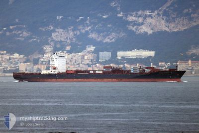
CONSTANTINOS P II
Container Ship
Current Trip
| Time Travelled | 4 days |
|---|---|
| Remaining Time | 11 h, 40 mins |
| Distance Travelled | 1164.90 nm |
| Remaining Distance | 288.59 nm |
| AVG Speed | 10.6 Knots |
| MAX Speed | 12.6 Knots |
| AVG Wind | 7.6 knots |
| MAX Wind | 14 knots |
| MIN Temp | 23.6°C / 74.48°F |
| MAX Temp | 26.9°C / 80.42°F |
| Dybgang | 12.4 m |
| Position Modtaget | 2 d siden |
Current Position
| Longitude | --- |
|---|---|
| Latitude | --- |
| Status | Under way using engine |
| Fart | 10.4 Knots |
| Kurs | 158.5° |
| Område | Gulf of Oman |
| Station | T-AIS |
| Position Modtaget | 2 d siden |
Info
Information
The current position of CONSTANTINOS P II is in Gulf of Oman with coordinates 24.93968° / 56.71012° as reported on 2025-12-09 03:01 by AIS to our vessel tracker app. The vessel's current speed is 10.4 Knots and is heading at the port of SALALAH. The estimated time of arrival as calculated by MyShipTracking vessel tracking app is 2025-12-12 05:42 LT
The vessel CONSTANTINOS P II (IMO: 9461623, MMSI: 538007683) is a Container Ship that was built in 2011 ( 14 år gamle ). It's sailing under the flag of [MH] Marshall Is.
In this page you can find informations about the vessels current position, last detected port calls, and current voyage information. If the vessels is not in coverage by AIS you will find the latest position.
The current position of CONSTANTINOS P II is detected by our AIS receivers and we are not responsible for the reliability of the data. The last position was recorded while the vessel was in Coverage by the Ais receivers of our vessel tracking app.
The current draught of CONSTANTINOS P II as reported by AIS is 12.4 meters
Weather
| Temperature | 24.7°C / 76.46°F |
|---|---|
| Wind Speed | 7 knots |
| Direction | 102° ESE |
| Pressure | 1014 hPa |
| Humidity | 70.5 % |
| Cloud Coverage | 5 % |
Featured Company
Last Port Calls
| Port | Arrival | Departure | Time In Port |
|---|---|---|---|
| 2025-12-06 09:17 | 2025-12-07 04:43 | 19 h | |
| 2025-12-03 17:26 | 2025-12-04 18:18 | 1 d | |
| 2025-11-28 07:01 | 2025-11-29 04:41 | 21 h | |
| 2025-11-22 09:55 | 2025-11-23 12:44 | 1 d | |
| 2025-11-20 05:19 | 2025-11-20 23:08 | 17 h | |
| 2025-11-14 08:55 | 2025-11-15 06:14 | 21 h | |
| 2025-11-08 06:31 | 2025-11-09 01:48 | 19 h | |
| 2025-11-06 04:08 | 2025-11-07 09:59 | 1 d | |
| 2025-10-31 08:03 | 2025-11-01 04:11 | 20 h | |
| 2025-10-25 03:09 | 2025-10-26 05:28 | 1 d |
Last Trips
| Origin | Departure | Destination | Arrival | Distance | |
|---|---|---|---|---|---|
| 2025-12-04 18:18 | 2025-12-06 09:17 | 163.33 nm | |||
| 2025-11-29 04:41 | 2025-12-03 17:26 | 1316.13 nm | |||
| 2025-11-23 12:44 | 2025-11-28 07:01 | 1303.56 nm | |||
| 2025-11-20 23:08 | 2025-11-22 09:55 | 133.85 nm | |||
| 2025-11-15 06:14 | 2025-11-20 05:19 | 1315.83 nm | |||
| 2025-11-09 01:48 | 2025-11-14 08:55 | 1310.83 nm | |||
| 2025-11-07 09:59 | 2025-11-08 06:31 | 138.38 nm | |||
| 2025-11-01 04:11 | 2025-11-06 04:08 | 1315.90 nm | |||
| 2025-10-26 05:28 | 2025-10-31 08:03 | 1305.68 nm | |||
| 2025-10-23 19:25 | 2025-10-25 03:09 | 146.61 nm |
Events
| Tid | Hændelsen | Detaljer | Position / Dest | Info |
|---|---|---|---|---|
| 2025-12-09 03:08 | Status er ændret | Default Under way using engine |
24.92583 / 56.72437
OMSLL
|
Fart: 10.4 kn Kurs: 158.5° |
| 2025-12-09 03:01 | Udenfor Dækning |
24.93968 / 56.71012
Gulf of Oman
OMSLL
|
Fart: 10.4 kn Kurs: 158.5° |
|
| 2025-12-09 02:31 | Fundet i havområde | Omani part of the Gulf of Oman |
25.03048 / 56.70095
Gulf of Oman
OMSLL
|
Fart: 11.1 kn Kurs: 176.1° |
| 2025-12-09 02:10 | Status er ændret | Under way using engine Default |
25.09579 / 56.69746
OMSLL
|
Fart: 10.7 kn Kurs: 177° |
| 2025-12-09 02:07 | Status er ændret | Default Under way using engine |
25.10230 / 56.69713
OMSLL
|
Fart: 10.6 kn Kurs: 177.2° |
| 2025-12-08 22:55 | Ændre havområde | United Arab Emirates part of the Gulf of Oman Omani part of the Gulf of Oman |
25.66933 / 56.73001
Gulf of Oman
OMSLL
|
Fart: 11 kn Kurs: 181.9° |
| 2025-12-08 21:34 | Fundet i havområde | Omani part of the Gulf of Oman |
25.91436 / 56.73455
Gulf of Oman
OMSLL
|
Fart: 10.7 kn Kurs: 181.1° |
| 2025-12-08 21:33 | Status er ændret | Under way using engine Default |
25.91745 / 56.73460
OMSLL
|
Fart: 10.6 kn Kurs: 182° |
| 2025-12-08 21:22 | Indenfor Dækning |
25.91436 / 56.73455
Gulf of Oman
OMSLL
|
Fart: 10.7 kn Kurs: 181.1° |
|
| 2025-12-08 14:20 | Udenfor Dækning |
26.15523 / 55.91716
Persian Gulf
OMSLL
|
Fart: 12.2 kn Kurs: 42.3° |