
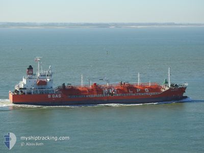
CGAS MAUD
Lpg Tanker
Current Trip
| Time Travelled | 2 days |
|---|---|
| Remaining Time | 2 days |
| Distance Travelled | 231.32 nm |
| Remaining Distance | 467.99 nm |
| AVG Speed | 10.5 Noeuds |
| MAX Speed | 14.5 Noeuds |
| AVG Wind | 17.5 knots |
| MAX Wind | 28.3 knots |
| MIN Temp | 4.8°C / 40.64°F |
| MAX Temp | 11.9°C / 53.42°F |
| Tirant d eau | 5.6 m |
| Position reçue | 43 m depuis |
Current Position
| Longitude | --- |
|---|---|
| Latitude | --- |
| Etat | Under way using engine |
| Vitesse | 8.9 Noeuds |
| Parcours | 182° |
| Zone | Celtic Sea |
| Station | T-AIS |
| Position reçue | 43 m depuis |
Info
Information
The current position of CGAS MAUD is in Celtic Sea with coordinates 51.43762° / -6.00882° as reported on 2025-12-06 20:41 by AIS to our vessel tracker app. The vessel's current speed is 8.9 Noeuds and is heading at the port of VLISSINGEN. The estimated time of arrival as calculated by MyShipTracking vessel tracking app is 2025-12-09 00:02 LT
The vessel CGAS MAUD (IMO: 9363522, MMSI: 248102000) is a Lpg Tanker that was built in 2006 ( 19 Age ). It's sailing under the flag of [MT] Malta.
In this page you can find informations about the vessels current position, last detected port calls, and current voyage information. If the vessels is not in coverage by AIS you will find the latest position.
The current position of CGAS MAUD is detected by our AIS receivers and we are not responsible for the reliability of the data. The last position was recorded while the vessel was in Coverage by the Ais receivers of our vessel tracking app.
The current draught of CGAS MAUD as reported by AIS is 5.6 meters
Weather
| Temperature | 11.9°C / 53.42°F |
|---|---|
| Wind Speed | 18 knots |
| Direction | 235° SW |
| Pressure | 1001.3 hPa |
| Humidity | 85.1 % |
| Cloud Coverage | 100 % |
Featured Company
Last Port Calls
| Port | Arrival | Departure | Time In Port |
|---|---|---|---|
| 2025-12-04 20:46 | 2025-12-04 21:24 | 38 m | |
| 2025-12-04 20:01 | 2025-12-04 20:21 | 19 m | |
| 2025-12-01 20:56 | 2025-12-02 11:16 | 14 h | |
| 2025-12-01 19:51 | 2025-12-01 20:33 | 42 m | |
| 2025-11-18 08:32 | 2025-11-19 12:24 | 1 d | |
| 2025-11-10 21:20 | 2025-11-12 11:57 | 1 d | |
| 2025-11-07 01:57 | 2025-11-08 19:35 | 1 d | |
| 2025-11-01 09:51 | 2025-11-03 22:04 | 2 d | |
| 2025-10-29 13:07 | 2025-10-30 12:26 | 23 h | |
| 2025-10-23 23:50 | 2025-10-24 17:16 | 17 h |
Last Trips
| Origin | Departure | Destination | Arrival | Distance | |
|---|---|---|---|---|---|
| 2025-12-04 20:21 | 2025-12-04 20:46 | 2.08 nm | |||
| 2025-12-02 11:16 | 2025-12-04 20:01 | 1.61 nm | |||
| 2025-12-01 20:33 | 2025-12-01 20:56 | 1.92 nm | |||
| 2025-11-19 12:24 | 2025-12-01 19:51 | 883.80 nm | |||
| 2025-11-12 11:57 | 2025-11-18 08:32 | 1006.38 nm | |||
| 2025-11-08 19:35 | 2025-11-10 21:20 | 600.49 nm | |||
| 2025-11-03 22:04 | 2025-11-07 01:57 | 103.91 nm | |||
| 2025-10-30 12:26 | 2025-11-01 09:51 | 315.14 nm | |||
| 2025-10-24 17:16 | 2025-10-29 13:07 | 899.51 nm | |||
| 2025-10-20 08:52 | 2025-10-23 23:50 | 933.24 nm |
Events
| Heure | Evenement | Détails | Position/ Destination | Info |
|---|---|---|---|---|
| 2025-12-06 20:47 | Etat Changé | Default Under way using engine |
51.42303 / -6.01172
NLVLI
|
Vitesse: 8.9 kn Parcours: 182° |
| 2025-12-06 20:41 | Changement de zone | United Kingdom part of the Celtic Sea Irish part of the Celtic Sea |
51.43762 / -6.00882
Celtic Sea
NLVLI
|
Vitesse: 8.9 kn Parcours: 182° |
| 2025-12-06 20:41 | Etat Changé | Under way using engine Default |
51.43762 / -6.00882
NLVLI
|
Vitesse: 9.1 kn Parcours: 185° |
| 2025-12-06 20:23 | Dans la zone couverte |
51.43762 / -6.00882
Celtic Sea
NLVLI
|
Vitesse: 8.9 kn Parcours: 182° |
|
| 2025-12-06 16:27 | Etat Changé | Default Under way using engine |
52.01266 / -5.88043
NLVLI
|
Vitesse: 9 kn Parcours: 173° |
| 2025-12-06 16:19 | Hors de la zone couverte |
52.03430 / -5.87915
Celtic Sea
NLVLI
|
Vitesse: 9 kn Parcours: 173° |
|
| 2025-12-06 16:09 | Changement de zone | Irish part of the Celtic Sea Irish part of the Irish Sea and St. George's Channel |
52.06415 / -5.87897
Celtic Sea
NLVLI
|
Vitesse: 10.4 kn Parcours: 182° |
| 2025-12-06 15:28 | Etat Changé | Under way using engine Default |
52.18435 / -5.87892
NLVLI
|
Vitesse: 11 kn Parcours: 179° |
| 2025-12-06 15:23 | Etat Changé | Default Under way using engine |
52.20082 / -5.87818
NLVLI
|
Vitesse: 11.8 kn Parcours: 175° |
| 2025-12-06 14:40 | Etat Changé | Under way using engine Default |
52.35105 / -5.89452
NLVLI
|
Vitesse: 14.1 kn Parcours: 175° |