
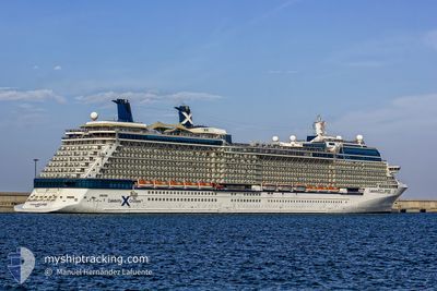
CELEBRITY ECLIPSE
Passengers Ship
Current Trip
| Time Travelled | 1 day |
|---|---|
| Remaining Time | 1 day |
| Distance Travelled | 531.78 nm |
| Remaining Distance | 842.28 nm |
| AVG Speed | 17.6 Noeuds |
| MAX Speed | 20 Noeuds |
| AVG Wind | 7.7 knots |
| MAX Wind | 13 knots |
| MIN Temp | 25.1°C / 77.18°F |
| MAX Temp | 26.8°C / 80.24°F |
| Tirant d eau | 0 m |
| Position reçue | 21 h, 31 m depuis |
Current Position
| Longitude | --- |
|---|---|
| Latitude | --- |
| Etat | Under way using engine |
| Vitesse | 18.7 Noeuds |
| Parcours | 108.6° |
| Zone | North Atlantic Ocean |
| Station | T-AIS |
| Position reçue | 21 h, 31 m depuis |
Info
Information
The current position of CELEBRITY ECLIPSE is in North Atlantic Ocean with coordinates 25.71565° / -77.20619° as reported on 2025-12-07 06:18 by AIS to our vessel tracker app. The vessel's current speed is 18.7 Noeuds and is heading at the port of ST JOHNS. The estimated time of arrival as calculated by MyShipTracking vessel tracking app is 2025-12-09 11:24 LT
The vessel CELEBRITY ECLIPSE (IMO: 9404314, MMSI: 249666000) is a Passengers Ship that was built in 2010 ( 15 Age ). It's sailing under the flag of [MT] Malta.
In this page you can find informations about the vessels current position, last detected port calls, and current voyage information. If the vessels is not in coverage by AIS you will find the latest position.
The current position of CELEBRITY ECLIPSE is detected by our AIS receivers and we are not responsible for the reliability of the data. The last position was recorded while the vessel was in Coverage by the Ais receivers of our vessel tracking app.
Weather
| Temperature | 26.7°C / 80.06°F |
|---|---|
| Wind Speed | 12 knots |
| Direction | 119° ESE |
| Pressure | 1017.1 hPa |
| Humidity | 77.1 % |
| Cloud Coverage | 7 % |
Featured Company
Last Port Calls
| Port | Arrival | Departure | Time In Port |
|---|---|---|---|
| 2025-12-06 06:22 | 2025-12-06 16:12 | 9 h | |
| 2025-12-05 09:16 | 2025-12-05 18:05 | 8 h | |
| 2025-12-03 09:29 | 2025-12-03 19:44 | 10 h | |
| 2025-11-30 04:50 | 2025-11-30 16:52 | 12 h | |
| 2025-11-28 08:45 | 2025-11-28 18:35 | 9 h | |
| 2025-11-27 05:49 | 2025-11-27 16:50 | 11 h | |
| 2025-11-26 07:23 | 2025-11-26 17:49 | 10 h | |
| 2025-11-25 08:48 | 2025-11-25 18:08 | 9 h | |
| 2025-11-22 06:28 | 2025-11-22 15:47 | 9 h | |
| 2025-11-21 09:10 | 2025-11-21 17:53 | 8 h |
Most Visited Ports (Last year)
| Port | Arrivals | |
|---|---|---|
| 20 | ||
| 19 | ||
| 12 | ||
| 11 | ||
| 7 | ||
| 6 |
Last Trips
| Origin | Departure | Destination | Arrival | Distance | |
|---|---|---|---|---|---|
| 2025-12-05 18:05 | 2025-12-06 06:22 | 186.60 nm | |||
| 2025-12-03 19:44 | 2025-12-05 09:16 | 699.33 nm | |||
| 2025-11-30 16:52 | 2025-12-03 09:29 | 1014.97 nm | |||
| 2025-11-28 18:35 | 2025-11-30 04:50 | 681.65 nm | |||
| 2025-11-27 16:50 | 2025-11-28 08:45 | 274.76 nm | |||
| 2025-11-26 17:49 | 2025-11-27 05:49 | 186.52 nm | |||
| 2025-11-25 18:08 | 2025-11-26 07:23 | 89.51 nm | |||
| 2025-11-22 15:47 | 2025-11-25 08:48 | 1168.63 nm | |||
| 2025-11-21 17:53 | 2025-11-22 06:28 | 186.54 nm | |||
| 2025-11-19 19:41 | 2025-11-21 09:10 | 701.58 nm |
Events
| Heure | Evenement | Détails | Position/ Destination | Info |
|---|---|---|---|---|
| 2025-12-07 06:24 | Etat Changé | Default Under way using engine |
25.70667 / -77.17333
AGSJO
|
Vitesse: 18.7 kn Parcours: 108.6° |
| 2025-12-07 06:18 | Hors de la zone couverte |
25.71565 / -77.20619
North Atlantic Ocean
AGSJO
|
Vitesse: 18.7 kn Parcours: 108.6° |
|
| 2025-12-07 06:17 | Etat Changé | Under way using engine Default |
25.71771 / -77.21276
AGSJO
|
Vitesse: 19 kn Parcours: 109° |
| 2025-12-07 05:28 | Etat Changé | Default Under way using engine |
25.78892 / -77.48597
AGSJO
|
Vitesse: 18.6 kn Parcours: 108.3° |
| 2025-12-07 02:53 | Etat Changé | Under way using engine Default |
26.02640 / -78.31736
AGSJO
|
Vitesse: 15.7 kn Parcours: 111° |
| 2025-12-07 02:48 | Dans la zone couverte |
26.02640 / -78.31736
North Atlantic Ocean
AGSJO
|
Vitesse: 15.7 kn Parcours: 111.2° |
|
| 2025-12-07 01:14 | Etat Changé | Default Under way using engine |
26.16231 / -78.83289
AGSJO
|
Vitesse: 17.3 kn Parcours: 106.4° |
| 2025-12-07 01:06 | Hors de la zone couverte |
26.17531 / -78.87076
North Atlantic Ocean
AGSJO
|
Vitesse: 17.3 kn Parcours: 106.4° |
|
| 2025-12-06 23:38 | Etat Changé | Under way using engine Default |
26.18216 / -79.34065
AGSJO
|
Vitesse: 19 kn Parcours: 71° |
| 2025-12-06 23:32 | Etat Changé | Default Under way using engine |
26.17333 / -79.37334
AGSJO
|
Vitesse: 18.1 kn Parcours: 86.2° |