
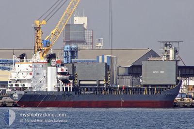
BRAVE KNIGHT
Bulk Carrier
Current Trip
| Time Travelled | 33 days |
|---|---|
| Remaining Time | --- |
| Distance Travelled | 2295.38 nm |
| Remaining Distance | --- |
| AVG Speed | 10 Noeuds |
| MAX Speed | 13.1 Noeuds |
| AVG Wind | 8.4 knots |
| MAX Wind | 24.9 knots |
| MIN Temp | 10.1°C / 50.18°F |
| MAX Temp | 26.3°C / 79.34°F |
| Tirant d eau | 7 m |
| Position reçue | 3 d depuis |
Current Position
| Longitude | 33.66109° |
|---|---|
| Latitude | 34.92388° |
| Etat | At anchor |
| Vitesse | |
| Parcours | 257° |
| Zone | Mediterranean Sea - Eastern Basin |
| Station | T-AIS |
| Position reçue | 3 d depuis |
Info
Information
The current position of BRAVE KNIGHT is in Mediterranean Sea - Eastern Basin with coordinates 34.92388° / 33.66109° as reported on 2024-05-10 23:32 by AIS to our vessel tracker app. The vessel's current speed is 0 Noeuds
The vessel BRAVE KNIGHT (IMO: 7129336, MMSI: 450552000) is a Bulk Carrier that was built in 1972 ( 52 Age ). It's sailing under the flag of [LB] Lebanon.
In this page you can find informations about the vessels current position, last detected port calls, and current voyage information. If the vessels is not in coverage by AIS you will find the latest position.
The current position of BRAVE KNIGHT is detected by our AIS receivers and we are not responsible for the reliability of the data. The last position was recorded while the vessel was in Coverage by the Ais receivers of our vessel tracking app.
The current draught of BRAVE KNIGHT as reported by AIS is 7 meters
Weather
| Temperature | 19.1°C / 66.38°F |
|---|---|
| Wind Speed | 5 knots |
| Direction | 291° WNW |
| Pressure | 1009.7 hPa |
| Humidity | 56.5 % |
| Cloud Coverage | --- |
Featured Company
Last Port Calls
| Port | Arrival | Departure | Time In Port |
|---|---|---|---|
| 2024-04-09 09:14 | 2024-04-10 11:16 | 1 d | |
| 2024-04-03 19:57 | 2024-04-08 14:41 | 4 d | |
| 2024-03-09 16:07 | 2024-03-10 07:16 | 15 h | |
| 2024-03-05 12:43 |
Events
| Heure | Evenement | Détails | Position/ Destination | Info |
|---|---|---|---|---|
| 2024-05-10 23:38 | Etat Changé | Default At anchor |
34.92387 / 33.66121
CYLCA
|
Vitesse: Parcours: 257° |
| 2024-05-10 23:32 | Hors de la zone couverte |
34.92388 / 33.66109
Mediterranean Sea - Eastern Basin
|
Vitesse: Parcours: 257° |
|
| 2024-05-10 23:26 | Etat Changé | At anchor Default |
34.92400 / 33.66111
CYLCA
|
Vitesse: 0.1 kn Parcours: 211° |
| 2024-05-10 23:17 | Etat Changé | Default At anchor |
34.92443 / 33.66074
CYLCA
|
Vitesse: Parcours: 204° |
| 2024-05-10 22:35 | Etat Changé | At anchor Default |
34.92448 / 33.66047
CYLCA
|
Vitesse: Parcours: 209° |
| 2024-05-10 22:26 | Etat Changé | Default At anchor |
34.92436 / 33.66033
CYLCA
|
Vitesse: Parcours: 201° |
| 2024-05-10 22:11 | Etat Changé | At anchor Default |
34.92440 / 33.66049
CYLCA
|
Vitesse: Parcours: 213° |
| 2024-05-10 22:08 | Etat Changé | Default At anchor |
34.92440 / 33.66050
CYLCA
|
Vitesse: Parcours: 210° |
| 2024-05-10 21:37 | Etat Changé | At anchor Default |
34.92439 / 33.66051
CYLCA
|
Vitesse: Parcours: 212° |
| 2024-05-10 21:34 | Etat Changé | Default At anchor |
34.92434 / 33.66048
CYLCA
|
Vitesse: Parcours: 217° |