
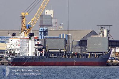
BRAVE KNIGHT
Bulk Carrier
Current Trip
UAIZM
| Time Travelled | 8 days |
|---|---|
| Remaining Time | --- |
| Distance Travelled | 1150.19 nm |
| Remaining Distance | --- |
| AVG Speed | 10.3 Knopen |
| MAX Speed | 12.1 Knopen |
| AVG Wind | 10.1 knots |
| MAX Wind | 24.3 knots |
| MIN Temp | 12°C / 53.6°F |
| MAX Temp | 23.1°C / 73.58°F |
| Diepgang | 4.2 M |
| Positie ontvangen | 1 d geleden |
Current Position
| Lengtegraad | 29.16444° |
|---|---|
| Breedtegraat | 41.49609° |
| Status | Under way sailing |
| Snelheid | 10.8 Knopen |
| Koers | 349.5° |
| Gebied | Black Sea |
| Station | T-AIS |
| Positie ontvangen | 1 d geleden |
Info
Information
The current position of BRAVE KNIGHT is in Black Sea with coordinates 41.49609° / 29.16444° as reported on 2024-04-17 10:54 by AIS to our vessel tracker app. The vessel's current speed is 10.8 Knopen
The vessel BRAVE KNIGHT (IMO: 7129336, MMSI: 450552000) is a Bulk Carrier that was built in 1972 ( 52 Jaar oud ). It's sailing under the flag of [LB] Lebanon.
In this page you can find informations about the vessels current position, last detected port calls, and current voyage information. If the vessels is not in coverage by AIS you will find the latest position.
The current position of BRAVE KNIGHT is detected by our AIS receivers and we are not responsible for the reliability of the data. The last position was recorded while the vessel was in Coverage by the Ais receivers of our vessel tracking app.
The current draught of BRAVE KNIGHT as reported by AIS is 4.2 meters
Weather
| Temperature | 11.3°C / 52.34°F |
|---|---|
| Wind Speed | 13 knots |
| Direction | 304° NW |
| Pressure | 999.6 hPa |
| Humidity | 92.4 % |
| Cloud Coverage | 93 % |
Featured Company
Last Trips
| Origin | Departure | Destination | Arrival | Distance | |
|---|---|---|---|---|---|
| 2024-04-08 14:41 | 2024-04-09 09:14 | 31.57 nm | |||
| 2024-03-10 07:16 | 2024-04-03 19:57 | 1146.93 nm | |||
| 2024-03-05 12:43 | 2024-03-09 16:07 | 687.26 nm | |||
| 2024-02-05 18:22 | 2024-02-29 10:27 | 1918.43 nm |
Events
| Tijd | Evenement | Details | Positie / Bestemming | Info |
|---|---|---|---|---|
| 2024-04-17 16:41 | Start beweging |
42.50651 / 28.96094
UAIZM
|
Snelheid: 11.1 kn Koers: 352° |
|
| 2024-04-17 16:36 | Stop beweging |
42.49182 / 28.96423
UAIZM
|
Snelheid: Koers: 352° |
|
| 2024-04-17 10:59 | Status Changed | Default Under way sailing |
41.51024 / 29.16071
UAIZM
|
Snelheid: 10.8 kn Koers: 349.5° |
| 2024-04-17 10:54 | Buitenbereik |
41.49609 / 29.16444
Black Sea
UAIZM
|
Snelheid: 10.8 kn Koers: 349.5° |
|
| 2024-04-17 09:25 | Wijzig zee gebeid | Turkish part of the Black Sea Turkish part of the Sea of Marmara |
41.23197 / 29.14249
Black Sea
UAIZM
|
Snelheid: 11.1 kn Koers: 34.6° |
| 2024-04-16 22:40 | Status Changed | Under way sailing Default |
40.51743 / 27.03699
UAIZM
|
Snelheid: 11.2 kn Koers: 67° |
| 2024-04-16 22:40 | Binnenbereik |
40.51743 / 27.03699
Sea of Marmara
UAIZM
|
Snelheid: 11.2 kn Koers: 66.3° |
|
| 2024-04-16 20:10 | Status Changed | Default Under way sailing |
40.26190 / 26.53975
UAIZM
|
Snelheid: 11.5 kn Koers: 44.8° |
| 2024-04-16 20:10 | Buitenbereik |
40.26152 / 26.53927
Sea of Marmara
UAIZM
|
Snelheid: 11.5 kn Koers: 44.8° |
|
| 2024-04-16 18:10 | Status Changed | Under way sailing Default |
40.02620 / 26.26208
UAIZM
|
Snelheid: 10.6 kn Koers: 70° |