
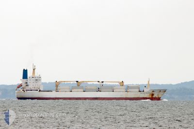
BELUGA REEFER
Reefer
Current Trip
| Time Travelled | 16 h, 56 mins |
|---|---|
| Remaining Time | --- |
| Distance Travelled | 277.28 nm |
| Remaining Distance | --- |
| AVG Speed | 15.8 Noeuds |
| MAX Speed | 17.3 Noeuds |
| AVG Wind | 10 knots |
| MAX Wind | 19 knots |
| MIN Temp | 14.4°C / 57.92°F |
| MAX Temp | 20.3°C / 68.54°F |
| Tirant d eau | 9.6 m |
| Position reçue | 13 h, 47 m depuis |
Current Position
| Longitude | 17.63895° |
|---|---|
| Latitude | -33.46916° |
| Etat | Under way using engine |
| Vitesse | 16.4 Noeuds |
| Parcours | 295.8° |
| Zone | South Atlantic Ocean |
| Station | T-AIS |
| Position reçue | 13 h, 47 m depuis |
Info
Information
The current position of BELUGA REEFER is in South Atlantic Ocean with coordinates -33.46916° / 17.63895° as reported on 2024-04-28 03:03 by AIS to our vessel tracker app. The vessel's current speed is 16.4 Noeuds and is heading at the port of ST PETERSBURG. The estimated time of arrival as calculated by MyShipTracking vessel tracking app is 2024-05-17 01:00 LT
The vessel BELUGA REEFER (IMO: 9015204, MMSI: 308121000) is a Reefer that was built in 1992 ( 32 Age ). It's sailing under the flag of [BS] Bahamas.
In this page you can find informations about the vessels current position, last detected port calls, and current voyage information. If the vessels is not in coverage by AIS you will find the latest position.
The current position of BELUGA REEFER is detected by our AIS receivers and we are not responsible for the reliability of the data. The last position was recorded while the vessel was in Coverage by the Ais receivers of our vessel tracking app.
The current draught of BELUGA REEFER as reported by AIS is 9.6 meters
Weather
| Temperature | 18.4°C / 65.12°F |
|---|---|
| Wind Speed | 5 knots |
| Direction | 254° WSW |
| Pressure | 1013.5 hPa |
| Humidity | 87.4 % |
| Cloud Coverage | --- |
Featured Company
Last Port Calls
| Port | Arrival | Departure | Time In Port |
|---|---|---|---|
| 2024-04-22 06:18 | 2024-04-27 23:55 | 5 d | |
| 2024-04-14 11:49 | 2024-04-20 05:35 | 5 d | |
| 2024-03-17 20:00 | 2024-03-24 13:45 | 6 d | |
| 2024-02-17 10:08 | 2024-02-20 13:26 | 3 d | |
| 2024-02-12 11:35 | 2024-02-15 17:58 | 3 d | |
| 2024-02-08 08:37 | 2024-02-08 10:34 | 1 h |
Most Visited Ports (Last year)
| Port | Arrivals | |
|---|---|---|
| 5 | ||
| 3 | ||
| 2 | ||
| 2 | ||
| 2 | ||
| 1 |
Last Trips
| Origin | Departure | Destination | Arrival | Distance | |
|---|---|---|---|---|---|
| 2024-04-20 07:35 | 2024-04-22 08:18 | 818.75 nm | |||
| 2024-03-24 16:45 | 2024-04-14 13:49 | 8441.05 nm | |||
| 2024-02-20 08:26 | 2024-03-17 23:00 | 7248.15 nm | |||
| 2024-02-15 12:58 | 2024-02-17 05:08 | 682.92 nm | |||
| 2024-02-08 05:34 | 2024-02-12 06:35 | 1496.97 nm | |||
| 2024-01-22 11:29 | 2024-02-08 03:37 | 6446.76 nm |
Events
| Heure | Evenement | Détails | Position/ Destination | Info |
|---|---|---|---|---|
| 2024-04-28 03:11 | Etat Changé | Default Under way using engine |
-33.45318 / 17.59778
RU LED
|
Vitesse: 16.4 kn Parcours: 295.8° |
| 2024-04-28 03:03 | Hors de la zone couverte |
-33.46916 / 17.63895
South Atlantic Ocean
RU LED
|
Vitesse: 16.4 kn Parcours: 295.8° |
|
| 2024-04-28 02:56 | Etat Changé | Under way using engine Default |
-33.48302 / 17.67499
RU LED
|
Vitesse: 15.9 kn Parcours: 294° |
| 2024-04-28 02:55 | Etat Changé | Default Under way using engine |
-33.48371 / 17.67684
RU LED
|
Vitesse: 16.7 kn Parcours: 293.3° |
| 2024-04-28 02:48 | Etat Changé | Under way using engine Default |
-33.49694 / 17.71255
RU LED
|
Vitesse: 16.6 kn Parcours: 293° |
| 2024-04-28 02:27 | Etat Changé | Default Under way using engine |
-33.53615 / 17.81795
RU LED
|
Vitesse: 16.4 kn Parcours: 292.4° |
| 2024-04-28 02:20 | Etat Changé | Under way using engine Default |
-33.55092 / 17.85783
RU LED
|
Vitesse: 16.5 kn Parcours: 296° |
| 2024-04-28 02:03 | Etat Changé | Default Under way using engine |
-33.58350 / 17.93672
RU LED
|
Vitesse: 16.7 kn Parcours: 294.9° |
| 2024-04-28 01:56 | Etat Changé | Under way using engine Default |
-33.59872 / 17.97506
RU LED
|
Vitesse: 16.6 kn Parcours: 294° |
| 2024-04-28 01:55 | Etat Changé | Default Under way using engine |
-33.60031 / 17.97917
RU LED
|
Vitesse: 16.6 kn Parcours: 294.6° |