
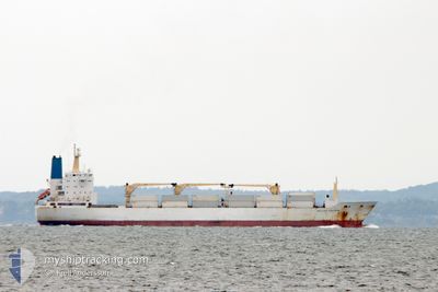
BELUGA REEFER
Reefer
Current Trip
| Time Travelled | 2 h, 38 mins |
|---|---|
| Remaining Time | 1 day |
| Distance Travelled | 42.62 nm |
| Remaining Distance | 786.22 nm |
| AVG Speed | 16.7 Knots |
| MAX Speed | 18 Knots |
| AVG Wind | 5.4 knots |
| MAX Wind | 6 knots |
| MIN Temp | 20°C / 68°F |
| MAX Temp | 23.4°C / 74.12°F |
| Draught | 8.5 m |
| Position Received | 1 h, 51 m ago |
Current Position
| Longitude | 31.11453° |
|---|---|
| Latitude | -29.98154° |
| Status | Under way using engine |
| Speed | 17.7 Knots |
| Course | 207.5° |
| Area | Indian Ocean |
| Station | T-AIS |
| Position Received | 1 h, 51 m ago |
Info
Information
The current position of BELUGA REEFER is in Indian Ocean with coordinates -29.98154° / 31.11453° as reported on 2024-04-20 06:22 by AIS to our vessel tracker app. The vessel's current speed is 17.7 Knots and is heading at the port of CAPE TOWN. The estimated time of arrival as calculated by MyShipTracking vessel tracking app is 2024-04-22 04:06 LT
The vessel BELUGA REEFER (IMO: 9015204, MMSI: 308121000) is a Reefer that was built in 1992 ( 32 years old ). It's sailing under the flag of [BS] Bahamas.
In this page you can find informations about the vessels current position, last detected port calls, and current voyage information. If the vessels is not in coverage by AIS you will find the latest position.
The current position of BELUGA REEFER is detected by our AIS receivers and we are not responsible for the reliability of the data. The last position was recorded while the vessel was in Coverage by the Ais receivers of our vessel tracking app.
The current draught of BELUGA REEFER as reported by AIS is 8.5 meters
Weather
| Temperature | 23.4°C / 74.12°F |
|---|---|
| Wind Speed | 5 knots |
| Direction | 29° NNE |
| Pressure | 1014 hPa |
| Humidity | 59.4 % |
| Cloud Coverage | 4 % |
Featured Company
Last Port Calls
| Port | Arrival | Departure | Time In Port |
|---|---|---|---|
| 2024-04-14 11:49 | 2024-04-20 05:35 | 5 d | |
| 2024-03-17 20:00 | 2024-03-24 13:45 | 6 d | |
| 2024-02-17 10:08 | 2024-02-20 13:26 | 3 d | |
| 2024-02-12 11:35 | 2024-02-15 17:58 | 3 d | |
| 2024-02-08 08:37 | 2024-02-08 10:34 | 1 h |
Most Visited Ports (Last year)
| Port | Arrivals | |
|---|---|---|
| 5 | ||
| 3 | ||
| 2 | ||
| 2 | ||
| 1 | ||
| 1 |
Last Trips
| Origin | Departure | Destination | Arrival | Distance | |
|---|---|---|---|---|---|
| 2024-03-24 16:45 | 2024-04-14 13:49 | 8441.05 nm | |||
| 2024-02-20 08:26 | 2024-03-17 23:00 | 7248.15 nm | |||
| 2024-02-15 12:58 | 2024-02-17 05:08 | 682.92 nm | |||
| 2024-02-08 05:34 | 2024-02-12 06:35 | 1496.97 nm | |||
| 2024-01-22 11:29 | 2024-02-08 03:37 | 6446.76 nm |
Events
| Time | Event | Details | Position / Dest | Info |
|---|---|---|---|---|
| 2024-04-20 06:24 | Status Changed | Default Under way using engine |
-29.99242 / 31.10805
ZA CPT
|
Speed: 17.7 kn Course: 207.5° |
| 2024-04-20 06:22 | OUT of Coverage |
-29.98154 / 31.11453
Indian Ocean
ZA CPT
|
Speed: 17.7 kn Course: 207.5° |
|
| 2024-04-20 06:01 | Draught Changed | 8.5 8.2 |
-29.88757 / 31.14677
ZA CPT
|
Speed: 17 kn Course: 174.6° |
| 2024-04-20 06:01 | Destination Changed | ZA CPT ZA DUR |
-29.88757 / 31.14677
ZA CPT
|
Speed: 17 kn Course: 174.6° |
| 2024-04-20 06:01 | ETA Changed | 2024/04/22 04:00 2024/04/14 11:00 |
-29.88757 / 31.14677
ZA CPT
|
Speed: 17 kn Course: 174.6° |
| 2024-04-20 05:45 | Status Changed | Under way using engine Default |
-29.84071 / 31.09126
ZA DUR
|
Speed: 13.6 kn Course: 62° |
| 2024-04-20 05:43 | IN Coverage |
-29.84174 / 31.10094
Indian Ocean
|
Speed: 14.6 kn Course: 101.7° |
|
| 2024-04-20 05:35 | PORT DEPARTURE |
|
-29.86463 / 31.06136
ZA DUR
|
Speed: 6.7 kn Course: 38° |
| 2024-04-20 05:15 | START Moving |
-29.86860 / 31.03166
[ZA] DURBAN
|
Speed: 3.6 kn Course: 194° |
|
| 2024-04-14 11:52 | OUT of Coverage |
-29.87561 / 31.05145
Indian Ocean
[ZA] DURBAN
|
Speed: 8.2 kn Course: 227.2° |