
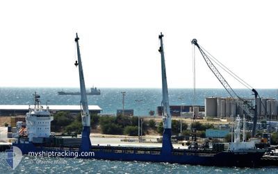
BBC EMSLAND
General Cargo
Current Trip
CLPAG
| Time Travelled | 7 days |
|---|---|
| Remaining Time | --- |
| Distance Travelled | 2122.43 nm |
| Remaining Distance | --- |
| AVG Speed | 12.1 Noeuds |
| MAX Speed | 13.1 Noeuds |
| AVG Wind | 11.7 knots |
| MAX Wind | 20.4 knots |
| MIN Temp | 16.5°C / 61.7°F |
| MAX Temp | 29.8°C / 85.64°F |
| Tirant d eau | 7 m |
| Position reçue | 12 d depuis |
Current Position
| Longitude | -71.88131° |
|---|---|
| Latitude | -32.66309° |
| Etat | Under way using engine |
| Vitesse | 11.9 Noeuds |
| Parcours | 2.8° |
| Zone | South Pacific Ocean |
| Station | T-AIS |
| Position reçue | 12 d depuis |
Info
Information
The current position of BBC EMSLAND is in South Pacific Ocean with coordinates -32.66309° / -71.88131° as reported on 2024-05-01 09:23 by AIS to our vessel tracker app. The vessel's current speed is 11.9 Noeuds
The vessel BBC EMSLAND (IMO: 9511648, MMSI: 305561000) is a General Cargo that was built in 2010 ( 14 Age ). It's sailing under the flag of [AG] Antigua Barbuda.
In this page you can find informations about the vessels current position, last detected port calls, and current voyage information. If the vessels is not in coverage by AIS you will find the latest position.
The current position of BBC EMSLAND is detected by our AIS receivers and we are not responsible for the reliability of the data. The last position was recorded while the vessel was in Coverage by the Ais receivers of our vessel tracking app.
The current draught of BBC EMSLAND as reported by AIS is 7 meters
Weather
| Temperature | 27.2°C / 80.96°F |
|---|---|
| Wind Speed | 15 knots |
| Direction | 307° NW |
| Pressure | 1006.5 hPa |
| Humidity | 88 % |
| Cloud Coverage | 100 % |
Featured Company
Last Port Calls
| Port | Arrival | Departure | Time In Port |
|---|---|---|---|
| 2024-05-05 06:53 | 2024-05-06 15:34 | 1 d | |
| 2024-04-29 13:14 | 2024-04-30 23:44 | 1 d | |
| 2024-04-13 07:02 | 2024-04-15 05:45 | 1 d | |
| 2024-03-10 05:55 | 2024-03-10 19:38 | 13 h | |
| 2024-03-02 14:16 | 2024-03-05 07:42 | 2 d |
Most Visited Ports (Last year)
| Port | Arrivals | |
|---|---|---|
| 4 | ||
| 2 | ||
| 2 | ||
| 2 | ||
| 1 | ||
| 1 |
Last Trips
| Origin | Departure | Destination | Arrival | Distance | |
|---|---|---|---|---|---|
| 2024-04-30 23:44 | 2024-05-05 06:53 | 723.38 nm | |||
| 2024-04-15 05:45 | 2024-04-29 13:14 | 674.31 nm | |||
| 2024-03-10 19:38 | 2024-04-13 07:02 | 6336.33 nm | |||
| 2024-03-05 07:42 | 2024-03-10 05:55 | 1377.38 nm | |||
| 2024-02-29 21:04 | 2024-03-02 14:16 | 505.39 nm |
Events
| Heure | Evenement | Détails | Position/ Destination | Info |
|---|---|---|---|---|
| 2024-05-14 03:09 | Arret | 3.49 nm, North of TABOGUILLA |
8.86670 / -79.52755
CLPAG
|
Vitesse: 0.1 kn Parcours: 10° |
| 2024-05-06 19:34 | PORT DE DEPART |
|
-23.04501 / -70.40515
CLPAG
|
Vitesse: 6.8 kn Parcours: 330° |
| 2024-05-06 19:25 | Démarrage |
-23.06360 / -70.39361
[CL] MEJILLONES
|
Vitesse: 4 kn Parcours: 322° |
|
| 2024-05-05 11:23 | Arret |
-23.06736 / -70.38720
[CL] MEJILLONES
|
Vitesse: 0.3 kn Parcours: 327° |
|
| 2024-05-05 10:53 | Port d'arrivée |
|
-23.06205 / -70.39510
[CL] MEJILLONES
|
Vitesse: 7.2 kn Parcours: 156° |
| 2024-05-05 10:05 | Démarrage | 5.22 nm, North of MEJILLONES |
-22.98595 / -70.42569
CLPAG
|
Vitesse: 7.2 kn Parcours: 167° |
| 2024-05-05 02:12 | Arret | 5.05 nm, North of MEJILLONES |
-22.99421 / -70.44838
CLPAG
|
Vitesse: 0.3 kn Parcours: 330° |
| 2024-05-05 00:23 | Démarrage | 4.06 nm, North of MEJILLONES |
-23.00716 / -70.39549
CLPAG
|
Vitesse: 6.8 kn Parcours: 324° |
| 2024-05-04 19:22 | Arret | 5.41 nm, North West of MEJILLONES |
-22.98954 / -70.45305
CLPAG
|
Vitesse: 0.3 kn Parcours: 141° |
| 2024-05-04 18:55 | Démarrage | 3.3 nm, North of MEJILLONES |
-23.02093 / -70.43508
CLPAG
|
Vitesse: 6.3 kn Parcours: 291° |