
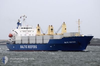
BALTIC HEATHER
Reefer
Current Trip
| Time Travelled | 10 days |
|---|---|
| Remaining Time | 6 days |
| Distance Travelled | 4701.45 nm |
| Remaining Distance | 2803.02 nm |
| AVG Speed | 17.6 Noeuds |
| MAX Speed | 22.1 Noeuds |
| AVG Wind | 13.7 knots |
| MAX Wind | 32.3 knots |
| MIN Temp | 1.8°C / 35.24°F |
| MAX Temp | 29.7°C / 85.46°F |
| Tirant d eau | 7 m |
| Position reçue | 2 d depuis |
Current Position
| Longitude | -18.19205° |
|---|---|
| Latitude | 16.89202° |
| Etat | Under way using engine |
| Vitesse | 19.3 Noeuds |
| Parcours | 179.8° |
| Zone | North Atlantic Ocean |
| Station | T-AIS |
| Position reçue | 2 d depuis |
Info
Information
The current position of BALTIC HEATHER is in North Atlantic Ocean with coordinates 16.89202° / -18.19205° as reported on 2024-05-04 14:36 by AIS to our vessel tracker app. The vessel's current speed is 19.3 Noeuds and is heading at the port of CAPE TOWN. The estimated time of arrival as calculated by MyShipTracking vessel tracking app is 2024-05-12 21:19 LT
The vessel BALTIC HEATHER (IMO: 9181144, MMSI: 311000973) is a Reefer that was built in 1998 ( 26 Age ). It's sailing under the flag of [BS] Bahamas.
In this page you can find informations about the vessels current position, last detected port calls, and current voyage information. If the vessels is not in coverage by AIS you will find the latest position.
The current position of BALTIC HEATHER is detected by our AIS receivers and we are not responsible for the reliability of the data. The last position was recorded while the vessel was in Coverage by the Ais receivers of our vessel tracking app.
The current draught of BALTIC HEATHER as reported by AIS is 7 meters
Weather
| Temperature | 29.6°C / 85.28°F |
|---|---|
| Wind Speed | 11 knots |
| Direction | 156° SSE |
| Pressure | 1007.6 hPa |
| Humidity | 68.9 % |
| Cloud Coverage | 100 % |
Featured Company
Last Port Calls
| Port | Arrival | Departure | Time In Port |
|---|---|---|---|
| 2024-04-19 02:40 | 2024-04-25 20:16 | 6 d | |
| 2024-04-10 17:53 | 2024-04-11 00:03 | 6 h | |
| 2024-03-25 19:10 | 2024-03-31 02:02 | 5 d | |
| 2024-03-18 08:55 | 2024-03-23 23:44 | 5 d | |
| 2024-03-13 06:33 | 2024-03-15 15:57 | 2 d | |
| 2024-03-02 10:34 |
Most Visited Ports (Last year)
| Port | Arrivals | |
|---|---|---|
| 5 | ||
| 3 | ||
| 2 | ||
| 2 | ||
| 1 | ||
| 1 |
Last Trips
| Origin | Departure | Destination | Arrival | Distance | |
|---|---|---|---|---|---|
| 2024-04-11 01:03 | 2024-04-19 05:40 | 3178.22 nm | |||
| 2024-03-31 04:02 | 2024-04-10 18:53 | 4435.17 nm | |||
| 2024-03-24 01:44 | 2024-03-25 21:10 | 814.62 nm | |||
| 2024-03-15 17:57 | 2024-03-18 10:55 | 666.24 nm | |||
| 2024-03-02 12:34 | 2024-03-13 08:33 | 2629.15 nm |
Events
| Heure | Evenement | Détails | Position/ Destination | Info |
|---|---|---|---|---|
| 2024-05-04 14:54 | Etat Changé | Default Under way using engine |
16.75017 / -18.19343
ZA CPT
|
Vitesse: 19.3 kn Parcours: 179.8° |
| 2024-05-04 14:36 | Hors de la zone couverte |
16.89202 / -18.19205
North Atlantic Ocean
ZA CPT
|
Vitesse: 19.3 kn Parcours: 179.8° |
|
| 2024-05-04 14:22 | Etat Changé | Under way using engine Default |
16.95593 / -18.19187
ZA CPT
|
Vitesse: 19.2 kn Parcours: 178° |
| 2024-05-04 14:18 | Dans la zone couverte |
16.95593 / -18.19187
North Atlantic Ocean
ZA CPT
|
Vitesse: 19.7 kn Parcours: 178.5° |
|
| 2024-05-04 06:50 | Etat Changé | Default Under way using engine |
19.41050 / -18.16704
ZA CPT
|
Vitesse: 19.3 kn Parcours: 181.4° |
| 2024-05-04 06:45 | Hors de la zone couverte |
19.43770 / -18.16707
North Atlantic Ocean
ZA CPT
|
Vitesse: 19.3 kn Parcours: 181.4° |
|
| 2024-05-04 06:41 | Changement de zone | Mauritanian part of the North Atlantic Ocean Western Saharan part of the North Atlantic Ocean |
19.46229 / -18.16725
North Atlantic Ocean
ZA CPT
|
Vitesse: 19.3 kn Parcours: 179.8° |
| 2024-05-04 06:41 | Etat Changé | Under way using engine Default |
19.46229 / -18.16725
ZA CPT
|
Vitesse: 19.8 kn Parcours: 179° |
| 2024-05-04 06:41 | Dans la zone couverte |
19.46229 / -18.16725
North Atlantic Ocean
ZA CPT
|
Vitesse: 19.3 kn Parcours: 179.8° |
|
| 2024-05-04 03:42 | Hors de la zone couverte |
20.47276 / -18.15279
North Atlantic Ocean
ZA CPT
|
Vitesse: 19.3 kn Parcours: 182.4° |