
ALMA
Reefer
Current Trip
| Time Travelled | 1 day |
|---|---|
| Remaining Time | --- |
| Distance Travelled | 419.53 nm |
| Remaining Distance | --- |
| AVG Speed | 11.8 Noeuds |
| MAX Speed | 14.2 Noeuds |
| AVG Wind | 16.8 knots |
| MAX Wind | 20.8 knots |
| MIN Temp | 5.6°C / 42.08°F |
| MAX Temp | 9.3°C / 48.74°F |
| Tirant d eau | 5.8 m |
| Position reçue | 1 d depuis |
Current Position
| Longitude | -6.51126° |
|---|---|
| Latitude | 61.86070° |
| Etat | Under way using engine |
| Vitesse | 11.9 Noeuds |
| Parcours | 174.1° |
| Zone | North Atlantic Ocean |
| Station | T-AIS |
| Position reçue | 1 d depuis |
Info
Information
The current position of ALMA is in North Atlantic Ocean with coordinates 61.86070° / -6.51126° as reported on 2024-04-28 03:16 by AIS to our vessel tracker app. The vessel's current speed is 11.9 Noeuds and is heading at the port of LAS PALMAS. The estimated time of arrival as calculated by MyShipTracking vessel tracking app is 2024-05-05 06:00 LT
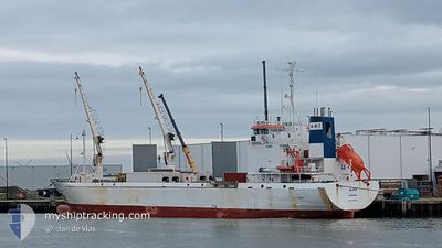
The vessel ALMA (IMO: 9140968, MMSI: 212856000) is a Reefer that was built in 1997 ( 27 Age ). It's sailing under the flag of [CY] Cyprus.
In this page you can find informations about the vessels current position, last detected port calls, and current voyage information. If the vessels is not in coverage by AIS you will find the latest position.
The current position of ALMA is detected by our AIS receivers and we are not responsible for the reliability of the data. The last position was recorded while the vessel was in Coverage by the Ais receivers of our vessel tracking app.
The current draught of ALMA as reported by AIS is 5.8 meters
Weather
| Temperature | 9.2°C / 48.56°F |
|---|---|
| Wind Speed | 20 knots |
| Direction | 135° SE |
| Pressure | 997.1 hPa |
| Humidity | 91 % |
| Cloud Coverage | 100 % |
Featured Company
Last Port Calls
| Port | Arrival | Departure | Time In Port |
|---|---|---|---|
| 2024-04-27 12:00 | 2024-04-28 01:26 | 13 h | |
| 2024-04-23 16:19 | 2024-04-26 09:50 | 2 d | |
| 2024-04-03 21:36 | 2024-04-04 12:15 | 14 h | |
| 2024-03-15 16:27 | 2024-03-28 16:54 | 13 d | |
| 2024-02-02 19:53 |
Most Visited Ports (Last year)
| Port | Arrivals | |
|---|---|---|
| 3 | ||
| 3 | ||
| 2 | ||
| 2 | ||
| 2 | ||
| 1 |
Last Trips
| Origin | Departure | Destination | Arrival | Distance | |
|---|---|---|---|---|---|
| 2024-04-26 10:50 | 2024-04-27 13:00 | 3.22 nm | |||
| 2024-04-04 13:15 | 2024-04-23 17:19 | 2204.94 nm | |||
| 2024-03-28 17:54 | 2024-04-03 22:36 | 1180.02 nm | |||
| 2024-02-02 20:53 | 2024-03-15 17:27 | 2050.19 nm |
Events
| Heure | Evenement | Détails | Position/ Destination | Info |
|---|---|---|---|---|
| 2024-04-28 03:21 | Etat Changé | Default Under way using engine |
61.84513 / -6.50750
FO RVK>ES LPA
|
Vitesse: 11.9 kn Parcours: 174.1° |
| 2024-04-28 03:16 | Hors de la zone couverte |
61.86070 / -6.51126
North Atlantic Ocean
FO RVK>ES LPA
|
Vitesse: 11.9 kn Parcours: 174.1° |
|
| 2024-04-28 02:59 | Tirant d'eau modifié | 5.8 4.6 |
61.91667 / -6.52215
FO RVK>ES LPA
|
Vitesse: 12 kn Parcours: 176.9° |
| 2024-04-28 02:59 | Changement de destination | FO RVK>ES LPA FO RVK |
61.91667 / -6.52215
FO RVK>ES LPA
|
Vitesse: 12 kn Parcours: 176.9° |
| 2024-04-28 02:59 | Changement d'ETA | 2024/05/05 06:00 2024/04/22 21:00 |
61.91667 / -6.52215
FO RVK>ES LPA
|
Vitesse: 12 kn Parcours: 176.9° |
| 2024-04-28 02:36 | Etat Changé | Under way using engine Default |
61.99294 / -6.53901
FO RVK
|
Vitesse: 11 kn Parcours: 122° |
| 2024-04-28 02:26 | Etat Changé | Default Under way using engine |
62.01833 / -6.57833
FO RVK
|
Vitesse: 9.2 kn Parcours: 109.5° |
| 2024-04-28 02:16 | Etat Changé | Under way using engine Default |
62.03062 / -6.62851
FO RVK
|
Vitesse: 8 kn Parcours: 111° |
| 2024-04-28 02:09 | Dans la zone couverte |
62.03062 / -6.62851
North Atlantic Ocean
|
Vitesse: 9 kn Parcours: 113.1° |
|
| 2024-04-28 01:26 | Démarrage | 0.48 nm, West of RUNAVIK |
62.11167 / -6.74333
FO RVK
|
Vitesse: 4 kn Parcours: -1° |