
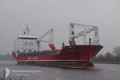
ALANIS
General Cargo
Current Trip
| Time Travelled | 39 days |
|---|---|
| Remaining Time | 21 days |
| Distance Travelled | 6642.69 nm |
| Remaining Distance | 5626.94 nm |
| AVG Speed | 11 Noeuds |
| MAX Speed | 13.3 Noeuds |
| AVG Wind | 12.1 knots |
| MAX Wind | 23 knots |
| MIN Temp | 11°C / 51.8°F |
| MAX Temp | 29°C / 84.2°F |
| Tirant d eau | 7.1 m |
| Position reçue | 2 m depuis |
Current Position
| Longitude | 18.26326° |
|---|---|
| Latitude | -34.32272° |
| Etat | Under way using engine |
| Vitesse | 11.4 Noeuds |
| Parcours | 141.4° |
| Zone | South Atlantic Ocean |
| Station | T-AIS |
| Position reçue | 2 m depuis |
Info
Information
The current position of ALANIS is in South Atlantic Ocean with coordinates -34.32272° / 18.26326° as reported on 2024-06-07 00:52 by AIS to our vessel tracker app. The vessel's current speed is 11.4 Noeuds and is heading at the port of SINGAPORE. The estimated time of arrival as calculated by MyShipTracking vessel tracking app is 2024-06-28 13:03 LT
The vessel ALANIS (IMO: 9468085, MMSI: 305469000) is a General Cargo that was built in 2010 ( 14 Age ). It's sailing under the flag of [AG] Antigua Barbuda.
In this page you can find informations about the vessels current position, last detected port calls, and current voyage information. If the vessels is not in coverage by AIS you will find the latest position.
The current position of ALANIS is detected by our AIS receivers and we are not responsible for the reliability of the data. The last position was recorded while the vessel was in Coverage by the Ais receivers of our vessel tracking app.
The current draught of ALANIS as reported by AIS is 7.1 meters
Weather
| Temperature | 15.4°C / 59.72°F |
|---|---|
| Wind Speed | 10 knots |
| Direction | 146° SE |
| Pressure | 1025.9 hPa |
| Humidity | 75.8 % |
| Cloud Coverage | 71 % |
Featured Company
Events
| Heure | Evenement | Détails | Position/ Destination | Info |
|---|---|---|---|---|
| 2024-06-06 21:44 | Detecté en mer | South African part of the South Atlantic Ocean |
-33.86289 / 17.84157
South Atlantic Ocean
SGSIN
|
Vitesse: 11.6 kn Parcours: 143.1° |
| 2024-06-06 21:44 | Dans la zone couverte |
-33.86289 / 17.84157
South Atlantic Ocean
SGSIN
|
Vitesse: 11.6 kn Parcours: 143.1° |