
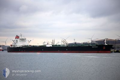
LYDIA II
Crude Oil Tanker
Current Trip
| Time Travelled | 2 days |
|---|---|
| Remaining Time | 3 days |
| Distance Travelled | 791.60 nm |
| Remaining Distance | 1252.13 nm |
| AVG Speed | 12.4 Noeuds |
| MAX Speed | 15 Noeuds |
| AVG Wind | 12.5 knots |
| MAX Wind | 17.9 knots |
| MIN Temp | 28°C / 82.4°F |
| MAX Temp | 30.4°C / 86.72°F |
| Tirant d eau | 11 m |
| Position reçue | 2 d depuis |
Current Position
| Longitude | 114.49947° |
|---|---|
| Latitude | 22.08363° |
| Etat | Under way using engine |
| Vitesse | 13.8 Noeuds |
| Parcours | 118.1° |
| Zone | South China Sea |
| Station | T-AIS |
| Position reçue | 2 d depuis |
Info
Information
The current position of LYDIA II is in South China Sea with coordinates 22.08363° / 114.49947° as reported on 2024-06-15 08:15 by AIS to our vessel tracker app. The vessel's current speed is 13.8 Noeuds and is heading at the port of SINGAPORE. The estimated time of arrival as calculated by MyShipTracking vessel tracking app is 2024-06-21 11:04 LT
The vessel LYDIA II (IMO: 9365776, MMSI: 352002042) is a Crude Oil Tanker that was built in 2009 ( 15 Age ). It's sailing under the flag of [PA] Panama.
In this page you can find informations about the vessels current position, last detected port calls, and current voyage information. If the vessels is not in coverage by AIS you will find the latest position.
The current position of LYDIA II is detected by our AIS receivers and we are not responsible for the reliability of the data. The last position was recorded while the vessel was in Coverage by the Ais receivers of our vessel tracking app.
The current draught of LYDIA II as reported by AIS is 11 meters
Weather
| Temperature | 30°C / 86°F |
|---|---|
| Wind Speed | 12 knots |
| Direction | 193° SSW |
| Pressure | 1009.3 hPa |
| Humidity | 80.4 % |
| Cloud Coverage | 100 % |
Featured Company
Events
| Heure | Evenement | Détails | Position/ Destination | Info |
|---|---|---|---|---|
| 2024-06-15 08:21 | Etat Changé | Default Under way using engine |
22.07095 / 114.52189
SG SIN
|
Vitesse: 13.8 kn Parcours: 118.1° |
| 2024-06-15 08:15 | Hors de la zone couverte |
22.08363 / 114.49947
South China Sea
SG SIN
|
Vitesse: 13.8 kn Parcours: 118.1° |
|
| 2024-06-15 07:30 | Tirant d'eau modifié | 11 9 |
22.11390 / 114.31158
SG SIN
|
Vitesse: 14.2 kn Parcours: 95.3° |
| 2024-06-15 07:20 | Etat Changé | Under way using engine Default |
22.11621 / 114.26694
SG SIN
|
Vitesse: 13.9 kn Parcours: 90° |
| 2024-06-15 07:17 | Etat Changé | Default Under way using engine |
22.11620 / 114.25654
SG SIN
|
Vitesse: 13.8 kn Parcours: 91.5° |
| 2024-06-15 06:54 | Etat Changé | Under way using engine Default |
22.11894 / 114.16133
SG SIN
|
Vitesse: 13.7 kn Parcours: 93° |
| 2024-06-15 06:49 | Etat Changé | Default Under way using engine |
22.11985 / 114.14155
SG SIN
|
Vitesse: 13.8 kn Parcours: 94.7° |
| 2024-06-15 05:44 | Etat Changé | Under way using engine Default |
22.10611 / 113.88179
SG SIN
|
Vitesse: 9.4 kn Parcours: 82° |
| 2024-06-15 05:37 | Etat Changé | Default Under way using engine |
22.10318 / 113.86235
SG SIN
|
Vitesse: 6.3 kn Parcours: 136.4° |
| 2024-06-15 04:29 | Etat Changé | Under way using engine Default |
22.18758 / 113.82283
SG SIN
|
Vitesse: 8.3 kn Parcours: 166° |