
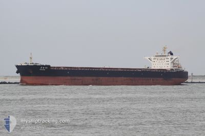
YUE DIAN 102
Bulk Carrier
Current Trip
| Time Travelled | 12 days |
|---|---|
| Remaining Time | 1 day |
| Distance Travelled | 3082.98 nm |
| Remaining Distance | 703.53 nm |
| AVG Speed | 10.6 Knots |
| MAX Speed | 14 Knots |
| AVG Wind | 10.7 knots |
| MAX Wind | 31 knots |
| MIN Temp | 14.7°C / 58.46°F |
| MAX Temp | 30.3°C / 86.54°F |
| Dybgang | 14.6 m |
| Position Modtaget | 1 d siden |
Current Position
| Longitude | 122.27102° |
|---|---|
| Latitude | 24.81754° |
| Status | Under way using engine |
| Fart | 12.3 Knots |
| Kurs | 13° |
| Område | Philippine Sea |
| Station | T-AIS |
| Position Modtaget | 1 d siden |
Info
Information
The current position of YUE DIAN 102 is in Philippine Sea with coordinates 24.81754° / 122.27102° as reported on 2024-04-29 23:53 by AIS to our vessel tracker app. The vessel's current speed is 12.3 Knots and is heading at the port of QINGDAO. The estimated time of arrival as calculated by MyShipTracking vessel tracking app is 2024-05-02 18:08 LT
The vessel YUE DIAN 102 (IMO: 9615121, MMSI: 414043000) is a Bulk Carrier that was built in 2012 ( 12 år gamle ). It's sailing under the flag of [CN] China.
In this page you can find informations about the vessels current position, last detected port calls, and current voyage information. If the vessels is not in coverage by AIS you will find the latest position.
The current position of YUE DIAN 102 is detected by our AIS receivers and we are not responsible for the reliability of the data. The last position was recorded while the vessel was in Coverage by the Ais receivers of our vessel tracking app.
The current draught of YUE DIAN 102 as reported by AIS is 14.6 meters
Weather
| Temperature | 15.4°C / 59.72°F |
|---|---|
| Wind Speed | 19 knots |
| Direction | 340° NNW |
| Pressure | 1013.1 hPa |
| Humidity | 67.9 % |
| Cloud Coverage | 100 % |
Featured Company
Last Port Calls
| Port | Arrival | Departure | Time In Port |
|---|---|---|---|
| 2024-04-17 11:29 | 2024-04-18 22:37 | 1 d | |
| 2024-03-10 08:44 | 2024-03-18 08:47 | 8 d |
Most Visited Ports (Last year)
| Port | Arrivals | |
|---|---|---|
| 2 | ||
| 1 | ||
| 1 | ||
| 1 | ||
| 1 | ||
| 1 |
Last Trips
| Origin | Departure | Destination | Arrival | Distance | |
|---|---|---|---|---|---|
| 2024-03-18 16:47 | 2024-04-17 19:29 | 1944.28 nm | |||
| 2024-01-11 14:54 | 2024-03-10 16:44 | 8439.80 nm |
Events
| Tid | Hændelsen | Detaljer | Position / Dest | Info |
|---|---|---|---|---|
| 2024-04-30 00:00 | Status er ændret | Default Under way using engine |
24.83962 / 122.27853
QINGDAO
|
Fart: 12.3 kn Kurs: 13° |
| 2024-04-29 23:53 | Udenfor Dækning |
24.81754 / 122.27102
Philippine Sea
QINGDAO
|
Fart: 12.3 kn Kurs: 13° |
|
| 2024-04-29 23:51 | Status er ændret | Under way using engine Default |
24.81023 / 122.26927
QINGDAO
|
Fart: 12.7 kn Kurs: 14° |
| 2024-04-29 23:44 | Status er ændret | Default Under way using engine |
24.78754 / 122.26299
QINGDAO
|
Fart: 12.9 kn Kurs: 12.2° |
| 2024-04-29 23:34 | Status er ændret | Under way using engine Default |
24.75208 / 122.25321
QINGDAO
|
Fart: 12.8 kn Kurs: 13° |
| 2024-04-29 23:32 | Indenfor Dækning |
24.75208 / 122.25321
Philippine Sea
QINGDAO
|
Fart: 12.5 kn Kurs: 14.9° |
|
| 2024-04-29 10:14 | Status er ændret | Default Under way using engine |
22.05939 / 121.32052
QINGDAO
|
Fart: 13.2 kn Kurs: 15.3° |
| 2024-04-29 10:11 | Status er ændret | Under way using engine Default |
22.05161 / 121.31813
QINGDAO
|
Fart: 13.4 kn Kurs: 19° |
| 2024-04-29 10:11 | Udenfor Dækning |
22.05161 / 121.31813
Philippine Sea
QINGDAO
|
Fart: 13.2 kn Kurs: 15.3° |
|
| 2024-04-29 10:11 | Ændre havområde | Taiwanese part of the Philippine Sea Philippines part of the South China Sea |
22.05161 / 121.31813
Philippine Sea
QINGDAO
|
Fart: 13.2 kn Kurs: 15.3° |