
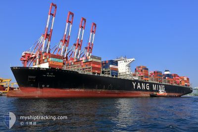
YM WARMTH
Cargo
Current Trip
PAPCN
| Time Travelled | 11 days |
|---|---|
| Remaining Time | --- |
| Distance Travelled | 4365.77 nm |
| Remaining Distance | --- |
| AVG Speed | 15.2 Knots |
| MAX Speed | 19.3 Knots |
| AVG Wind | 13.1 knots |
| MAX Wind | 29.9 knots |
| MIN Temp | 4.1°C / 39.38°F |
| MAX Temp | 17.9°C / 64.22°F |
| Dybgang | 13.4 m |
| Position Modtaget | 9 d siden |
Current Position
| Longitude | 141.85147° |
|---|---|
| Latitude | 41.64215° |
| Status | Under way using engine |
| Fart | 14.6 Knots |
| Kurs | 87.6° |
| Område | North Pacific Ocean |
| Station | T-AIS |
| Position Modtaget | 9 d siden |
Info
Information
The current position of YM WARMTH is in North Pacific Ocean with coordinates 41.64215° / 141.85147° as reported on 2024-05-05 13:25 by AIS to our vessel tracker app. The vessel's current speed is 14.6 Knots
The vessel YM WARMTH (IMO: 9704647, MMSI: 477948800) is a Cargo It's sailing under the flag of [HK] Hong Kong.
In this page you can find informations about the vessels current position, last detected port calls, and current voyage information. If the vessels is not in coverage by AIS you will find the latest position.
The current position of YM WARMTH is detected by our AIS receivers and we are not responsible for the reliability of the data. The last position was recorded while the vessel was in Coverage by the Ais receivers of our vessel tracking app.
The current draught of YM WARMTH as reported by AIS is 13.4 meters
Weather
| Temperature | 13.4°C / 56.12°F |
|---|---|
| Wind Speed | 12 knots |
| Direction | 46° NE |
| Pressure | 1027.9 hPa |
| Humidity | 79.1 % |
| Cloud Coverage | 72 % |
Featured Company
Last Port Calls
| Port | Arrival | Departure | Time In Port |
|---|---|---|---|
| 2024-05-01 23:06 | 2024-05-03 11:48 | 1 d | |
| 2024-04-30 02:00 | 2024-04-30 17:16 | 15 h | |
| 2024-04-21 02:16 | 2024-04-21 20:03 | 17 h | |
| 2024-04-18 07:03 | 2024-04-19 03:35 | 20 h | |
| 2024-04-11 23:34 | 2024-04-13 14:38 | 1 d | |
| 2024-03-07 10:50 | 2024-03-09 09:25 | 1 d | |
| 2024-03-02 08:29 |
Most Visited Ports (Last year)
| Port | Arrivals | |
|---|---|---|
| 6 | ||
| 5 | ||
| 4 | ||
| 4 | ||
| 3 | ||
| 3 |
Last Trips
| Origin | Departure | Destination | Arrival | Distance | |
|---|---|---|---|---|---|
| 2024-05-01 01:16 | 2024-05-02 08:06 | 520.10 nm | |||
| 2024-04-22 04:03 | 2024-04-30 10:00 | 1002.33 nm | |||
| 2024-04-19 11:35 | 2024-04-21 10:16 | 487.33 nm | |||
| 2024-04-13 22:38 | 2024-04-18 15:03 | 1635.69 nm | |||
| 2024-03-09 04:25 | 2024-04-12 07:34 | 12559.38 nm | |||
| 2024-03-02 03:29 | 2024-03-07 05:50 | 120.01 nm |
Events
| Tid | Hændelsen | Detaljer | Position / Dest | Info |
|---|---|---|---|---|
| 2024-05-05 13:32 | Status er ændret | Default Under way using engine |
41.64381 / 141.88902
PAPCN
|
Fart: 14.6 kn Kurs: 87.6° |
| 2024-05-05 13:25 | Udenfor Dækning |
41.64215 / 141.85147
North Pacific Ocean
PAPCN
|
Fart: 14.6 kn Kurs: 87.6° |
|
| 2024-05-05 11:53 | Ændre havområde | Japanese part of the North Pacific Ocean Japanese part of the Japan Sea |
41.63109 / 141.30137
North Pacific Ocean
PAPCN
|
Fart: 15.7 kn Kurs: 89.1° |
| 2024-05-05 10:56 | Status er ændret | Under way using engine Default |
41.63001 / 140.94852
PAPCN
|
Fart: 18.8 kn Kurs: 87° |
| 2024-05-05 10:52 | Status er ændret | Default Under way using engine |
41.62914 / 140.92105
PAPCN
|
Fart: 19.2 kn Kurs: 72.9° |
| 2024-05-05 10:42 | Status er ændret | Under way using engine Default |
41.61824 / 140.84788
PAPCN
|
Fart: 19 kn Kurs: 61° |
| 2024-05-05 10:28 | Status er ændret | Default Under way using engine |
41.58273 / 140.77316
PAPCN
|
Fart: 17.8 kn Kurs: 55.9° |
| 2024-05-05 09:15 | Status er ændret | Under way using engine Default |
41.37501 / 140.37526
PAPCN
|
Fart: 17.3 kn Kurs: 57° |