
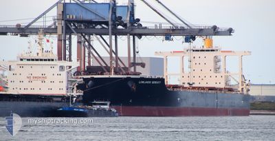
YM SERENITY
Bulk Carrier
Current Trip
| Time Travelled | 11 days |
|---|---|
| Remaining Time | 4 h, 5 mins |
| Distance Travelled | 3115.90 nm |
| Remaining Distance | 420.71 nm |
| AVG Speed | 12 Knots |
| MAX Speed | 15 Knots |
| AVG Wind | 10.2 knots |
| MAX Wind | 22.2 knots |
| MIN Temp | 17.8°C / 64.04°F |
| MAX Temp | 30.2°C / 86.36°F |
| Dybgang | 17.2 m |
| Position Modtaget | 2 d siden |
Current Position
| Longitude | 122.38692° |
|---|---|
| Latitude | 25.28295° |
| Status | Under way using engine |
| Fart | 11.3 Knots |
| Kurs | 13° |
| Område | Eastern China Sea |
| Station | T-AIS |
| Position Modtaget | 2 d siden |
Info
Information
The current position of YM SERENITY is in Eastern China Sea with coordinates 25.28295° / 122.38692° as reported on 2024-05-03 19:07 by AIS to our vessel tracker app. The vessel's current speed is 11.3 Knots and is heading at the port of QINGDAO. The estimated time of arrival as calculated by MyShipTracking vessel tracking app is 2024-05-06 04:04 LT
The vessel YM SERENITY (IMO: 9581758, MMSI: 370096000) is a Bulk Carrier that was built in 2011 ( 13 år gamle ). It's sailing under the flag of [PA] Panama.
In this page you can find informations about the vessels current position, last detected port calls, and current voyage information. If the vessels is not in coverage by AIS you will find the latest position.
The current position of YM SERENITY is detected by our AIS receivers and we are not responsible for the reliability of the data. The last position was recorded while the vessel was in Coverage by the Ais receivers of our vessel tracking app.
The current draught of YM SERENITY as reported by AIS is 17.2 meters
Weather
| Temperature | 17.9°C / 64.22°F |
|---|---|
| Wind Speed | 10 knots |
| Direction | 344° NNW |
| Pressure | 1013.2 hPa |
| Humidity | 91.8 % |
| Cloud Coverage | 100 % |
Featured Company
Last Port Calls
| Port | Arrival | Departure | Time In Port |
|---|---|---|---|
| 2024-04-22 16:03 | 2024-04-24 03:58 | 1 d | |
| 2024-03-15 12:24 | 2024-03-18 01:07 | 2 d |
Most Visited Ports (Last year)
| Port | Arrivals | |
|---|---|---|
| 3 | ||
| 1 | ||
| 1 | ||
| 1 | ||
| 1 | ||
| 1 |
Last Trips
| Origin | Departure | Destination | Arrival | Distance | |
|---|---|---|---|---|---|
| 2024-03-18 09:07 | 2024-04-23 00:03 | 3774.78 nm | |||
| 2024-02-11 13:54 | 2024-03-15 20:24 | 8297.99 nm |
Events
| Tid | Hændelsen | Detaljer | Position / Dest | Info |
|---|---|---|---|---|
| 2024-05-04 18:16 | STOP Sejllads |
29.66793 / 123.01887
CN TAO
|
Fart: 0.2 kn Kurs: 130° |
|
| 2024-05-03 19:12 | Status er ændret | Default Under way using engine |
25.29773 / 122.39044
CN TAO
|
Fart: 11.3 kn Kurs: 13° |
| 2024-05-03 19:07 | Status er ændret | Under way using engine Default |
25.28295 / 122.38692
CN TAO
|
Fart: 11.6 kn Kurs: 12° |
| 2024-05-03 19:07 | Indenfor Dækning |
25.28295 / 122.38692
Eastern China Sea
CN TAO
|
Fart: 11.3 kn Kurs: 13° |
|
| 2024-05-03 19:07 | Udenfor Dækning |
25.28295 / 122.38692
Eastern China Sea
CN TAO
|
Fart: 11.3 kn Kurs: 13° |
|
| 2024-05-03 17:48 | Status er ændret | Default Under way using engine |
25.02350 / 122.32045
CN TAO
|
Fart: 12.2 kn Kurs: 13° |
| 2024-05-03 17:43 | Fundet i havområde | Taiwanese part of the Eastern China Sea |
25.00677 / 122.31645
Eastern China Sea
CN TAO
|
Fart: 12.2 kn Kurs: 13° |
| 2024-05-03 17:43 | Udenfor Dækning |
25.00677 / 122.31645
Eastern China Sea
CN TAO
|
Fart: 12.2 kn Kurs: 13° |
|
| 2024-05-03 17:42 | Status er ændret | Under way using engine Default |
25.00520 / 122.31604
CN TAO
|
Fart: 12.2 kn Kurs: 11° |
| 2024-05-03 17:42 | Indenfor Dækning |
25.00677 / 122.31645
Eastern China Sea
CN TAO
|
Fart: 12.2 kn Kurs: 13° |