
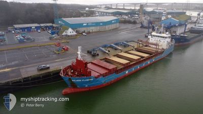
WILSON FLUSHING
General Cargo
Current Trip
PT SET
| Time Travelled | 44 mins |
|---|---|
| Remaining Time | --- |
| Distance Travelled | 0.53 nm |
| Remaining Distance | --- |
| AVG Speed | --- |
| MAX Speed | --- |
| AVG Wind | 11.2 knots |
| MAX Wind | 11.5 knots |
| MIN Temp | 11.4°C / 52.52°F |
| MAX Temp | 11.7°C / 53.06°F |
| Dybgang | 6.1 m |
| Position Modtaget | 1 d siden |
Current Position
| Longitude | --- |
|---|---|
| Latitude | --- |
| Status | Under way using engine |
| Fart | 8.9 Knots |
| Kurs | 56° |
| Område | North Atlantic Ocean |
| Station | T-AIS |
| Position Modtaget | 1 d siden |
Info
Information
The current position of WILSON FLUSHING is in North Atlantic Ocean with coordinates 38.39471° / -9.04142° as reported on 2025-12-11 23:49 by AIS to our vessel tracker app. The vessel's current speed is 8.9 Knots
The vessel WILSON FLUSHING (IMO: 9491745, MMSI: 314396000) is a General Cargo that was built in 2012 ( 13 år gamle ). It's sailing under the flag of [BB] Barbados.
In this page you can find informations about the vessels current position, last detected port calls, and current voyage information. If the vessels is not in coverage by AIS you will find the latest position.
The current position of WILSON FLUSHING is detected by our AIS receivers and we are not responsible for the reliability of the data. The last position was recorded while the vessel was in Coverage by the Ais receivers of our vessel tracking app.
The current draught of WILSON FLUSHING as reported by AIS is 6.1 meters
Weather
| Temperature | 11.4°C / 52.52°F |
|---|---|
| Wind Speed | 11 knots |
| Direction | 38° NE |
| Pressure | 1016.2 hPa |
| Humidity | 95.7 % |
| Cloud Coverage | 100 % |
Featured Company
Last Port Calls
| Port | Arrival | Departure | Time In Port |
|---|---|---|---|
| 2025-12-12 01:11 | 2025-12-13 01:07 | 23 h | |
| 2025-12-02 09:28 | 2025-12-03 18:31 | 1 d | |
| 2025-12-02 08:54 | 2025-12-02 08:56 | 1 m | |
| 2025-11-25 14:01 | 2025-12-02 08:40 | 6 d | |
| 2025-11-16 18:06 | 2025-11-17 16:22 | 22 h | |
| 2025-11-12 16:46 | 2025-11-14 19:25 | 2 d | |
| 2025-10-27 16:05 | 2025-10-29 16:36 | 2 d | |
| 2025-10-23 03:54 | 2025-10-24 23:27 | 1 d | |
| 2025-10-13 14:54 | 2025-10-15 02:37 | 1 d | |
| 2025-10-02 14:16 | 2025-10-04 09:58 | 1 d |
Last Trips
| Origin | Departure | Destination | Arrival | Distance | |
|---|---|---|---|---|---|
| 2025-12-03 18:31 | 2025-12-12 01:11 | 1200.95 nm | |||
| 2025-12-02 08:56 | 2025-12-02 09:28 | 4.16 nm | |||
| 2025-12-02 08:56 | 2025-12-02 08:54 | 4.16 nm | |||
| 2025-11-17 16:22 | 2025-11-25 14:01 | 1415.89 nm | |||
| 2025-11-14 19:25 | 2025-11-16 18:06 | 120.56 nm | |||
| 2025-10-29 16:36 | 2025-11-12 16:46 | 1504.06 nm | |||
| 2025-10-24 23:27 | 2025-10-27 16:05 | 403.97 nm | |||
| 2025-10-15 02:37 | 2025-10-23 03:54 | 1552.96 nm | |||
| 2025-10-04 09:58 | 2025-10-13 14:54 | 1379.91 nm | |||
| 2025-10-01 17:53 | 2025-10-02 14:16 | 35.50 nm |
Events
| Tid | Hændelsen | Detaljer | Position / Dest | Info |
|---|---|---|---|---|
| 2025-12-13 01:26 | STOP Sejllads | 1.74 nm, West of SETUBAL |
38.51358 / -8.89351
PT SET
|
Fart: 0.2 kn Kurs: 46° |
| 2025-12-13 01:07 | Afsejlet fra sidste havn |
|
38.51299 / -8.88414
PT SET
|
Fart: 4.3 kn Kurs: 283° |
| 2025-12-13 00:47 | START Sejllads |
38.50312 / -8.84937
[PT] SETUBAL
|
Fart: 5.1 kn Kurs: 302° |
|
| 2025-12-12 01:47 | STOP Sejllads |
38.50058 / -8.84278
[PT] SETUBAL
|
Fart: Kurs: 140° |
|
| 2025-12-12 01:11 | Skibe i havn |
|
38.51331 / -8.87556
[PT] SETUBAL
|
Fart: 7.9 kn Kurs: 90° |
| 2025-12-11 23:55 | Status er ændret | Default Under way using engine |
38.40317 / -9.02497
PT SET
|
Fart: 8.9 kn Kurs: 56° |
| 2025-12-11 23:49 | Udenfor Dækning |
38.39471 / -9.04142
North Atlantic Ocean
|
Fart: 8.9 kn Kurs: 56° |
|
| 2025-12-11 23:29 | Status er ændret | Under way using engine Default |
38.37344 / -9.09468
PT SET
|
Fart: 8.5 kn Kurs: 70° |
| 2025-12-11 23:27 | Status er ændret | Default Under way using engine |
38.37149 / -9.10135
PT SET
|
Fart: 8.1 kn Kurs: 68.4° |
| 2025-12-11 23:20 | Status er ændret | Under way using engine Default |
38.36602 / -9.11977
PT SET
|
Fart: 8.5 kn Kurs: 58° |