
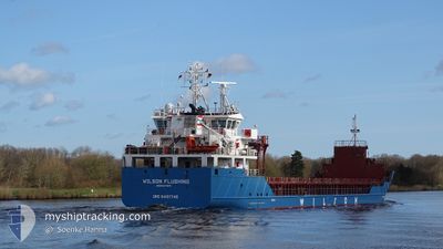
WILSON FLUSHING
General Cargo
Current Trip
| Time Travelled | 4 days |
|---|---|
| Remaining Time | 3 h, 3 mins |
| Distance Travelled | 1008.18 nm |
| Remaining Distance | 32.08 nm |
| AVG Speed | 9.3 Knopen |
| MAX Speed | 13 Knopen |
| AVG Wind | 10 knots |
| MAX Wind | 24.3 knots |
| MIN Temp | 1.2°C / 34.16°F |
| MAX Temp | 7.6°C / 45.68°F |
| Diepgang | 6 M |
| Positie ontvangen | Nu |
Current Position
| Lengtegraad | 13.05596° |
|---|---|
| Breedtegraat | 66.22515° |
| Status | At anchor |
| Snelheid | 0.1 Knopen |
| Koers | 317° |
| Gebied | Norwegian Sea |
| Station | T-AIS |
| Positie ontvangen | Nu |
Info
Information
The current position of WILSON FLUSHING is in Norwegian Sea with coordinates 66.22515° / 13.05596° as reported on 2024-04-23 10:54 by AIS to our vessel tracker app. The vessel's current speed is 0.1 Knopen and is heading at the port of MOIRANA. The estimated time of arrival as calculated by MyShipTracking vessel tracking app is 2024-04-23 13:58 LT
The vessel WILSON FLUSHING (IMO: 9491745, MMSI: 314396000) is a General Cargo that was built in 2012 ( 12 Jaar oud ). It's sailing under the flag of [BB] Barbados.
In this page you can find informations about the vessels current position, last detected port calls, and current voyage information. If the vessels is not in coverage by AIS you will find the latest position.
The current position of WILSON FLUSHING is detected by our AIS receivers and we are not responsible for the reliability of the data. The last position was recorded while the vessel was in Coverage by the Ais receivers of our vessel tracking app.
The current draught of WILSON FLUSHING as reported by AIS is 6 meters
Weather
| Temperature | 1.2°C / 34.16°F |
|---|---|
| Wind Speed | 1 knots |
| Direction | 338° NNW |
| Pressure | 1014.6 hPa |
| Humidity | 64.3 % |
| Cloud Coverage | 89 % |
Featured Company
Last Port Calls
| Port | Arrival | Departure | Time In Port |
|---|---|---|---|
| 2024-04-17 20:33 | 2024-04-18 16:54 | 20 h | |
| 2024-04-15 17:52 | 2024-04-16 13:50 | 19 h | |
| 2024-04-10 21:09 | 2024-04-10 23:34 | 2 h | |
| 2024-04-08 21:26 | 2024-04-10 16:13 | 1 d | |
| 2024-04-01 05:26 | 2024-04-04 16:47 | 3 d | |
| 2024-03-30 16:27 | 2024-03-31 09:26 | 16 h | |
| 2024-03-22 06:11 | 2024-03-22 11:47 | 5 h | |
| 2024-03-09 15:56 | 2024-03-13 19:37 | 4 d | |
| 2024-02-23 07:21 | 2024-02-27 16:50 | 4 d | |
| 2024-02-14 12:43 | 2024-02-14 17:31 | 4 h |
Most Visited Ports (Last year)
| Port | Arrivals | |
|---|---|---|
| 5 | ||
| 2 | ||
| 2 | ||
| 2 | ||
| 2 | ||
| 2 |
Last Trips
| Origin | Departure | Destination | Arrival | Distance | |
|---|---|---|---|---|---|
| 2024-04-16 15:50 | 2024-04-17 22:33 | 211.02 nm | |||
| 2024-04-11 01:34 | 2024-04-15 19:52 | 915.24 nm | |||
| 2024-04-10 18:13 | 2024-04-10 23:09 | 39.08 nm | |||
| 2024-04-04 18:47 | 2024-04-08 23:26 | 891.41 nm | |||
| 2024-03-31 11:26 | 2024-04-01 07:26 | 186.96 nm | |||
| 2024-03-22 12:47 | 2024-03-30 17:27 | 1741.37 nm | |||
| 2024-03-13 21:37 | 2024-03-22 07:11 | 1900.88 nm | |||
| 2024-02-27 17:50 | 2024-03-09 17:56 | 1374.97 nm | |||
| 2024-02-14 18:31 | 2024-02-23 08:21 | 1677.08 nm | |||
| 2024-02-05 12:01 | 2024-02-14 13:43 | 1494.82 nm |
Events
| Tijd | Evenement | Details | Positie / Bestemming | Info |
|---|---|---|---|---|
| 2024-04-23 10:48 | Status Changed | At anchor Under way using engine |
66.22506 / 13.05539
NOMQN
|
Snelheid: 0.5 kn Koers: 333° |
| 2024-04-23 10:40 | Stop beweging | 1.83 nm, North East of NESNA |
66.22600 / 13.05303
NOMQN
|
Snelheid: 0.2 kn Koers: 317° |
| 2024-04-22 05:45 | ETA Changed | 2024/04/23 09:00 2024/04/23 06:00 |
63.02816 / 6.53230
NOMQN
|
Snelheid: 9.7 kn Koers: 45.7° |
| 2024-04-21 15:07 | Wijzig zee gebeid | Norwegian part of the Norwegian Sea Norwegian part of the North Sea |
61.00108 / 4.29610
Norwegian Sea
NOMQN
|
Snelheid: 9 kn Koers: 5.1° |
| 2024-04-20 14:11 | Wijzig zee gebeid | Norwegian part of the North Sea Norwegian part of the Skaggerak |
57.93233 / 7.09841
North Sea
NOMQN
|
Snelheid: 8.3 kn Koers: 280.2° |
| 2024-04-20 09:41 | Draught Changed | 6 6.1 |
57.90340 / 8.30995
NOMQN
|
Snelheid: 8.4 kn Koers: 268.4° |
| 2024-04-20 09:41 | ETA Changed | 2024/04/23 06:00 2024/04/23 00:00 |
57.90340 / 8.30995
NOMQN
|
Snelheid: 8.4 kn Koers: 268.4° |
| 2024-04-20 06:28 | Wijzig zee gebeid | Norwegian part of the Skaggerak Danish part of the Skaggerak |
57.86088 / 9.13204
Skaggerak
NOMQN
|
Snelheid: 8 kn Koers: 272.6° |
| 2024-04-20 06:15 | Status Changed | Under way using engine Default |
57.85980 / 9.18849
NOMQN
|
Snelheid: 8 kn Koers: 273° |
| 2024-04-20 06:07 | Status Changed | Default Under way using engine |
57.85928 / 9.22400
NOMQN
|
Snelheid: 8 kn Koers: 274.2° |