
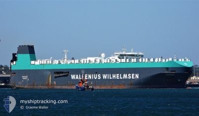
TARAGO
Vehicles Carrier
Current Trip
| Time Travelled | 9 days |
|---|---|
| Remaining Time | 40 mins |
| Distance Travelled | 2241.43 nm |
| Remaining Distance | 16.34 nm |
| AVG Speed | 12.3 Knots |
| MAX Speed | 12.3 Knots |
| AVG Wind | 15.9 knots |
| MAX Wind | 32 knots |
| MIN Temp | -1.4°C / 29.48°F |
| MAX Temp | 14.7°C / 58.46°F |
| Dybgang | 10 m |
| Position Modtaget | 1 m siden |
Current Position
| Longitude | --- |
|---|---|
| Latitude | --- |
| Status | Under way using engine |
| Fart | 17.1 Knots |
| Kurs | 48.2° |
| Område | Inland Sea |
| Station | T-AIS |
| Position Modtaget | 1 m siden |
Info
Information
The current position of TARAGO is in Inland Sea with coordinates 34.47579° / 135.18472° as reported on 2026-01-05 20:58 by AIS to our vessel tracker app. The vessel's current speed is 17.1 Knots and is heading at the port of KOBE. The estimated time of arrival as calculated by MyShipTracking vessel tracking app is 2026-01-06 06:39 LT
The vessel TARAGO (IMO: 9191321, MMSI: 257672000) is a Vehicles Carrier that was built in 2000 ( 26 år gamle ). It's sailing under the flag of [NO] Norway.
In this page you can find informations about the vessels current position, last detected port calls, and current voyage information. If the vessels is not in coverage by AIS you will find the latest position.
The current position of TARAGO is detected by our AIS receivers and we are not responsible for the reliability of the data. The last position was recorded while the vessel was in Coverage by the Ais receivers of our vessel tracking app.
The current draught of TARAGO as reported by AIS is 10 meters
Weather
| Temperature | 5.9°C / 42.62°F |
|---|---|
| Wind Speed | 17 knots |
| Direction | 6° N |
| Pressure | 1018.4 hPa |
| Humidity | 66.8 % |
| Cloud Coverage | 51 % |
Featured Company
Last Port Calls
| Port | Arrival | Departure | Time In Port |
|---|---|---|---|
| 2025-12-26 16:43 | 2025-12-27 20:37 | 1 d | |
| 2025-12-23 23:58 | 2025-12-25 22:39 | 1 d | |
| 2025-11-24 22:23 | 2025-11-25 23:33 | 1 d | |
| 2025-11-21 05:55 | 2025-11-22 18:09 | 1 d | |
| 2025-11-18 11:49 | 2025-11-20 19:59 | 2 d | |
| 2025-11-12 18:56 | 2025-11-13 04:42 | 9 h | |
| 2025-11-11 13:54 |
Last Trips
| Origin | Departure | Destination | Arrival | Distance | |
|---|---|---|---|---|---|
| 2025-12-25 22:39 | 2025-12-26 16:43 | 131.67 nm | |||
| 2025-11-25 23:33 | 2025-12-23 23:58 | 10791.52 nm | |||
| 2025-11-22 18:09 | 2025-11-24 22:23 | 688.53 nm | |||
| 2025-11-20 19:59 | 2025-11-21 05:55 | 162.45 nm | |||
| 2025-11-13 04:42 | 2025-11-18 11:49 | 1774.20 nm | |||
| 2025-10-23 16:32 | 2025-11-12 18:56 | 8011.74 nm | |||
| 2025-10-23 16:32 | 2025-11-11 13:54 | 8011.21 nm |
Events
| Tid | Hændelsen | Detaljer | Position / Dest | Info |
|---|---|---|---|---|
| 2026-01-05 20:21 | Status er ændret | Under way using engine Default |
34.34501 / 135.04061
JP UKB
|
Fart: 17.4 kn Kurs: 40° |
| 2026-01-05 20:09 | Status er ændret | Default Under way using engine |
34.30045 / 134.99589
JP UKB
|
Fart: 16.5 kn Kurs: 34.6° |
| 2026-01-05 20:08 | Status er ændret | Under way using engine Default |
34.29934 / 134.99491
JP UKB
|
Fart: 16.5 kn Kurs: 6° |
| 2026-01-05 20:08 | Ændre havområde | Japanese part of the Inland Sea Japanese part of the Philippine Sea |
34.29934 / 134.99491
Inland Sea
JP UKB
|
Fart: 16.5 kn Kurs: 34.6° |
| 2026-01-05 20:05 | Status er ændret | Default Under way using engine |
34.28340 / 134.98843
JP UKB
|
Fart: 14.9 kn Kurs: 1.9° |
| 2026-01-05 19:00 | Dybgangen er ændret | 10 8.2 |
34.10481 / 134.96174
JP UKB
|
Fart: 9.1 kn Kurs: 14.4° |
| 2026-01-05 19:00 | Destination er ændret | JP UKB PANAMA CANAL |
34.10481 / 134.96174
JP UKB
|
Fart: 9.1 kn Kurs: 14.4° |
| 2026-01-05 19:00 | ETA er ændret | 2026/01/05 19:30 2025/12/01 13:00 |
34.10481 / 134.96174
JP UKB
|
Fart: 9.1 kn Kurs: 14.4° |
| 2026-01-05 18:13 | Ændre havområde | Japanese part of the Philippine Sea Panamanian part of the North Pacific Ocean |
33.96231 / 134.95780
Philippine Sea
|
Fart: 13.2 kn Kurs: 355.2° |
| 2026-01-05 18:13 | Status er ændret | Under way using engine Default |
33.96231 / 134.95780
PANAMA CANAL
|
Fart: 11.7 kn Kurs: 6° |