
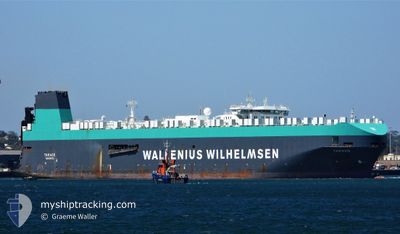
TARAGO
Vehicles Carrier
Current Trip
| Time Travelled | 20 days |
|---|---|
| Remaining Time | 22 h, 53 mins |
| Distance Travelled | 7765.85 nm |
| Remaining Distance | 390.59 nm |
| AVG Speed | 15.9 Knopen |
| MAX Speed | 19 Knopen |
| AVG Wind | 13.7 knots |
| MAX Wind | 29.2 knots |
| MIN Temp | 11.4°C / 52.52°F |
| MAX Temp | 29.9°C / 85.82°F |
| Diepgang | 11.1 M |
| Positie ontvangen | 3 d geleden |
Current Position
| Lengtegraad | -107.80645° |
|---|---|
| Breedtegraat | 15.88020° |
| Status | Under way using engine |
| Snelheid | 17.3 Knopen |
| Koers | 108.7° |
| Gebied | North Pacific Ocean |
| Station | T-AIS |
| Positie ontvangen | 3 d geleden |
Info
Information
The current position of TARAGO is in North Pacific Ocean with coordinates 15.88020° / -107.80645° as reported on 2024-04-22 04:32 by AIS to our vessel tracker app. The vessel's current speed is 17.3 Knopen and is heading at the port of BALBOA. The estimated time of arrival as calculated by MyShipTracking vessel tracking app is 2024-04-26 21:18 LT
The vessel TARAGO (IMO: 9191321, MMSI: 257672000) is a Vehicles Carrier that was built in 2000 ( 24 Jaar oud ). It's sailing under the flag of [NO] Norway.
In this page you can find informations about the vessels current position, last detected port calls, and current voyage information. If the vessels is not in coverage by AIS you will find the latest position.
The current position of TARAGO is detected by our AIS receivers and we are not responsible for the reliability of the data. The last position was recorded while the vessel was in Coverage by the Ais receivers of our vessel tracking app.
The current draught of TARAGO as reported by AIS is 11.1 meters
Weather
| Temperature | 27.8°C / 82.04°F |
|---|---|
| Wind Speed | 13 knots |
| Direction | 238° WSW |
| Pressure | 1007.2 hPa |
| Humidity | 81.8 % |
| Cloud Coverage | 100 % |
Featured Company
Last Trips
| Origin | Departure | Destination | Arrival | Distance | |
|---|---|---|---|---|---|
| 2024-03-28 16:24 | 2024-04-05 13:37 | 725.03 nm | |||
| 2024-03-27 06:44 | 2024-03-28 07:38 | 365.46 nm | |||
| 2024-03-24 18:30 | 2024-03-26 06:48 | 476.67 nm | |||
| 2024-03-20 08:32 | 2024-03-23 16:00 | 1182.01 nm | |||
| 2024-01-26 17:13 | 2024-03-19 21:55 | 13070.48 nm |
Events
| Tijd | Evenement | Details | Positie / Bestemming | Info |
|---|---|---|---|---|
| 2024-04-22 04:37 | Status Changed | Default Under way using engine |
15.87199 / -107.78205
PA BLB
|
Snelheid: 17.3 kn Koers: 108.7° |
| 2024-04-22 04:32 | Buitenbereik |
15.88020 / -107.80645
North Pacific Ocean
PA BLB
|
Snelheid: 17.3 kn Koers: 108.7° |
|
| 2024-04-22 03:56 | Status Changed | Under way using engine Default |
15.93673 / -107.98010
PA BLB
|
Snelheid: 17 kn Koers: 108° |
| 2024-04-22 03:54 | Status Changed | Default Under way using engine |
15.93833 / -107.98500
PA BLB
|
Snelheid: 17.5 kn Koers: 107.6° |
| 2024-04-22 03:00 | Status Changed | Under way using engine Default |
16.02063 / -108.24908
PA BLB
|
Snelheid: 17.6 kn Koers: 110° |
| 2024-04-22 02:49 | Status Changed | Default Under way using engine |
16.03842 / -108.30196
PA BLB
|
Snelheid: 17.4 kn Koers: 108.4° |
| 2024-04-22 02:08 | Status Changed | Under way using engine Default |
16.10119 / -108.49840
PA BLB
|
Snelheid: 17.5 kn Koers: 107° |
| 2024-04-22 02:02 | Status Changed | Default Under way using engine |
16.11004 / -108.52891
PA BLB
|
Snelheid: 17.3 kn Koers: 108.8° |
| 2024-04-22 01:28 | Wijzig zee gebeid | High seas of the North Pacific Ocean Mexican part of the North Pacific Ocean |
16.16069 / -108.68944
North Pacific Ocean
PA BLB
|
Snelheid: 17.7 kn Koers: 109.7° |
| 2024-04-22 00:14 | Status Changed | Under way using engine Default |
16.26959 / -109.03060
PA BLB
|
Snelheid: 16 kn Koers: 107° |