
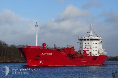
RYSTRAUM
Oil/Chemical Tanker
Current Trip
| Trip Time | 1 day |
|---|---|
| Trip Distance | 278.26 nm |
| AVG Speed | 12.2 Knots |
| MAX Speed | 14.2 Knots |
| Dybgang | 6.2 m |
| AVG Wind | 8.1 knots |
| MAX Wind | 13 knots |
| MIN Temp | -1.4°C / 29.48°F |
| MAX Temp | 1.8°C / 35.24°F |
| Position Modtaget | 1 d siden |
Current Position
| Longitude | 21.45683° |
|---|---|
| Latitude | 63.65283° |
| Status | Under way using engine |
| Fart | 12 Knots |
| Kurs | 48.6° |
| Område | Gulf of Bothnia |
| Station | T-AIS |
| Position Modtaget | 1 d siden |
Info
Information
The current position of RYSTRAUM is in Gulf of Bothnia with coordinates 63.65283° / 21.45683° as reported on 2024-04-25 07:07 by AIS to our vessel tracker app. The vessel's current speed is 12 Knots and is currently inside the port of RONNSKAR.
The vessel RYSTRAUM (IMO: 9391000, MMSI: 258858000) is a Oil/Chemical Tanker that was built in 2009 ( 15 år gamle ). It's sailing under the flag of [NO] Norway.
In this page you can find informations about the vessels current position, last detected port calls, and current voyage information. If the vessels is not in coverage by AIS you will find the latest position.
The current position of RYSTRAUM is detected by our AIS receivers and we are not responsible for the reliability of the data. The last position was recorded while the vessel was in Coverage by the Ais receivers of our vessel tracking app.
The current draught of RYSTRAUM as reported by AIS is 6.2 meters
Weather
| Temperature | -0.1°C / 31.82°F |
|---|---|
| Wind Speed | 3 knots |
| Direction | 52° NE |
| Pressure | 1011.2 hPa |
| Humidity | 99.3 % |
| Cloud Coverage | 100 % |
Featured Company
Last Port Calls
| Port | Arrival | Departure | Time In Port |
|---|---|---|---|
| 2024-04-26 13:56 | |||
| 2024-04-24 02:56 | 2024-04-24 18:12 | 15 h | |
| 2024-04-17 16:25 | 2024-04-18 16:09 | 23 h | |
| 2024-04-15 14:59 | 2024-04-16 08:21 | 17 h | |
| 2024-04-12 21:09 | 2024-04-13 21:57 | 1 d | |
| 2024-04-10 19:35 | 2024-04-12 00:24 | 1 d | |
| 2024-04-10 19:01 | 2024-04-10 19:14 | 13 m | |
| 2024-04-08 02:49 | 2024-04-09 01:21 | 22 h | |
| 2024-04-08 02:32 | |||
| 2024-04-07 03:15 | 2024-04-07 23:19 | 20 h |
Last Trips
| Origin | Departure | Destination | Arrival | Distance | |
|---|---|---|---|---|---|
| 2024-04-24 20:12 | 2024-04-26 15:56 | 278.26 nm | |||
| 2024-04-18 18:09 | 2024-04-24 04:56 | 1416.11 nm | |||
| 2024-04-16 10:21 | 2024-04-17 18:25 | 398.88 nm | |||
| 2024-04-13 23:57 | 2024-04-15 16:59 | 502.85 nm | |||
| 2024-04-12 02:24 | 2024-04-12 23:09 | 250.08 nm | |||
| 2024-04-10 21:14 | 2024-04-10 21:35 | 1.19 nm | |||
| 2024-04-09 03:21 | 2024-04-10 21:01 | 375.97 nm | |||
| 2024-04-08 01:19 | 2024-04-08 04:49 | 22.66 nm | |||
| 2024-04-08 01:19 | 2024-04-08 04:32 | 22.17 nm | |||
| 2024-03-28 04:01 | 2024-04-07 05:15 | 1681.93 nm |
Events
| Tid | Hændelsen | Detaljer | Position / Dest | Info |
|---|---|---|---|---|
| 2024-04-26 14:04 | STOP Sejllads |
64.66962 / 21.28219
[SE] RONNSKAR
|
Fart: 0.3 kn Kurs: 296° |
|
| 2024-04-26 13:56 | Skibe i havn |
|
64.66917 / 21.28717
[SE] RONNSKAR
|
Fart: 4.6 kn Kurs: 291° |
| 2024-04-26 13:36 | START Sejllads | 2.87 nm, South East of RONNSKAR |
64.64852 / 21.34268
SEROR
|
Fart: 6.3 kn Kurs: 264° |
| 2024-04-26 03:01 | STOP Sejllads | 3.25 nm, South East of RONNSKAR |
64.64915 / 21.36197
SEROR
|
Fart: Kurs: 252° |
| 2024-04-26 01:44 | START Sejllads | 13.46 nm, North East of RONNSKAR |
64.79250 / 21.70900
SEROR
|
Fart: 4.3 kn Kurs: 270° |
| 2024-04-25 21:48 | STOP Sejllads | 13.63 nm, North East of RONNSKAR |
64.79719 / 21.70996
SEROR
|
Fart: Kurs: 250° |
| 2024-04-25 21:16 | START Sejllads | 18.55 nm, North East of RONNSKAR |
64.82634 / 21.89200
SEROR
|
Fart: 6.9 kn Kurs: 276° |
| 2024-04-25 15:09 | STOP Sejllads | 20.07 nm, North East of RONNSKAR |
64.84016 / 21.94151
SEROR
|
Fart: 0.1 kn Kurs: 296° |
| 2024-04-25 07:12 | Status er ændret | Default Under way using engine |
63.66033 / 21.49667
SEROR
|
Fart: 12 kn Kurs: 48.6° |
| 2024-04-25 07:07 | Udenfor Dækning |
63.65283 / 21.45683
Gulf of Bothnia
SEROR
|
Fart: 12 kn Kurs: 48.6° |