
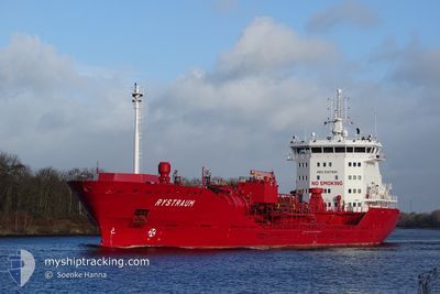
RYSTRAUM
Oil/Chemical Tanker
Current Trip
| Time Travelled | 4 days |
|---|---|
| Remaining Time | 9 h, 30 mins |
| Distance Travelled | 1284.36 nm |
| Remaining Distance | 129.58 nm |
| AVG Speed | 12.3 Noeuds |
| MAX Speed | 14.8 Noeuds |
| AVG Wind | 15.5 knots |
| MAX Wind | 26.1 knots |
| MIN Temp | -1.5°C / 29.3°F |
| MAX Temp | 6.5°C / 43.7°F |
| Tirant d eau | 7.8 m |
| Position reçue | 1 m depuis |
Current Position
| Longitude | 19.04583° |
|---|---|
| Latitude | 60.47183° |
| Etat | Under way using engine |
| Vitesse | 13.2 Noeuds |
| Parcours | 0.2° |
| Zone | Gulf of Bothnia |
| Station | T-AIS |
| Position reçue | 1 m depuis |
Info
Information
The current position of RYSTRAUM is in Gulf of Bothnia with coordinates 60.47183° / 19.04583° as reported on 2024-04-23 15:36 by AIS to our vessel tracker app. The vessel's current speed is 13.2 Noeuds and is heading at the port of SUNDSVALL. The estimated time of arrival as calculated by MyShipTracking vessel tracking app is 2024-04-24 01:07 LT
The vessel RYSTRAUM (IMO: 9391000, MMSI: 258858000) is a Oil/Chemical Tanker that was built in 2009 ( 15 Age ). It's sailing under the flag of [NO] Norway.
In this page you can find informations about the vessels current position, last detected port calls, and current voyage information. If the vessels is not in coverage by AIS you will find the latest position.
The current position of RYSTRAUM is detected by our AIS receivers and we are not responsible for the reliability of the data. The last position was recorded while the vessel was in Coverage by the Ais receivers of our vessel tracking app.
The current draught of RYSTRAUM as reported by AIS is 7.8 meters
Weather
| Temperature | -0.2°C / 31.64°F |
|---|---|
| Wind Speed | 4 knots |
| Direction | 332° NNW |
| Pressure | 1010.9 hPa |
| Humidity | 65.5 % |
| Cloud Coverage | 100 % |
Featured Company
Last Port Calls
| Port | Arrival | Departure | Time In Port |
|---|---|---|---|
| 2024-04-17 16:25 | 2024-04-18 16:09 | 23 h | |
| 2024-04-15 14:59 | 2024-04-16 08:21 | 17 h | |
| 2024-04-12 21:09 | 2024-04-13 21:57 | 1 d | |
| 2024-04-10 19:35 | 2024-04-12 00:24 | 1 d | |
| 2024-04-10 19:01 | 2024-04-10 19:14 | 13 m | |
| 2024-04-08 02:49 | 2024-04-09 01:21 | 22 h | |
| 2024-04-08 02:32 | |||
| 2024-04-07 03:15 | 2024-04-07 23:19 | 20 h | |
| 2024-03-28 02:25 | 2024-03-28 03:01 | 36 m | |
| 2024-03-16 17:21 | 2024-03-18 17:02 | 1 d |
Most Visited Ports (Last year)
| Port | Arrivals | |
|---|---|---|
| 9 | ||
| 7 | ||
| 6 | ||
| 5 | ||
| 4 | ||
| 4 |
Last Trips
| Origin | Departure | Destination | Arrival | Distance | |
|---|---|---|---|---|---|
| 2024-04-16 10:21 | 2024-04-17 18:25 | 398.88 nm | |||
| 2024-04-13 23:57 | 2024-04-15 16:59 | 502.85 nm | |||
| 2024-04-12 02:24 | 2024-04-12 23:09 | 250.08 nm | |||
| 2024-04-10 21:14 | 2024-04-10 21:35 | 1.19 nm | |||
| 2024-04-09 03:21 | 2024-04-10 21:01 | 375.97 nm | |||
| 2024-04-08 01:19 | 2024-04-08 04:49 | 22.66 nm | |||
| 2024-04-08 01:19 | 2024-04-08 04:32 | 22.17 nm | |||
| 2024-03-28 04:01 | 2024-04-07 05:15 | 1681.93 nm | |||
| 2024-03-18 18:02 | 2024-03-28 03:25 | 1934.88 nm | |||
| 2024-03-09 23:04 | 2024-03-16 18:21 | 483.91 nm |
Events
| Heure | Evenement | Détails | Position/ Destination | Info |
|---|---|---|---|---|
| 2024-04-23 14:19 | Changement de zone | Swedish part of the Gulf of Bothnia Finnish part of the Gulf of Bothnia |
60.19896 / 19.08630
Gulf of Bothnia
SESDL
|
Vitesse: 12.3 kn Parcours: 323.1° |
| 2024-04-23 11:47 | Changement de zone | Finnish part of the Gulf of Bothnia Finnish part of the Baltic Sea |
59.78708 / 19.76190
Gulf of Bothnia
SESDL
|
Vitesse: 12.8 kn Parcours: 321.1° |
| 2024-04-23 10:35 | Etat Changé | Under way using engine Default |
59.60440 / 20.09992
SESDL
|
Vitesse: 12.7 kn Parcours: 313° |
| 2024-04-23 10:28 | Etat Changé | Default Under way using engine |
59.58868 / 20.13413
SESDL
|
Vitesse: 12.5 kn Parcours: 312.7° |
| 2024-04-23 10:15 | Etat Changé | Under way using engine Default |
59.55615 / 20.20090
SESDL
|
Vitesse: 12.5 kn Parcours: 359° |
| 2024-04-23 09:57 | Dans la zone couverte |
59.55883 / 20.19800
Baltic Sea
SESDL
|
Vitesse: 11.8 kn Parcours: 325.2° |
|
| 2024-04-23 08:07 | Etat Changé | Default Under way using engine |
59.39061 / 20.90240
SESDL
|
Vitesse: 12.3 kn Parcours: 264.8° |
| 2024-04-23 07:52 | Hors de la zone couverte |
59.39535 / 21.00381
Baltic Sea
SESDL
|
Vitesse: 12.3 kn Parcours: 264.8° |
|
| 2024-04-23 02:38 | Changement de zone | Finnish part of the Baltic Sea Finnish part of the Gulf of Finland |
59.59500 / 23.08517
Baltic Sea
SESDL
|
Vitesse: 13.3 kn Parcours: 256.1° |
| 2024-04-23 01:01 | Etat Changé | Under way using engine Default |
59.69128 / 23.75941
SESDL
|
Vitesse: 13.1 kn Parcours: 254° |