
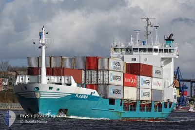
RAGNA
Container Ship
Current Trip
| Time Travelled | 1 day |
|---|---|
| Remaining Time | 19 h, 43 mins |
| Distance Travelled | 361.49 nm |
| Remaining Distance | 212.39 nm |
| AVG Speed | 9.6 Knots |
| MAX Speed | 18.8 Knots |
| AVG Wind | 11.6 knots |
| MAX Wind | 31 knots |
| MIN Temp | 4.5°C / 40.1°F |
| MAX Temp | 10.8°C / 51.44°F |
| Dybgang | 6.7 m |
| Position Modtaget | Nu |
Current Position
| Longitude | --- |
|---|---|
| Latitude | --- |
| Status | Under way using engine |
| Fart | 11.3 Knots |
| Kurs | 251° |
| Område | North Sea |
| Station | T-AIS |
| Position Modtaget | Nu |
Info
Information
The current position of RAGNA is in North Sea with coordinates 53.67117° / 5.58650° as reported on 2025-12-08 03:30 by AIS to our vessel tracker app. The vessel's current speed is 11.3 Knots and is heading at the port of ANTWERP. The estimated time of arrival as calculated by MyShipTracking vessel tracking app is 2025-12-09 00:14 LT
The vessel RAGNA (IMO: 9173329, MMSI: 211265530) is a Container Ship that was built in 1998 ( 27 år gamle ). It's sailing under the flag of [DE] Germany.
In this page you can find informations about the vessels current position, last detected port calls, and current voyage information. If the vessels is not in coverage by AIS you will find the latest position.
The current position of RAGNA is detected by our AIS receivers and we are not responsible for the reliability of the data. The last position was recorded while the vessel was in Coverage by the Ais receivers of our vessel tracking app.
The current draught of RAGNA as reported by AIS is 6.7 meters
Weather
| Temperature | 10.3°C / 50.54°F |
|---|---|
| Wind Speed | 28 knots |
| Direction | 251° WSW |
| Pressure | 1003.3 hPa |
| Humidity | 80.6 % |
| Cloud Coverage | 3 % |
Featured Company
Last Port Calls
| Port | Arrival | Departure | Time In Port |
|---|---|---|---|
| 2025-12-06 08:08 | 2025-12-06 17:43 | 9 h | |
| 2025-12-03 12:39 | 2025-12-03 23:31 | 10 h | |
| 2025-12-01 22:00 | 2025-12-02 20:02 | 22 h | |
| 2025-11-27 06:05 | 2025-11-27 21:19 | 15 h | |
| 2025-11-23 22:22 | 2025-11-24 13:25 | 15 h | |
| 2025-11-22 20:57 | 2025-11-23 08:47 | 11 h | |
| 2025-11-19 04:47 | 2025-11-19 21:18 | 16 h | |
| 2025-11-15 03:28 | 2025-11-15 20:07 | 16 h | |
| 2025-11-14 07:31 | 2025-11-14 14:53 | 7 h | |
| 2025-11-11 00:05 | 2025-11-11 11:34 | 11 h |
Most Visited Ports (Last year)
| Port | Arrivals | |
|---|---|---|
| 36 | ||
| 31 | ||
| 29 | ||
| 7 | ||
| 6 | ||
| 5 |
Last Trips
| Origin | Departure | Destination | Arrival | Distance | |
|---|---|---|---|---|---|
| 2025-12-03 23:31 | 2025-12-06 08:08 | 699.40 nm | |||
| 2025-12-02 20:02 | 2025-12-03 12:39 | 164.67 nm | |||
| 2025-11-27 21:19 | 2025-12-01 22:00 | 592.32 nm | |||
| 2025-11-24 13:25 | 2025-11-27 06:05 | 620.06 nm | |||
| 2025-11-23 08:47 | 2025-11-23 22:22 | 163.09 nm | |||
| 2025-11-19 21:18 | 2025-11-22 20:57 | 585.99 nm | |||
| 2025-11-15 20:07 | 2025-11-19 04:47 | 697.97 nm | |||
| 2025-11-14 14:53 | 2025-11-15 03:28 | 163.81 nm | |||
| 2025-11-11 11:34 | 2025-11-14 07:31 | 656.90 nm | |||
| 2025-11-08 21:51 | 2025-11-11 00:05 | 649.29 nm |
Events
| Tid | Hændelsen | Detaljer | Position / Dest | Info |
|---|---|---|---|---|
| 2025-12-08 02:37 | Destination er ændret | BEANR BEANR VIA NOK |
53.72667 / 5.84483
BEANR
|
Fart: 11.1 kn Kurs: 251° |
| 2025-12-08 02:37 | ETA er ændret | 2025/12/08 22:00 2025/12/08 22:59 |
53.72667 / 5.84483
BEANR
|
Fart: 11.1 kn Kurs: 251° |
| 2025-12-08 02:08 | Status er ændret | Under way using engine Default |
53.75350 / 5.97817
BEANR VIA NOK
|
Fart: 10.8 kn Kurs: 250° |
| 2025-12-08 01:37 | Status er ændret | Default Under way using engine |
53.78333 / 6.12350
BEANR VIA NOK
|
Fart: 10.9 kn Kurs: 250° |
| 2025-12-08 01:32 | Fundet i havområde | Dutch part of the North Sea |
53.78883 / 6.14800
North Sea
BEANR VIA NOK
|
Fart: 10.9 kn Kurs: 250° |
| 2025-12-08 01:32 | Status er ændret | Under way using engine Default |
53.78883 / 6.14800
BEANR VIA NOK
|
Fart: 10.7 kn Kurs: 250° |
| 2025-12-08 01:09 | Status er ændret | Default Under way using engine |
53.81200 / 6.25533
BEANR VIA NOK
|
Fart: 10.4 kn Kurs: 255° |
| 2025-12-08 01:01 | Status er ændret | Under way using engine Default |
53.81850 / 6.29450
BEANR VIA NOK
|
Fart: 10.3 kn Kurs: 254° |
| 2025-12-08 00:05 | Status er ændret | Default Under way using engine |
53.86300 / 6.55867
BEANR VIA NOK
|
Fart: 10.7 kn Kurs: 253° |
| 2025-12-08 00:00 | Status er ændret | Under way using engine Default |
53.86683 / 6.58167
BEANR VIA NOK
|
Fart: 10.8 kn Kurs: 254° |