
NOR'EASTER
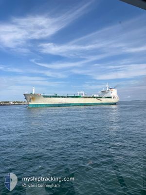
Oil/Chemical Tanker
Current Trip
| Time Travelled | 1 day |
|---|---|
| Remaining Time | --- |
| Distance Travelled | 263.56 nm |
| Remaining Distance | --- |
| AVG Speed | 10 Knots |
| MAX Speed | 14.3 Knots |
| AVG Wind | 16.8 knots |
| MAX Wind | 34.5 knots |
| MIN Temp | 1.6°C / 34.88°F |
| MAX Temp | 8.3°C / 46.94°F |
| Dybgang | 7.4 m |
| Position Modtaget | 6 h, 0 m siden |
Current Position
| Longitude | --- |
|---|---|
| Latitude | --- |
| Status | Under way using engine |
| Fart | 7.7 Knots |
| Kurs | 45.9° |
| Område | Bay of Fundy |
| Station | T-AIS |
| Position Modtaget | 6 h, 0 m siden |
Info
Information
The current position of NOR'EASTER is in Bay of Fundy with coordinates 44.28783° / -66.61757° as reported on 2026-01-10 12:53 by AIS to our vessel tracker app. The vessel's current speed is 7.7 Knots and is heading at the port of SAINT JOHN. The estimated time of arrival as calculated by MyShipTracking vessel tracking app is 2026-01-10 08:30 LT
The vessel NOR'EASTER (IMO: 9350642, MMSI: 538002783) is a Oil/Chemical Tanker that was built in 2007 ( 19 år gamle ). It's sailing under the flag of [MH] Marshall Is.
In this page you can find informations about the vessels current position, last detected port calls, and current voyage information. If the vessels is not in coverage by AIS you will find the latest position.
The current position of NOR'EASTER is detected by our AIS receivers and we are not responsible for the reliability of the data. The last position was recorded while the vessel was in Coverage by the Ais receivers of our vessel tracking app.
The current draught of NOR'EASTER as reported by AIS is 7.4 meters
Weather
| Temperature | 4.7°C / 40.46°F |
|---|---|
| Wind Speed | 16 knots |
| Direction | 283° WNW |
| Pressure | 1019.2 hPa |
| Humidity | 65.4 % |
| Cloud Coverage | 67 % |
Featured Company
Last Port Calls
| Port | Arrival | Departure | Time In Port |
|---|---|---|---|
| 2026-01-06 10:06 | 2026-01-09 08:40 | 2 d | |
| 2026-01-04 00:23 | 2026-01-05 00:04 | 23 h | |
| 2025-12-31 06:35 | 2026-01-02 07:59 | 2 d | |
| 2025-12-27 16:26 | 2025-12-28 18:18 | 1 d | |
| 2025-12-24 12:09 | 2025-12-26 09:42 | 1 d | |
| 2025-12-21 00:05 | 2025-12-22 00:32 | 1 d | |
| 2025-12-17 06:33 | 2025-12-18 17:31 | 1 d | |
| 2025-12-15 19:04 | 2025-12-16 09:29 | 14 h | |
| 2025-12-12 14:20 | 2025-12-14 13:42 | 1 d | |
| 2025-12-10 11:14 | 2025-12-11 09:01 | 21 h |
Most Visited Ports (Last year)
| Port | Arrivals | |
|---|---|---|
| 50 | ||
| 34 | ||
| 16 | ||
| 8 | ||
| 6 | ||
| 2 |
Last Trips
| Origin | Departure | Destination | Arrival | Distance | |
|---|---|---|---|---|---|
| 2026-01-05 00:04 | 2026-01-06 10:06 | 290.27 nm | |||
| 2026-01-02 07:59 | 2026-01-04 00:23 | 296.18 nm | |||
| 2025-12-28 18:18 | 2025-12-31 06:35 | 306.87 nm | |||
| 2025-12-26 09:42 | 2025-12-27 16:26 | 292.57 nm | |||
| 2025-12-22 00:32 | 2025-12-24 12:09 | 294.98 nm | |||
| 2025-12-18 17:31 | 2025-12-21 00:05 | 362.64 nm | |||
| 2025-12-16 09:29 | 2025-12-17 06:33 | 228.25 nm | |||
| 2025-12-14 13:42 | 2025-12-15 19:04 | 293.86 nm | |||
| 2025-12-11 09:01 | 2025-12-12 14:20 | 109.45 nm | |||
| 2025-12-09 14:37 | 2025-12-10 11:14 | 228.64 nm |
Events
| Tid | Hændelsen | Detaljer | Position / Dest | Info |
|---|---|---|---|---|
| 2026-01-10 13:05 | Status er ændret | Default Under way using engine |
44.30542 / -66.59116
CASJB
|
Fart: 7.7 kn Kurs: 45.9° |
| 2026-01-10 12:53 | Ændre havområde | Canadian part of the Bay of Fundy United States part of the North Atlantic Ocean |
44.28783 / -66.61757
Bay of Fundy
CASJB
|
Fart: 7.7 kn Kurs: 45.9° |
| 2026-01-10 12:53 | Status er ændret | Under way using engine Default |
44.28783 / -66.61757
CASJB
|
Fart: 8.2 kn Kurs: 48° |
| 2026-01-10 12:53 | Udenfor Dækning |
44.28783 / -66.61757
Bay of Fundy
CASJB
|
Fart: 7.7 kn Kurs: 45.9° |
|
| 2026-01-10 12:46 | Indenfor Dækning |
44.28783 / -66.61757
Bay of Fundy
CASJB
|
Fart: 7.7 kn Kurs: 45.9° |
|
| 2026-01-10 00:45 | Status er ændret | Default Under way using engine |
43.27818 / -68.85925
CASJB
|
Fart: 9.8 kn Kurs: 60.4° |
| 2026-01-10 00:41 | Udenfor Dækning |
43.27223 / -68.87334
North Atlantic Ocean
CASJB
|
Fart: 9.8 kn Kurs: 60.4° |
|
| 2026-01-10 00:38 | Status er ændret | Under way using engine Default |
43.26920 / -68.88040
CASJB
|
Fart: 9.7 kn Kurs: 58° |
| 2026-01-10 00:34 | Status er ændret | Default Under way using engine |
43.26230 / -68.89635
CASJB
|
Fart: 9.7 kn Kurs: 56.3° |
| 2026-01-10 00:29 | Status er ændret | Under way using engine Default |
43.25564 / -68.91106
CASJB
|
Fart: 9.7 kn Kurs: 57° |