
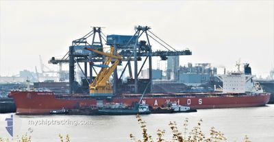
NAVIOS ETOILE
Cargo
Current Trip
| Time Travelled | 29 days |
|---|---|
| Remaining Time | --- |
| Distance Travelled | 5100.88 nm |
| Remaining Distance | --- |
| AVG Speed | 9.2 Knots |
| MAX Speed | 14.5 Knots |
| AVG Wind | 9.1 knots |
| MAX Wind | 22.4 knots |
| MIN Temp | 12.8°C / 55.04°F |
| MAX Temp | 31.2°C / 88.16°F |
| Dybgang | 18 m |
| Position Modtaget | 6 d siden |
Current Position
| Longitude | 103.43337° |
|---|---|
| Latitude | 1.23463° |
| Status | Under way using engine |
| Fart | 10.7 Knots |
| Kurs | 282° |
| Område | Malacca Strait |
| Station | T-AIS |
| Position Modtaget | 6 d siden |
Info
Information
The current position of NAVIOS ETOILE is in Malacca Strait with coordinates 1.23463° / 103.43337° as reported on 2024-05-19 21:30 by AIS to our vessel tracker app. The vessel's current speed is 10.7 Knots and is heading at the port of MUNDRA. The estimated time of arrival as calculated by MyShipTracking vessel tracking app is 2024-05-31 19:30 LT
The vessel NAVIOS ETOILE (IMO: 9481312, MMSI: 372160000) is a Cargo It's sailing under the flag of [PA] Panama.
In this page you can find informations about the vessels current position, last detected port calls, and current voyage information. If the vessels is not in coverage by AIS you will find the latest position.
The current position of NAVIOS ETOILE is detected by our AIS receivers and we are not responsible for the reliability of the data. The last position was recorded while the vessel was in Coverage by the Ais receivers of our vessel tracking app.
The current draught of NAVIOS ETOILE as reported by AIS is 18 meters
Weather
| Temperature | 28.9°C / 84.02°F |
|---|---|
| Wind Speed | 15 knots |
| Direction | 214° SW |
| Pressure | 1007.1 hPa |
| Humidity | 82.7 % |
| Cloud Coverage | 100 % |
Featured Company
Last Port Calls
| Port | Arrival | Departure | Time In Port |
|---|---|---|---|
| 2024-04-23 17:56 | 2024-04-27 10:00 | 3 d | |
| 2024-03-03 15:05 | 2024-03-07 21:03 | 4 d |
Most Visited Ports (Last year)
| Port | Arrivals | |
|---|---|---|
| 2 | ||
| 1 | ||
| 1 | ||
| 1 | ||
| 1 | ||
| 1 |
Last Trips
| Origin | Departure | Destination | Arrival | Distance | |
|---|---|---|---|---|---|
| 2024-03-07 21:03 | 2024-04-23 17:56 | 10092.39 nm | |||
| 2024-01-27 04:14 | 2024-03-03 15:05 | 8775.55 nm |
Events
| Tid | Hændelsen | Detaljer | Position / Dest | Info |
|---|---|---|---|---|
| 2024-05-19 21:37 | Status er ændret | Default Under way using engine |
1.23865 / 103.41373
INMUN
|
Fart: 10.7 kn Kurs: 282° |
| 2024-05-19 21:30 | Udenfor Dækning |
1.23463 / 103.43337
Malacca Strait
INMUN
|
Fart: 10.7 kn Kurs: 282° |
|
| 2024-05-19 21:20 | Ændre havområde | Malaysian part of the Malacca Strait Malaysian part of the Singapore Strait |
1.22727 / 103.46293
Malacca Strait
INMUN
|
Fart: 10.7 kn Kurs: 284° |
| 2024-05-19 20:35 | Ændre havområde | Malaysian part of the Singapore Strait Indonesian part of the Singapore Strait |
1.19950 / 103.58835
Singapore Strait
INMUN
|
Fart: 9.7 kn Kurs: 278° |
| 2024-05-19 19:47 | Ændre havområde | Indonesian part of the Singapore Strait Singaporean part of the Singapore Strait |
1.15622 / 103.70155
Singapore Strait
INMUN
|
Fart: 8.3 kn Kurs: 297° |
| 2024-05-19 17:23 | Ændre havområde | Singaporean part of the Singapore Strait Indonesian part of the Singapore Strait |
1.25415 / 103.99258
Singapore Strait
INMUN
|
Fart: 9.3 kn Kurs: 263° |
| 2024-05-19 16:59 | Ændre havområde | Indonesian part of the Singapore Strait Singaporean part of the Singapore Strait |
1.27052 / 104.04890
Singapore Strait
INMUN
|
Fart: 7.4 kn Kurs: 218° |
| 2024-05-19 16:50 | Ændre havområde | Singaporean part of the Singapore Strait Malaysian part of the Singapore Strait |
1.28348 / 104.05915
Singapore Strait
INMUN
|
Fart: 5.7 kn Kurs: 218° |
| 2024-05-19 16:44 | START Sejllads | 3.09 nm, South East of TANAH MERAH |
1.28937 / 104.06400
INMUN
|
Fart: 3.1 kn Kurs: 231° |
| 2024-05-19 16:37 | Status er ændret | Under way using engine At anchor |
1.29003 / 104.06640
INMUN
|
Fart: 0.4 kn Kurs: 282° |