
MOANA
Container Ship
Current Trip
| Time Travelled | 17 days |
|---|---|
| Remaining Time | --- |
| Distance Travelled | 5491.41 nm |
| Remaining Distance | --- |
| AVG Speed | 13.2 Knots |
| MAX Speed | 23.2 Knots |
| AVG Wind | 15.4 knots |
| MAX Wind | 34.8 knots |
| MIN Temp | 20.5°C / 68.9°F |
| MAX Temp | 34.8°C / 94.64°F |
| Dybgang | 12.6 m |
| Position Modtaget | Nu |
Current Position
| Longitude | 25.78155° |
|---|---|
| Latitude | 38.07055° |
| Status | Under way using engine |
| Fart | 15.2 Knots |
| Kurs | 351.2° |
| Område | Aegean Sea |
| Station | T-AIS |
| Position Modtaget | Nu |
Info
Information
The current position of MOANA is in Aegean Sea with coordinates 38.07055° / 25.78155° as reported on 2024-06-05 09:17 by AIS to our vessel tracker app. The vessel's current speed is 15.2 Knots and is heading at the port of IZMIT. The estimated time of arrival as calculated by MyShipTracking vessel tracking app is 2024-06-06 10:00 LT
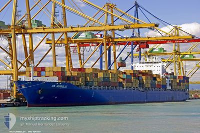
The vessel MOANA (IMO: 9292151, MMSI: 636021323) is a Container Ship that was built in 2004 ( 20 år gamle ). It's sailing under the flag of [LR] Liberia.
In this page you can find informations about the vessels current position, last detected port calls, and current voyage information. If the vessels is not in coverage by AIS you will find the latest position.
The current position of MOANA is detected by our AIS receivers and we are not responsible for the reliability of the data. The last position was recorded while the vessel was in Coverage by the Ais receivers of our vessel tracking app.
The current draught of MOANA as reported by AIS is 12.6 meters
Weather
| Temperature | 24.7°C / 76.46°F |
|---|---|
| Wind Speed | 5 knots |
| Direction | 321° NW |
| Pressure | 1013 hPa |
| Humidity | 69.6 % |
| Cloud Coverage | --- |
Featured Company
Last Port Calls
| Port | Arrival | Departure | Time In Port |
|---|---|---|---|
| 2024-06-03 03:21 | 2024-06-03 12:36 | 9 h | |
| 2024-05-18 14:52 | 2024-05-18 23:28 | 8 h | |
| 2024-05-10 15:14 | 2024-05-11 03:44 | 12 h | |
| 2024-05-07 08:32 | 2024-05-07 22:40 | 14 h | |
| 2024-04-30 17:24 | 2024-05-01 15:12 | 21 h | |
| 2024-04-25 11:35 | 2024-04-26 04:24 | 16 h | |
| 2024-04-06 02:57 | 2024-04-06 12:13 | 9 h | |
| 2024-04-02 05:18 | 2024-04-04 04:45 | 1 d |
Most Visited Ports (Last year)
| Port | Arrivals | |
|---|---|---|
| 7 | ||
| 7 | ||
| 6 | ||
| 5 | ||
| 5 | ||
| 5 |
Last Trips
| Origin | Departure | Destination | Arrival | Distance | |
|---|---|---|---|---|---|
| 2024-05-19 07:28 | 2024-06-03 05:21 | 4873.50 nm | |||
| 2024-05-11 11:44 | 2024-05-18 22:52 | 1698.62 nm | |||
| 2024-05-08 06:40 | 2024-05-10 23:14 | 825.32 nm | |||
| 2024-05-01 23:12 | 2024-05-07 16:32 | 640.63 nm | |||
| 2024-04-26 12:24 | 2024-05-01 01:24 | 1379.82 nm | |||
| 2024-04-04 06:45 | 2024-04-25 19:35 | 6819.11 nm | |||
| 2024-04-04 06:45 | 2024-04-06 04:57 | 216.71 nm | |||
| 2024-03-31 03:55 | 2024-04-02 07:18 | 602.23 nm |
Events
| Tid | Hændelsen | Detaljer | Position / Dest | Info |
|---|---|---|---|---|
| 2024-06-05 01:57 | Status er ændret | Under way using engine Default |
36.52538 / 26.80137
TRIZT
|
Fart: 14.9 kn Kurs: 317° |
| 2024-06-05 01:10 | Status er ændret | Default Under way using engine |
36.37530 / 26.95733
TRIZT
|
Fart: 14.8 kn Kurs: 321.9° |
| 2024-06-04 22:04 | Ændre havområde | Greek part of the Aegean Sea Greek part of the Mediterranean Sea - Eastern Basin |
35.80408 / 27.58859
Aegean Sea
TRIZT
|
Fart: 14.5 kn Kurs: 319.5° |
| 2024-06-04 14:27 | Destination er ændret | TRIZT TRALI |
34.41067 / 29.10264
TRIZT
|
Fart: 14.6 kn Kurs: 318.5° |
| 2024-06-04 14:27 | ETA er ændret | 2024/06/06 10:00 2024/06/06 05:00 |
34.41067 / 29.10264
TRIZT
|
Fart: 14.6 kn Kurs: 318.5° |
| 2024-06-04 10:04 | ETA er ændret | 2024/06/06 05:00 2024/06/05 10:00 |
33.89341 / 29.68417
TRALI
|
Fart: 8.8 kn Kurs: 317.2° |
| 2024-06-04 09:14 | Ændre havområde | Greek part of the Mediterranean Sea - Eastern Basin Egyptian part of the Mediterranean Sea - Eastern Basin |
33.79927 / 29.77719
Mediterranean Sea - Eastern Basin
TRALI
|
Fart: 9 kn Kurs: 320.8° |
| 2024-06-04 05:02 | Status er ændret | Under way using engine Default |
33.30266 / 30.30592
TRALI
|
Fart: 10 kn Kurs: 320° |
| 2024-06-04 04:36 | Status er ændret | Default Under way using engine |
33.24712 / 30.36030
TRALI
|
Fart: 9.9 kn Kurs: 320.7° |
| 2024-06-04 04:23 | Status er ændret | Under way using engine Default |
33.22062 / 30.38587
TRALI
|
Fart: 9.9 kn Kurs: 322° |