
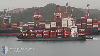
PACANDA
Container Ship
Current Trip
| Time Travelled | 1 day |
|---|---|
| Remaining Time | 19 h, 23 mins |
| Distance Travelled | 628.35 nm |
| Remaining Distance | 424.21 nm |
| AVG Speed | 14.4 Knots |
| MAX Speed | 15.9 Knots |
| AVG Wind | 10.7 knots |
| MAX Wind | 24 knots |
| MIN Temp | 16.1°C / 60.98°F |
| MAX Temp | 21.5°C / 70.7°F |
| Dybgang | 6.6 m |
| Position Modtaget | 1 d siden |
Current Position
| Longitude | 136.92075° |
|---|---|
| Latitude | 34.61268° |
| Status | Under way using engine |
| Fart | 15.4 Knots |
| Kurs | 128° |
| Område | Philippine Sea |
| Station | T-AIS |
| Position Modtaget | 1 d siden |
Info
Information
The current position of PACANDA is in Philippine Sea with coordinates 34.61268° / 136.92075° as reported on 2024-04-25 15:05 by AIS to our vessel tracker app. The vessel's current speed is 15.4 Knots and is heading at the port of TAICANG. The estimated time of arrival as calculated by MyShipTracking vessel tracking app is 2024-04-28 05:29 LT
The vessel PACANDA (IMO: 9343675, MMSI: 305060000) is a Container Ship that was built in 2007 ( 17 år gamle ). It's sailing under the flag of [AG] Antigua Barbuda.
In this page you can find informations about the vessels current position, last detected port calls, and current voyage information. If the vessels is not in coverage by AIS you will find the latest position.
The current position of PACANDA is detected by our AIS receivers and we are not responsible for the reliability of the data. The last position was recorded while the vessel was in Coverage by the Ais receivers of our vessel tracking app.
The current draught of PACANDA as reported by AIS is 6.6 meters
Weather
| Temperature | 18.6°C / 65.48°F |
|---|---|
| Wind Speed | 8 knots |
| Direction | 54° NE |
| Pressure | 1010.7 hPa |
| Humidity | 91.4 % |
| Cloud Coverage | 5 % |
Featured Company
Last Port Calls
| Port | Arrival | Departure | Time In Port |
|---|---|---|---|
| 2024-04-25 04:20 | 2024-04-25 13:20 | 9 h | |
| 2024-04-24 08:59 | 2024-04-24 14:16 | 5 h | |
| 2024-04-23 21:16 | 2024-04-24 08:04 | 10 h | |
| 2024-04-20 00:09 | |||
| 2024-04-15 09:38 | 2024-04-15 13:42 | 4 h | |
| 2024-04-14 22:18 | 2024-04-15 08:22 | 10 h | |
| 2024-04-13 14:21 | 2024-04-13 20:31 | 6 h | |
| 2024-04-10 12:51 | 2024-04-11 00:21 | 11 h | |
| 2024-04-07 05:53 | 2024-04-07 13:29 | 7 h | |
| 2024-04-04 05:33 | 2024-04-04 12:26 | 6 h |
Last Trips
| Origin | Departure | Destination | Arrival | Distance | |
|---|---|---|---|---|---|
| 2024-04-24 23:16 | 2024-04-25 13:20 | 200.85 nm | |||
| 2024-04-24 17:04 | 2024-04-24 17:59 | 12.79 nm | |||
| 2024-04-20 08:09 | 2024-04-24 06:16 | 1073.54 nm | |||
| 2024-04-15 17:22 | 2024-04-15 18:38 | 13.80 nm | |||
| 2024-04-14 05:31 | 2024-04-15 07:18 | 216.29 nm | |||
| 2024-04-11 08:21 | 2024-04-13 23:21 | 930.53 nm | |||
| 2024-04-07 21:29 | 2024-04-10 20:51 | 302.12 nm | |||
| 2024-04-04 21:26 | 2024-04-07 13:53 | 932.03 nm | |||
| 2024-04-03 23:31 | 2024-04-04 14:33 | 200.54 nm | |||
| 2024-04-03 16:51 | 2024-04-03 17:56 | 11.42 nm |
Events
| Tid | Hændelsen | Detaljer | Position / Dest | Info |
|---|---|---|---|---|
| 2024-04-25 15:12 | Status er ændret | Default Under way using engine |
34.59460 / 136.94786
CNTAG
|
Fart: 15.4 kn Kurs: 128° |
| 2024-04-25 15:05 | Status er ændret | Under way using engine Default |
34.61268 / 136.92075
CNTAG
|
Fart: 15.4 kn Kurs: 128° |
| 2024-04-25 15:05 | Udenfor Dækning |
34.61268 / 136.92075
Philippine Sea
CNTAG
|
Fart: 15.4 kn Kurs: 128° |
|
| 2024-04-25 14:52 | Status er ændret | Default Under way using engine |
34.64733 / 136.86676
CNTAG
|
Fart: 14.9 kn Kurs: 127° |
| 2024-04-25 14:45 | Status er ændret | Under way using engine Default |
34.66373 / 136.83958
CNTAG
|
Fart: 14.9 kn Kurs: 143° |
| 2024-04-25 14:45 | Dybgangen er ændret | 6.6 6.9 |
34.68283 / 136.82533
CNTAG
|
Fart: 15.4 kn Kurs: 154° |
| 2024-04-25 14:45 | Destination er ændret | CNTAG JP NGO W5 |
34.68283 / 136.82533
CNTAG
|
Fart: 15.4 kn Kurs: 154° |
| 2024-04-25 14:45 | ETA er ændret | 2024/04/28 04:00 2024/04/25 03:00 |
34.68283 / 136.82533
CNTAG
|
Fart: 15.4 kn Kurs: 154° |
| 2024-04-25 14:20 | Status er ændret | Default Under way using engine |
34.75850 / 136.78050
JP NGO W5
|
Fart: 15.4 kn Kurs: 175° |
| 2024-04-25 14:10 | Status er ændret | Under way using engine Default |
34.79957 / 136.76195
JP NGO W5
|
Fart: 15.5 kn Kurs: 178° |