
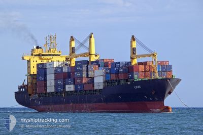
LION
Container Ship
Current Trip
| Trip Time | 3 days |
|---|---|
| Trip Distance | 502.05 nm |
| AVG Speed | 11.7 Knots |
| MAX Speed | 15.7 Knots |
| Dybgang | 6.9 m |
| AVG Wind | 12.9 knots |
| MAX Wind | 20 knots |
| MIN Temp | 19.3°C / 66.74°F |
| MAX Temp | 28.3°C / 82.94°F |
| Position Modtaget | 6 d siden |
Current Position
| Longitude | -17.39068° |
|---|---|
| Latitude | 12.67407° |
| Status | Under way using engine |
| Fart | 13.1 Knots |
| Kurs | 161.9° |
| Område | North Atlantic Ocean |
| Station | T-AIS |
| Position Modtaget | 6 d siden |
Info
Information
The current position of LION is in North Atlantic Ocean with coordinates 12.67407° / -17.39068° as reported on 2024-04-30 06:32 by AIS to our vessel tracker app. The vessel's current speed is 13.1 Knots and is currently inside the port of BISSAU.
The vessel LION (IMO: 9208356, MMSI: 229247000) is a Container Ship that was built in 2000 ( 24 år gamle ). It's sailing under the flag of [MT] Malta.
In this page you can find informations about the vessels current position, last detected port calls, and current voyage information. If the vessels is not in coverage by AIS you will find the latest position.
The current position of LION is detected by our AIS receivers and we are not responsible for the reliability of the data. The last position was recorded while the vessel was in Coverage by the Ais receivers of our vessel tracking app.
The current draught of LION as reported by AIS is 6.9 meters
Weather
| Temperature | 28.2°C / 82.76°F |
|---|---|
| Wind Speed | 6 knots |
| Direction | 227° SW |
| Pressure | 1009 hPa |
| Humidity | 50 % |
| Cloud Coverage | 36 % |
Featured Company
Last Port Calls
| Port | Arrival | Departure | Time In Port |
|---|---|---|---|
| 2024-05-02 16:25 | |||
| 2024-04-26 17:50 | 2024-04-29 01:02 | 2 d | |
| 2024-04-18 21:49 | 2024-04-20 01:35 | 1 d | |
| 2024-04-14 09:39 | 2024-04-15 03:49 | 18 h | |
| 2024-04-05 12:39 | 2024-04-06 17:15 | 1 d | |
| 2024-04-03 09:35 | 2024-04-03 23:39 | 14 h | |
| 2024-03-26 11:01 | 2024-03-27 20:49 | 1 d | |
| 2024-03-13 19:29 | |||
| 2024-03-01 20:32 |
Most Visited Ports (Last year)
| Port | Arrivals | |
|---|---|---|
| 9 | ||
| 9 | ||
| 9 | ||
| 7 | ||
| 5 | ||
| 4 |
Last Trips
| Origin | Departure | Destination | Arrival | Distance | |
|---|---|---|---|---|---|
| 2024-04-29 01:02 | 2024-05-02 16:25 | 502.05 nm | |||
| 2024-04-20 02:35 | 2024-04-26 17:50 | 1345.76 nm | |||
| 2024-04-15 05:49 | 2024-04-18 22:49 | 62.25 nm | |||
| 2024-04-06 17:15 | 2024-04-14 11:39 | 1429.61 nm | |||
| 2024-04-03 23:39 | 2024-04-05 12:39 | 241.40 nm | |||
| 2024-03-27 21:49 | 2024-04-03 09:35 | 1610.03 nm | |||
| 2024-02-21 17:19 | 2024-03-01 21:32 | 200.37 nm |
Events
| Tid | Hændelsen | Detaljer | Position / Dest | Info |
|---|---|---|---|---|
| 2024-05-02 16:25 | STOP Sejllads |
11.85713 / -15.57443
[GW] BISSAU
|
Fart: 0.2 kn Kurs: 218° |
|
| 2024-05-02 16:25 | Skibe i havn |
|
11.85713 / -15.57443
[GW] BISSAU
|
Fart: 1.2 kn Kurs: 235° |
| 2024-05-02 15:27 | START Sejllads | 1.49 nm, South East of BISSAU |
11.83642 / -15.56253
TANGER MED
|
Fart: 3.8 kn Kurs: 240° |
| 2024-04-30 18:22 | STOP Sejllads | 1.58 nm, South East of BISSAU |
11.83614 / -15.56018
TANGER MED
|
Fart: 0.2 kn Kurs: 68° |
| 2024-04-30 06:38 | Status er ændret | Default Under way using engine |
12.65235 / -17.38605
TANGER MED
|
Fart: 13.1 kn Kurs: 161.9° |
| 2024-04-30 06:32 | Ændre havområde | Senegalese part of the North Atlantic Ocean Mauritanian part of the North Atlantic Ocean |
12.67407 / -17.39068
North Atlantic Ocean
|
Fart: 13.1 kn Kurs: 161.9° |
| 2024-04-30 06:32 | Udenfor Dækning |
12.67407 / -17.39068
North Atlantic Ocean
|
Fart: 13.1 kn Kurs: 161.9° |
|
| 2024-04-30 06:31 | Status er ændret | Under way using engine Default |
12.67801 / -17.39202
TANGER MED
|
Fart: 13.1 kn Kurs: 161° |
| 2024-04-30 06:26 | Indenfor Dækning |
12.67407 / -17.39068
North Atlantic Ocean
|
Fart: 13.1 kn Kurs: 161.9° |
|
| 2024-04-29 05:21 | Udenfor Dækning |
17.37234 / -16.41393
North Atlantic Ocean
|
Fart: 10 kn Kurs: 206.8° |