
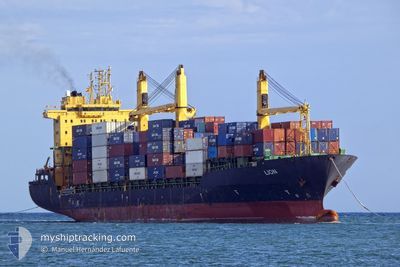
LION
Container Ship
Current Trip
TANGER MED
| Time Travelled | 3 days |
|---|---|
| Remaining Time | --- |
| Distance Travelled | 1031.88 nm |
| Remaining Distance | --- |
| AVG Speed | 12.7 Knop |
| MAX Speed | 16.1 Knop |
| AVG Wind | 14 knots |
| MAX Wind | 21 knots |
| MIN Temp | 14.9°C / 58.82°F |
| MAX Temp | 20.2°C / 68.36°F |
| Djupgående | 6.9 m |
| Position mottagen | 3 d sen |
Current Position
| Longitud | -6.33984° |
|---|---|
| Latitude | 35.66283° |
| Status | Under way using engine |
| Fart | 14.7 Knop |
| Kurs | 224.6° |
| Område | North Atlantic Ocean |
| Station | T-AIS |
| Position mottagen | 3 d sen |
Info
Information
The current position of LION is in North Atlantic Ocean with coordinates 35.66283° / -6.33984° as reported on 2024-04-20 05:44 by AIS to our vessel tracker app. The vessel's current speed is 14.7 Knop
The vessel LION (IMO: 9208356, MMSI: 229247000) is a Container Ship that was built in 2000 ( 24 År gammal ). It's sailing under the flag of [MT] Malta.
In this page you can find informations about the vessels current position, last detected port calls, and current voyage information. If the vessels is not in coverage by AIS you will find the latest position.
The current position of LION is detected by our AIS receivers and we are not responsible for the reliability of the data. The last position was recorded while the vessel was in Coverage by the Ais receivers of our vessel tracking app.
The current draught of LION as reported by AIS is 6.9 meters
Weather
| Temperature | 18.8°C / 65.84°F |
|---|---|
| Wind Speed | 14 knots |
| Direction | 27° NNE |
| Pressure | 1011.8 hPa |
| Humidity | 88.7 % |
| Cloud Coverage | 100 % |
Featured Company
Last Port Calls
| Port | Arrival | Departure | Time In Port |
|---|---|---|---|
| 2024-04-18 21:49 | 2024-04-20 01:35 | 1 d | |
| 2024-04-14 09:39 | 2024-04-15 03:49 | 18 h | |
| 2024-04-05 12:39 | 2024-04-06 17:15 | 1 d | |
| 2024-04-03 09:35 | 2024-04-03 23:39 | 14 h | |
| 2024-03-26 11:01 | 2024-03-27 20:49 | 1 d | |
| 2024-03-13 19:29 | |||
| 2024-03-01 20:32 | |||
| 2024-02-19 02:08 | 2024-02-21 16:19 | 2 d | |
| 2024-02-01 07:49 |
Last Trips
| Origin | Departure | Destination | Arrival | Distance | |
|---|---|---|---|---|---|
| 2024-04-15 05:49 | 2024-04-18 22:49 | 62.25 nm | |||
| 2024-04-06 17:15 | 2024-04-14 11:39 | 1429.61 nm | |||
| 2024-04-03 23:39 | 2024-04-05 12:39 | 241.40 nm | |||
| 2024-03-27 21:49 | 2024-04-03 09:35 | 1610.03 nm | |||
| 2024-02-21 17:19 | 2024-03-01 21:32 | 200.37 nm | |||
| 2024-02-01 08:49 | 2024-02-19 03:08 | 211.63 nm |
Events
| Tid | Event | Detaljer | Position / Dest | Information |
|---|---|---|---|---|
| 2024-04-20 06:04 | Status ändrad | Default Under way using engine |
35.57277 / -6.44931
TANGER MED
|
Fart: 14.7 kn Kurs: 224.6° |
| 2024-04-20 05:44 | UTANFÖR täckningsområde |
35.66283 / -6.33984
North Atlantic Ocean
|
Fart: 14.7 kn Kurs: 224.6° |
|
| 2024-04-20 05:19 | Upptäckt i hav | Moroccan part of the North Atlantic Ocean |
35.71032 / -6.28189
North Atlantic Ocean
|
Fart: 14.5 kn Kurs: 225.5° |
| 2024-04-20 05:19 | Status ändrad | Under way using engine Default |
35.71032 / -6.28189
TANGER MED
|
Fart: 14.5 kn Kurs: 225° |
| 2024-04-20 05:16 | I täckningsområde |
35.71032 / -6.28189
North Atlantic Ocean
|
Fart: 14.5 kn Kurs: 225.5° |
|
| 2024-04-20 02:58 | Status ändrad | Default Under way using engine |
35.95176 / -5.76775
TANGER MED
|
Fart: 12 kn Kurs: 267.9° |
| 2024-04-20 02:50 | UTANFÖR täckningsområde |
35.95263 / -5.73303
Strait of Gibraltar
|
Fart: 12 kn Kurs: 267.9° |
|
| 2024-04-20 02:46 | Status ändrad | Under way using engine Default |
35.95306 / -5.71725
TANGER MED
|
Fart: 12 kn Kurs: 269° |
| 2024-04-20 02:30 | Status ändrad | Default Under way using engine |
35.95517 / -5.65084
TANGER MED
|
Fart: 12.3 kn Kurs: 271.3° |
| 2024-04-20 02:04 | Byter havsområde | Spanish part of the Strait of Gibraltar Moroccan part of the Strait of Gibraltar |
35.95493 / -5.54732
Strait of Gibraltar
|
Fart: 11.1 kn Kurs: 271.3° |