
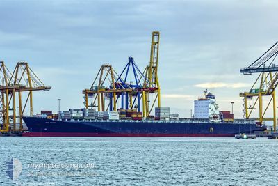
GSL ELENI
Container Ship
Current Trip
| Time Travelled | 5 days |
|---|---|
| Remaining Time | --- |
| Distance Travelled | 1880.76 nm |
| Remaining Distance | --- |
| AVG Speed | 12.1 Knots |
| MAX Speed | 21.8 Knots |
| AVG Wind | 11.3 knots |
| MAX Wind | 29 knots |
| MIN Temp | 5.6°C / 42.08°F |
| MAX Temp | 23.8°C / 74.84°F |
| Dybgang | 10.8 m |
| Position Modtaget | 4 d siden |
Current Position
| Longitude | --- |
|---|---|
| Latitude | --- |
| Status | Under way using engine |
| Fart | 13.2 Knots |
| Kurs | 88.1° |
| Område | North Atlantic Ocean |
| Station | T-AIS |
| Position Modtaget | 4 d siden |
Info
Information
The current position of GSL ELENI is in North Atlantic Ocean with coordinates 30.77869° / -74.51539° as reported on 2025-12-05 10:03 by AIS to our vessel tracker app. The vessel's current speed is 13.2 Knots and is heading at the port of TANGER MED. The estimated time of arrival as calculated by MyShipTracking vessel tracking app is 2025-12-17 17:30 LT
The vessel GSL ELENI (IMO: 9285677, MMSI: 636019342) is a Container Ship that was built in 2004 ( 21 år gamle ). It's sailing under the flag of [LR] Liberia.
In this page you can find informations about the vessels current position, last detected port calls, and current voyage information. If the vessels is not in coverage by AIS you will find the latest position.
The current position of GSL ELENI is detected by our AIS receivers and we are not responsible for the reliability of the data. The last position was recorded while the vessel was in Coverage by the Ais receivers of our vessel tracking app.
The current draught of GSL ELENI as reported by AIS is 10.8 meters
Weather
| Temperature | 23.5°C / 74.3°F |
|---|---|
| Wind Speed | 29 knots |
| Direction | 232° SW |
| Pressure | 1014.8 hPa |
| Humidity | 87.5 % |
| Cloud Coverage | 94 % |
Featured Company
Last Port Calls
| Port | Arrival | Departure | Time In Port |
|---|---|---|---|
| 2025-12-03 04:41 | 2025-12-04 01:26 | 20 h | |
| 2025-11-30 03:36 | 2025-11-30 18:58 | 15 h | |
| 2025-11-26 08:55 | 2025-11-27 02:47 | 17 h | |
| 2025-11-24 03:19 | 2025-11-24 19:33 | 16 h | |
| 2025-11-21 03:10 | 2025-11-22 08:28 | 1 d | |
| 2025-11-05 17:36 | 2025-11-08 17:10 | 2 d | |
| 2025-11-04 12:27 | 2025-11-04 20:52 | 8 h | |
| 2025-11-03 08:55 | 2025-11-04 12:23 | 1 d | |
| 2025-10-29 17:14 | 2025-10-30 13:45 | 20 h | |
| 2025-10-14 16:19 | 2025-10-15 19:25 | 1 d |
Most Visited Ports (Last year)
| Port | Arrivals | |
|---|---|---|
| 4 | ||
| 3 | ||
| 3 | ||
| 3 | ||
| 2 | ||
| 2 |
Last Trips
| Origin | Departure | Destination | Arrival | Distance | |
|---|---|---|---|---|---|
| 2025-11-30 18:58 | 2025-12-03 04:41 | 126.80 nm | |||
| 2025-11-27 02:47 | 2025-11-30 03:36 | 570.83 nm | |||
| 2025-11-24 19:33 | 2025-11-26 08:55 | 204.04 nm | |||
| 2025-11-22 08:28 | 2025-11-24 03:19 | 302.80 nm | |||
| 2025-11-08 17:10 | 2025-11-21 03:10 | 4281.49 nm | |||
| 2025-11-04 20:52 | 2025-11-05 17:36 | 52.96 nm | |||
| 2025-11-04 12:23 | 2025-11-04 12:27 | 0.32 nm | |||
| 2025-10-30 13:45 | 2025-11-03 08:55 | 925.75 nm | |||
| 2025-10-15 19:25 | 2025-10-29 17:14 | 3913.23 nm | |||
| 2025-10-12 03:33 | 2025-10-14 16:19 | 112.77 nm |
Events
| Tid | Hændelsen | Detaljer | Position / Dest | Info |
|---|---|---|---|---|
| 2025-12-05 10:03 | Udenfor Dækning |
30.77869 / -74.51539
North Atlantic Ocean
TANGER MED
|
Fart: 13.2 kn Kurs: 88.1° |
|
| 2025-12-05 08:01 | Fundet i havområde | High seas of the North Atlantic Ocean |
30.73379 / -75.04177
North Atlantic Ocean
TANGER MED
|
Fart: 13 kn Kurs: 84.7° |
| 2025-12-05 07:59 | Indenfor Dækning |
30.73379 / -75.04177
North Atlantic Ocean
TANGER MED
|
Fart: 13 kn Kurs: 84.7° |
|
| 2025-12-04 15:44 | Status er ændret | Default Under way using engine |
31.40352 / -79.10100
TANGER MED
|
Fart: 13.5 kn Kurs: 113.5° |
| 2025-12-04 15:38 | Udenfor Dækning |
31.41213 / -79.12591
North Atlantic Ocean
TANGER MED
|
Fart: 13.5 kn Kurs: 113.5° |
|
| 2025-12-04 15:18 | Status er ændret | Under way using engine Default |
31.44181 / -79.20923
TANGER MED
|
Fart: 13.9 kn Kurs: 112° |
| 2025-12-04 14:31 | Status er ændret | Default Under way using engine |
31.51207 / -79.40733
TANGER MED
|
Fart: 14.2 kn Kurs: 111.6° |
| 2025-12-04 14:20 | Status er ændret | Under way using engine Default |
31.52747 / -79.45273
TANGER MED
|
Fart: 14.1 kn Kurs: 110° |
| 2025-12-04 13:32 | Status er ændret | Default Under way using engine |
31.59156 / -79.66021
TANGER MED
|
Fart: 14.1 kn Kurs: 109.5° |
| 2025-12-04 12:55 | Status er ændret | Under way using engine Default |
31.64186 / -79.81785
TANGER MED
|
Fart: 13.7 kn Kurs: 111° |