
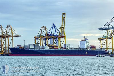
GSL ELENI
Container Ship
Current Trip
| Time Travelled | 34 days |
|---|---|
| Remaining Time | 1 day |
| Distance Travelled | 12304.36 nm |
| Remaining Distance | 526.07 nm |
| AVG Speed | 16.3 Knots |
| MAX Speed | 16.3 Knots |
| AVG Wind | 13.3 knots |
| MAX Wind | 36 knots |
| MIN Temp | 9.2°C / 48.56°F |
| MAX Temp | 29.9°C / 85.82°F |
| Draught | 12.3 m |
| Position Received | 7 h, 13 m ago |
Current Position
| Longitude | 11.98290° |
|---|---|
| Latitude | 37.24751° |
| Status | Under way using engine |
| Speed | 15.1 Knots |
| Course | 284.4° |
| Area | Mediterranean Sea - Eastern Basin |
| Station | T-AIS |
| Position Received | 7 h, 13 m ago |
Info
Information
The current position of GSL ELENI is in Mediterranean Sea - Eastern Basin with coordinates 37.24751° / 11.98290° as reported on 2024-04-19 06:11 by AIS to our vessel tracker app. The vessel's current speed is 15.1 Knots and is heading at the port of BARCELONA. The estimated time of arrival as calculated by MyShipTracking vessel tracking app is 2024-04-20 13:39 LT
The vessel GSL ELENI (IMO: 9285677, MMSI: 636019342) is a Container Ship that was built in 2004 ( 20 years old ). It's sailing under the flag of [LR] Liberia.
In this page you can find informations about the vessels current position, last detected port calls, and current voyage information. If the vessels is not in coverage by AIS you will find the latest position.
The current position of GSL ELENI is detected by our AIS receivers and we are not responsible for the reliability of the data. The last position was recorded while the vessel was in Coverage by the Ais receivers of our vessel tracking app.
The current draught of GSL ELENI as reported by AIS is 12.3 meters
Weather
| Temperature | 14.1°C / 57.38°F |
|---|---|
| Wind Speed | 32 knots |
| Direction | 291° WNW |
| Pressure | 1013.4 hPa |
| Humidity | 58.2 % |
| Cloud Coverage | 60 % |
Featured Company
Last Port Calls
| Port | Arrival | Departure | Time In Port |
|---|---|---|---|
| 2024-04-15 07:34 | 2024-04-16 14:28 | 1 d | |
| 2024-03-15 06:13 | 2024-03-15 16:26 | 10 h | |
| 2024-03-08 01:10 | 2024-03-08 15:06 | 13 h | |
| 2024-03-06 16:03 | 2024-03-07 09:53 | 17 h | |
| 2024-03-05 01:51 | |||
| 2024-03-02 15:28 | 2024-03-03 17:31 | 1 d | |
| 2024-02-26 14:46 | 2024-02-27 16:54 | 1 d | |
| 2024-02-21 16:59 | 2024-02-23 13:24 | 1 d |
Most Visited Ports (Last year)
| Port | Arrivals | |
|---|---|---|
| 7 | ||
| 6 | ||
| 5 | ||
| 4 | ||
| 3 | ||
| 3 |
Last Trips
| Origin | Departure | Destination | Arrival | Distance | |
|---|---|---|---|---|---|
| 2024-03-15 20:26 | 2024-04-15 09:34 | 11213.79 nm | |||
| 2024-03-08 19:06 | 2024-03-15 10:13 | 1022.59 nm | |||
| 2024-03-07 13:53 | 2024-03-08 05:10 | 59.36 nm | |||
| 2024-03-05 04:51 | 2024-03-06 20:03 | 355.22 nm | |||
| 2024-02-27 20:54 | 2024-03-02 18:28 | 626.99 nm | |||
| 2024-02-23 17:24 | 2024-02-26 18:46 | 851.09 nm | |||
| 2024-01-27 23:11 | 2024-02-21 20:59 | 10865.38 nm |
Events
| Time | Event | Details | Position / Dest | Info |
|---|---|---|---|---|
| 2024-04-19 06:11 | OUT of Coverage |
37.24751 / 11.98290
Mediterranean Sea - Eastern Basin
BARCELONA
|
Speed: 15.1 kn Course: 284.4° |
|
| 2024-04-19 05:34 | IN Coverage |
37.20392 / 12.17041
Mediterranean Sea - Eastern Basin
BARCELONA
|
Speed: 15.3 kn Course: 286.8° |
|
| 2024-04-19 00:09 | OUT of Coverage |
36.66804 / 13.92738
Mediterranean Sea - Eastern Basin
BARCELONA
|
Speed: 17.2 kn Course: 289.6° |
|
| 2024-04-18 23:07 | ETA Changed | 2024/04/20 16:00 2024/04/20 18:00 |
36.56622 / 14.27159
BARCELONA
|
Speed: 16.8 kn Course: 294.2° |
| 2024-04-18 21:13 | Change Sea Area | Italian part of the Mediterranean Sea - Eastern Basin Greek part of the Mediterranean Sea - Eastern Basin |
36.40863 / 14.87686
Mediterranean Sea - Eastern Basin
BARCELONA
|
Speed: 17 kn Course: 291.2° |
| 2024-04-18 21:12 | IN Coverage |
36.40863 / 14.87686
Mediterranean Sea - Eastern Basin
BARCELONA
|
Speed: 17 kn Course: 291.2° |
|
| 2024-04-17 09:47 | Status Changed | Default Under way using engine |
33.42116 / 26.10620
BARCELONA
|
Speed: 16.9 kn Course: 288.3° |
| 2024-04-17 09:45 | OUT of Coverage |
33.41688 / 26.12098
Mediterranean Sea - Eastern Basin
BARCELONA
|
Speed: 16.9 kn Course: 288.3° |
|
| 2024-04-17 08:20 | Change Sea Area | Greek part of the Mediterranean Sea - Eastern Basin Egyptian part of the Mediterranean Sea - Eastern Basin |
33.27333 / 26.62131
Mediterranean Sea - Eastern Basin
BARCELONA
|
Speed: 20.4 kn Course: 288.6° |
| 2024-04-17 07:39 | Status Changed | Under way using engine Default |
33.20307 / 26.88351
BARCELONA
|
Speed: 20.4 kn Course: 286° |